world.wikisort.org - Brazil
Uberlândia (Portuguese pronunciation: [ubɛʁˈlɐ̃d͡ʒiɐ]) is a municipality in the state of Minas Gerais, southeastern Brazil. It is the second largest municipality in the state of Minas Gerais after the state capital Belo Horizonte. Its population in 2020 was 699,097, making it the fourth largest city of the interior region of Brazil. The city is located on the Brazilian Highlands 2,802 feet (854 m) above sea level. It is an important logistic hub between São Paulo and Brasília. The city sits within the Brazilian cerrado and has eight protected zones of tropical savanna vegetation.[4]
This article has multiple issues. Please help improve it or discuss these issues on the talk page. (Learn how and when to remove these template messages)
|
Uberlândia | |
|---|---|
Municipality | |
| Municipality of Uberlândia | |
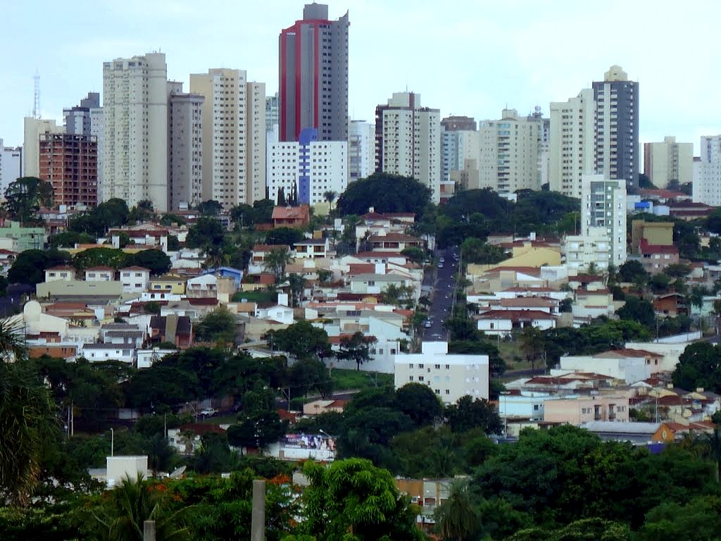 Downtown Uberlandia in mid-November 2011 | |
 Flag | |
| Nickname(s): "Udi", "The Logistical Capital", "Greater Pole Wholesale in Latin America"[clarification needed] | |
 Location of Uberlândia in Minas Gerais | |
 Uberlândia Location of Uberlândia in Brazil | |
| Coordinates: 18°55′23″S 48°17′19″W | |
| Country | |
| Region | Southeast |
| State | |
| Founded | 31 August 1888 |
| Government | |
| • Mayor | Odelmo Leão (PP) |
| Area | |
| • Total | 4,115.9 km2 (1,589.2 sq mi) |
| Elevation | 863 m (2,831 ft) |
| Population (2020)[2] | |
| • Total | 699,097 |
| • Density | 170/km2 (440/sq mi) |
| Demonym | Uberlandense |
| Time zone | UTC−3 (BRT) |
| Postal Code (CEP) | 38400-000 |
| Area code | +55 34 |
| HDI (2010) | 0.789 – high[3] |
| Website | uberlandia |

Uberlândia is served by Uberlândia–Ten. Cel. Av. César Bombonato Airport.

Geography

Uberlândia is located in the western part of the state of Minas Gerais, in the region called Triângulo Mineiro, one of the richest agricultural regions of Brazil, between the Paranaíba and Grande rivers.[4] It is connected to major cities by the following federal highways: BR-050, BR-365, BR-455, BR-452, and BR-497. Uberlândia is about 580 km away from São Paulo, connected by a modern and safe double trace highway (BR-050). The capital of the state of Minas Gerais, Belo Horizonte, is 560 km away and Brasília, the capital of the country, lies just 440 kilometres (1,440,000 ft) to the north. There are railways connecting Uberlândia via the north-south Centro-Atlântica line.
Uberlândia is a statistical micro-region including the following municipalities: Araguari, Araporã, Canápolis, Cascalho Rico, Centralina, Indianópolis, Monte Alegre de Minas, Prata, Tupaciguara, and Uberlândia. In 2007 the population of these cities' agglomeration was 818,395 inhabitants in a total area of 18,864.20 square kilometres (7,283.51 sq mi). The population density (2000) was 43.38 inhabitants/km2.[5]
Due to its location and transport links, Uberlândia has been chosen as a point for the Free Economic Zone of Manaus, the first ever such distribution point.[6]
According to the modern (2017) geographic classification by Brazil's National Institute of Geography and Statistics (IBGE), the city is the main municipality in the Intermediate Geographic Region of Uberlândia.
Religion
According to the 2010 census its citizens are members of the Roman Catholic Church (54.73%), while Evangelical Christians comprise the second largest religious affiliation in the city (25.23%). There are also minorities of Spiritists (7.80%) and not religious (7.80%). There are smaller minorities adhering the Brazilian Catholic Apostolic Church, the Eastern Orthodox Church, Jehovah's Witnesses, The Church of Jesus Christ of Latter-day Saints, Islam, Buddhism, indigenous beliefs, Umbanda and Candomblé, (all below 1% of Uberlândia's population).[7]
Tourism
The city has architectural, culture, and natural values. Here are the main attractions in the city:
- Municipal Market of Uberlândia: It is located at the centre of the city. It was established in 1923, but only had its construction started in 1944, under the tenure of Mayor Vasconcelos Costa, with modern era architecture. It was a wholesaler centre until 1977, when the commerce was transferred to the Ceasa. It is situated in Olegario Máciel Road, and offers diverse typical products from the state of Minas Gerais.[8]
- Municipal Museum of Uberlândia: It is located at the centre of the city, on the Clarimundo Carneiro Square. The same building had been used as City Hall. It has been reformed and today is a place where many cultural projects take place.[9]
- Sabiá Park It is a park/zoo administrated by FUTEL (the Uberlândian Foundation for Tourism, Sport and Leisure), located in the borough of Tibery, on the East Zone of the city. It is a green complex made up of a Zoo with dozens of animals in captivity; seven lakes that come together to form one big lagoon; an aquarium that has 36 tanks and 36 different fish species; a running track of 5.100 meters; and much more.[10]
- Municipal Park Victoria Siquierolli: It is located on the North Zone of Uberlândia, being where legitimate examples of vegetation of the Brazilian cerrado can be found, with trees with leathery leaves, twisted trunks, colourful flowers and many fruits, as well as a playground for children and a biodiversity museum. Its total area complies of a total of 232 300 square meters and is located between the boroughs of Jardim América II, Residencial Gramado, Nossa Senhora das Graças e Cruzeiro do Sul.[11]
- Rondon Pacheco Avenue: It is considered to be the “gastronomic corridor” of Uberlândia. Around it is where the nightlife in Uberlândia can be found, having many bars, restaurants, cachaçarias, pizzerias, cafes, ice cream parlours and sweet shops. There are more than 60 establishments across the avenue. Furthermore, the avenue also has many hotels, convenience stores, gas stations, supermarkets and hypermarkets. The avenue cuts the city from east to west. The Governor Rondon Pacheco Avenue starts with its merge with the Silvio Regain Avenue, on the Tubalina borough, on the southeast region of the city, and ends up on the BR-050 highway, on the furthest side of the Custodio Pereira borough, on the west region of the city.
See also
- List of municipalities in Minas Gerais
References
- IBGE (10 October 2002). "Área territorial oficial". Resolução da Presidência do IBGE de n° 5 (R.PR-5/02). Retrieved 5 December 2010.
- IBGE 2020
- "Archived copy" (PDF). United Nations Development Programme (UNDP). Archived from the original (PDF) on 8 July 2014. Retrieved 1 August 2013.
{{cite web}}: CS1 maint: archived copy as title (link) - "Uberlândia". Encyclopædia Britannica. Chicago, Ill.: Encyclopædia Britannica, Inc. 2018.
- "Citybrazil". citybrazil.com.br. Archived from the original on 25 April 2008. Retrieved 5 April 2018.
- www.caldoquantico.com.br, Caldo Quântico Ltda. -. "Zona Franca de Manaus terá entreposto em Uberlândia - FarolCom". www.farolcomunitario.com.br. Retrieved 5 April 2018.
- "Censo 2010: Listas municipios e religiões" (in Portuguese). Ministério de Apoio com Informação. 2010. Retrieved 20 October 2012.
- "Mercado Municipal" (in Portuguese). Prefeitura de Uberlandia. 2016. Retrieved 2 November 2016.
- "Museo Municipal" (in Portuguese). Prefeitura de Uberlandia. 2016. Retrieved 2 November 2016.
- "Complexo Parque do Sabia" (in Portuguese). Prefeitura de Uberlandia. 2016. Retrieved 2 November 2016.
- "Parque Municipal Vitoria Siquerolli" (in Portuguese). Prefeitura de Uberlandia. 2016. Retrieved 2 November 2016.
External links
Capital: Belo Horizonte | |||||||||||||||||||||||||
|  | ||||||||||||||||||||||||
|
| |||||||||||||||||||||||||
| |||||||||||||||||||||||||
| |||||||||||||||||||||||||
| |||||||||||||||||||||||||
| |||||||||||||||||||||||||
| |||||||||||||||||||||||||
| |||||||||||||||||||||||||
| |||||||||||||||||||||||||
| |||||||||||||||||||||||||
Authority control | |
|---|---|
| General |
|
| National libraries | |
| Other |
|
На других языках
[de] Uberlândia
Uberlândia, amtlich portugiesisch Município de Uberlândia, ist eine Stadt im brasilianischen Bundesstaat Minas Gerais. Uberlândia liegt im Triângulo Mineiro, dem „Bergbau-Dreieck“, und ist nach Belo Horizonte die zweitgrößte Stadt in Minas Gerais und das wichtigste Wirtschaftszentrum der Region.- [en] Uberlândia
[ru] Уберландия
Уберландия (порт. Uberlândia) — город и муниципалитет в Бразилии, входит в штат Минас-Жерайс. Составная часть мезорегиона Триангулу-Минейру-и-Алту-Паранаиба. Находится в составе крупной городской агломерации . Входит в экономико-статистический микрорегион Уберландия. Население составляет 608 369 человек на 2007 год. Занимает площадь 4 115,822 км². Плотность населения — 147,8 чел./км².Другой контент может иметь иную лицензию. Перед использованием материалов сайта WikiSort.org внимательно изучите правила лицензирования конкретных элементов наполнения сайта.
WikiSort.org - проект по пересортировке и дополнению контента Википедии