world.wikisort.org - Brésil
Paragominas est une ville et municipalité de l'État du Pará au Brésil.
- Portail du Pará
| Paragominas | |
 Héraldique |
 Drapeau |
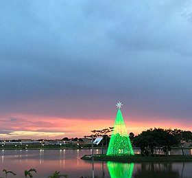
 Photo en fin d'après midi au lac vert à Paragominas | |
| Administration | |
|---|---|
| Pays | |
| Région | Nord |
| État | |
| Langue(s) | portugais |
| Géographie | |
| Coordonnées | 2° 59′ 42″ sud, 47° 21′ 10″ ouest |
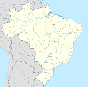
| Localisation | |
| modifier |
|
На других языках
[de] Paragominas
Paragominas, amtlich portugiesisch Município de Paragominas, ist eine Stadt im Bundesstaat Pará in Brasilien. In ca. 70 km Entfernung befindet sich die Mine von Paragominas, eine der größten Bauxitminen weltweit. Die Stadt hatte 115.838 Einwohner laut Schätzung zum 1. Juli 2021[1] und liegt auf 90 m ü. M. Bei einer Gemeindefläche von rund 19.342,6 km², etwa so groß wie das Land Rheinland-Pfalz, ergibt sich eine Bevölkerungsdichte von 5,7 Einwohnern pro km². Die Entfernung zur Hauptstadt Belém beträgt 300 km.[en] Paragominas
Paragominas is a municipality in the state of Pará in the Northern region of Brazil.[2][3][4][5] Paragominas mine, one of the largest bauxite mines in the world, is approximately 70 km away. According to an estimate dated 1 July 2020,[6] the city has a population of 111,764 and is at an altitude of 90 m above sea level. M. With a municipal area of approximately 19,342 km², it has a population density of 5.7 inhabitants per km², approximately the size of the state of Rhineland-Palatinate. Its distance from the capital Belém is 300 km.- [fr] Paragominas
[ru] Парагоминас
Парагоминас (порт. Paragominas) — муниципалитет в Бразилии, входит в штат Пара. Составная часть мезорегиона Юго-восток штата Пара. Входит в экономико-статистический микрорегион Парагоминас. Население составляет 97 819 человек на 2010 год. Занимает площадь 19 342,250 км². Плотность населения — 5,06 чел./км².Текст в блоке "Читать" взят с сайта "Википедия" и доступен по лицензии Creative Commons Attribution-ShareAlike; в отдельных случаях могут действовать дополнительные условия.
Другой контент может иметь иную лицензию. Перед использованием материалов сайта WikiSort.org внимательно изучите правила лицензирования конкретных элементов наполнения сайта.
Другой контент может иметь иную лицензию. Перед использованием материалов сайта WikiSort.org внимательно изучите правила лицензирования конкретных элементов наполнения сайта.
2019-2025
WikiSort.org - проект по пересортировке и дополнению контента Википедии
WikiSort.org - проект по пересортировке и дополнению контента Википедии


