world.wikisort.org - Brazil
Sidrolândia is a municipality located in the Brazilian state of Mato Grosso do Sul. Its population was 59,245 (2020) and its area is 5,286 km².
Sidrolândia | |
|---|---|
Municipality | |
 Flag  Coat of arms | |
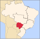
 Location in Mato Grosso do Sul state | |
 Sidrolândia Location in Brazil | |
| Coordinates: 20°55′55″S 54°57′39″W | |
| Country | Brazil |
| Region | Central-West |
| State | Mato Grosso do Sul |
| Area | |
| • Total | 5,286 km2 (2,041 sq mi) |
| Population (2020 [1]) | |
| • Total | 59,245 |
| • Density | 11/km2 (29/sq mi) |
| Time zone | UTC−4 (AMT) |
Buriti farm
On 15 May 2013, a group of hundreds of Terena people re-occupied a parcel of land in Sidrolândia, now owned by a local politician and rancher, that they believe is part of their Indigenous ancestral territory. After two weeks of occupation, they were forcibly evicted from the Buriti farm on May 30 by local police. One of their members, 35-year-old Osiel Gabriel, was shot and killed by police during the eviction, and three others were injured.[2] The Terena managed to regain control of the land on 1 June.[3]
References
Capital: Campo Grande | |||||||||
| Mesoregion Centro Norte de Mato Grosso do Sul |
|  | |||||||
| Mesoregion Leste de Mato Grosso do Sul |
| ||||||||
| Mesoregion Pantanal Sul Mato-Grossense |
| ||||||||
| Mesoregion Sudoeste de Mato Grosso do Sul |
| ||||||||
This Mato Grosso do Sul, Brazil location article is a stub. You can help Wikipedia by expanding it. |
На других языках
- [en] Sidrolândia
[ru] Сидроландия
Сидроландия (порт. Sidrolândia) — муниципалитет в Бразилии, входит в штат Мату-Гросу-ду-Сул. Составная часть мезорегиона Северо-центральная часть штата Мату-Гроссу-ду-Сул. Входит в экономико-статистический микрорегион Кампу-Гранди. Население составляет 38 139 человек на 2007 год. Занимает площадь 5 286,490 км². Плотность населения — 7,21 чел./км².Другой контент может иметь иную лицензию. Перед использованием материалов сайта WikiSort.org внимательно изучите правила лицензирования конкретных элементов наполнения сайта.
WikiSort.org - проект по пересортировке и дополнению контента Википедии