world.wikisort.org - Brazil
Pimenteiras do Oeste is a municipality located in the Brazilian state of Rondônia. Its population was 2,148 (2020) and its area is 6,015 km².[2]
Pimenteiras do Oeste | |
|---|---|
Municipality | |
 | |
 Flag  Coat of arms | |
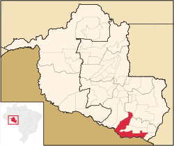 Location in Rondônia state | |
 Pimenteiras do Oeste Location in Brazil | |
| Coordinates: 13°28′57″S 61°2′48″W | |
| Country | Brazil |
| Region | North |
| State | Rondônia |
| Area | |
| • Total | 6,015 km2 (2,322 sq mi) |
| Elevation | 185 m (607 ft) |
| Population (2020 [1]) | |
| • Total | 2,148 |
| • Density | 0.36/km2 (0.92/sq mi) |
| Time zone | UTC-04:00 (BRT-1) |
The municipality contains 52% of the 384,055 hectares (949,020 acres) Corumbiara State Park, created in 1990.[3]
References
- IBGE 2020
- IBGE -
- PES de Corumbiara (in Portuguese), ISA: Instituto Socioambiental, retrieved 2016-10-31
Capital: Porto Velho | ||
| Alvorada d'Oeste |  | |
| Ariquemes |
| |
| Cacoal |
| |
| Colorado do Oeste |
| |
| Guajara-Mirim |
| |
| Ji-Parana |
| |
| Porto Velho |
| |
| Vilhena |
| |
This Rondônia, Brazil location article is a stub. You can help Wikipedia by expanding it. |
На других языках
- [en] Pimenteiras do Oeste
[ru] Пиментейрас-ду-Уэсти
Пиментейрас-ду-Уэсти (порт. Pimenteiras do Oeste) — муниципалитет в Бразилии, входит в штат Рондония. Составная часть мезорегиона Восток штата Рондония. Входит в экономико-статистический микрорегион Колораду-ду-Уэсти. Население составляет 2 315 человек на 2010 год. Занимает площадь 6 014,73 км². Плотность населения — 0,38 чел./км².Текст в блоке "Читать" взят с сайта "Википедия" и доступен по лицензии Creative Commons Attribution-ShareAlike; в отдельных случаях могут действовать дополнительные условия.
Другой контент может иметь иную лицензию. Перед использованием материалов сайта WikiSort.org внимательно изучите правила лицензирования конкретных элементов наполнения сайта.
Другой контент может иметь иную лицензию. Перед использованием материалов сайта WikiSort.org внимательно изучите правила лицензирования конкретных элементов наполнения сайта.
2019-2026
WikiSort.org - проект по пересортировке и дополнению контента Википедии
WikiSort.org - проект по пересортировке и дополнению контента Википедии