world.wikisort.org - Brazil
Malhador is a municipality located in the Brazilian state of Sergipe. It is a little city in a rural area. It is located near Itabaiana. Its population was 12,653 (2020) and its area is 101 km².[2]
Malhador | |
|---|---|
Municipality | |
 Flag  Coat of arms | |
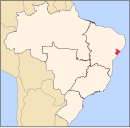
 Malhador Location in Brazil | |
| Coordinates: 10°39′28″S 37°18′18″W | |
| Country | Brazil |
| Region | Northeast |
| State | Sergipe |
| Area | |
| • Total | 101 km2 (39 sq mi) |
| Population (2020 [1]) | |
| • Total | 12,653 |
| • Density | 130/km2 (320/sq mi) |
| Time zone | UTC-03:00 (BRT) |
The municipality contains part of the Serra de Itabaiana National Park.[3]
References
- IBGE 2020
- IBGE -
- Unidade de Conservação: Parque Nacional da Serra de Itabaiana (in Portuguese), MMA: Ministério do Meio Ambiente, retrieved 2016-05-03
Capital: Aracaju | |||||||||||||||
| Agreste Sergipano |
|  | |||||||||||||
| Leste Sergipano |
| ||||||||||||||
| Sertao Sergipano |
| ||||||||||||||
This Sergipe, Brazil location article is a stub. You can help Wikipedia by expanding it. |
На других языках
- [en] Malhador
[ru] Мальядор
Мальядор (порт. Malhador) — муниципалитет в Бразилии, входит в штат Сержипи. Составная часть мезорегиона Сельскохозяйственный район штата Сержипи. Входит в экономико-статистический микрорегион Агрести-ди-Итабаяна. Население составляет 12 589 человек на 2006 год. Занимает площадь 102,2 км². Плотность населения — 123,18 чел./км².Текст в блоке "Читать" взят с сайта "Википедия" и доступен по лицензии Creative Commons Attribution-ShareAlike; в отдельных случаях могут действовать дополнительные условия.
Другой контент может иметь иную лицензию. Перед использованием материалов сайта WikiSort.org внимательно изучите правила лицензирования конкретных элементов наполнения сайта.
Другой контент может иметь иную лицензию. Перед использованием материалов сайта WikiSort.org внимательно изучите правила лицензирования конкретных элементов наполнения сайта.
2019-2026
WikiSort.org - проект по пересортировке и дополнению контента Википедии
WikiSort.org - проект по пересортировке и дополнению контента Википедии