world.wikisort.org - Brazil
Coruripe is a municipality located in the southern coast of the Brazilian state of Alagoas. Its population is 57,294 (2020)[2] and its area is 913 km².[3] It is the largest municipality in Alagoas by area, but among the largest municipalities of each Brazilian state, it is the smallest. It is situated at the edge of Coruripe river.
Coruripe | |
|---|---|
Municipality | |
| The Municipality of Coruripe | |
 Flag  Seal | |
| Nickname(s): "Land of the Caetés" | |
| Motto(s): "Trabalho e Progresso" ("Work and Progress") | |
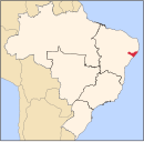
 Location of Coruripe in the State of Alagoas | |
| Coordinates: 10°07′33″S 36°10′33″W | |
| Country | |
| State | |
| Mesoregion | Leste Alagoano |
| Microregion | São Miguel dos Campos |
| Founded | 1850 |
| Government | |
| • Mayor | Marx Beltrão Lima Siqueira (PMDB) |
| Area | |
| • Total | 912.716 km2 (352.402 sq mi) |
| Elevation | 16 m (52 ft) |
| Population (2020) | |
| • Total | 57,294 |
| • Density | 63/km2 (160/sq mi) |
| Demonym(s) | Coruripense |
| Time zone | UTC−3 (BRT) |
| Area code(s) | +55 82 |
| HDI (2000) | 0.665 – medium[1] |
| Website | Official website |
References
- "Archived copy". Archived from the original on 2009-10-03. Retrieved 2009-12-17.
{{cite web}}: CS1 maint: archived copy as title (link) - UNDP - IBGE 2020
- IBGE - "Archived copy". Archived from the original on 2008-06-11. Retrieved 2008-06-11.
{{cite web}}: CS1 maint: archived copy as title (link)
Capital: Maceió | ||
| Arapiraca |
|  |
| Palmeira dos Índios |
| |
| Traipu |
| |
| Litoral Norte Alagoano |
| |
| Maceió |
| |
| Mata Alagoana |
| |
| Penedo |
| |
| São Miguel dos Campos |
| |
| Serrana dos Quilombos |
| |
| Alagoana do Sertão do São Francisco | ||
| Batalha |
| |
| Santana do Ipanema |
| |
| Serrana do Sertão Alagoano |
| |
This Alagoas, Brazil location article is a stub. You can help Wikipedia by expanding it. |
На других языках
- [en] Coruripe
[ru] Корурипи
Корурипи (порт. Coruripe) — муниципалитет в Бразилии, входит в штат Алагоас. Составная часть мезорегиона Восток штата Алагоас. Входит в экономико-статистический микрорегион Сан-Мигел-дус-Кампус. Население составляет 44 727 человек на 2000 год. Занимает площадь 971,4 км². Плотность населения — 46,04 чел./км².Текст в блоке "Читать" взят с сайта "Википедия" и доступен по лицензии Creative Commons Attribution-ShareAlike; в отдельных случаях могут действовать дополнительные условия.
Другой контент может иметь иную лицензию. Перед использованием материалов сайта WikiSort.org внимательно изучите правила лицензирования конкретных элементов наполнения сайта.
Другой контент может иметь иную лицензию. Перед использованием материалов сайта WikiSort.org внимательно изучите правила лицензирования конкретных элементов наполнения сайта.
2019-2026
WikiSort.org - проект по пересортировке и дополнению контента Википедии
WikiSort.org - проект по пересортировке и дополнению контента Википедии