world.wikisort.org - Brazil
Camaragibe (population 156,736) is a city in northeastern Brazil, in the State of Pernambuco. It lies near Recife at 8.00° South, 35.04° West.
Camaragibe
Municipality of Camaragibe | |
|---|---|
 Flag | |
 Location in the state of Pernambuco and Brazil | |
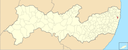
 Camaragibe Location in Brazil | |
| Coordinates: 8°01′19″S 34°58′51″W | |
| Country | Brazil |
| Area | |
| • Total | 51.257 km2 (19.790 sq mi) |
| Elevation | 55 m (180 ft) |
| Population (2020 [2]) | |
| • Total | 158,899 |
| • Density | 3,100/km2 (8,000/sq mi) |
Currently, Camaragibe is run by Nadegi Queiroz (from the political party Republicans) and Délio Junior (The Vice-mayor).
The lands now belonging to the city were used as a reserve of wood, and then for sugar planting. It was populated by natives, until the arrival of Portuguese with Duarte Coelho Pereira, around 1500. After the Portuguese arrival, however, the natives were not completely driven from the area. Instead, they lived "peacefully" with the invaders.
In the 16th century the city (then just an engenho) was considered one of richest in the region until the Dutch invasion in 1645. At that time, the farm was burned to the ground by the natives.
On 13 May 1982, Camaragibe, which was then part of the bigger city São Lourenço da Mata, was elevated to the category of city.
The small city is considered among the most densely populated urban areas in the world because of the very accelerated growth that the city experienced from the emancipation until now.
Geography
- State - Pernambuco
- Region - RMR (Recife)
- Boundaries - Paulista (N), Sao Lourenco da Mata (S), Paudalho (W), Recife (E)
- Area - 55.08 km2
- Elevation - 55 m
- Hydrography - Capibaribe and Beberibe rivers
- Vegetation - Hidrofila, capoeirao, capoeira, and sugarcane plantation
- Climate - Hot tropical and humid
- Annual average temperature - 25.1 °C
- Main road - PE 005
- Distance to Recife - 16 km
Economy
The main economic activities in Camaragibe are based in commerce and general industry. Also is a main and terminal stop in the metropolitan train (subway or tube system), with integration with local bus lanes.
Economic Indicators
| Population [3] | GDP x(1000 R$).[4] | GDP pc (R$) | PE | RMR |
|---|---|---|---|---|
| 143.210 | 492.113 | 3.608 | 0.82% | 1.22% |
Economy by Sector 2006
| Primary sector | Secondary sector | Service sector |
|---|---|---|
| 1.43% | 13.35% | 85.22% |
Health Indicators
| HDI (2000) | Hospitals (2007) | Hospitals beds (2007) | Children's Mortality every 1000 (2005) |
|---|---|---|---|
| 0.747 | 4 | 1291 | 15.1 |
Notable people
- Hélio José Muniz Filho, Brazilian criminal suspected of killing 65 people
References
- "Brazilian Institute of Geography and Statistics" (in Portuguese). 2017. Retrieved 27 March 2019.
2018 Area Total
- IBGE 2020
- http://www.ibge.gov.br/home/estatistica/populacao/estimativa2009/POP2009_DOU.pdf IBGE Population 2009 Camaragibe, page 32]
- Camaragibe 2007 GDP IBGE pag 30 Archived March 4, 2016, at the Wayback Machine
- PE State site - City by city profile
Capital: Recife | ||||||||||||||
| Mesoregion Agreste Pernambucano |
|  | ||||||||||||
| Mesoregion Mata Pernambucana |
| |||||||||||||
| Mesoregion Metropolitana de Recife |
| |||||||||||||
| Mesoregion Sao Francisco Pernambucano |
| |||||||||||||
| Mesoregion Sertão Pernambucano |
| |||||||||||||
| Authority control |
|
|---|
This Pernambuco, Brazil location article is a stub. You can help Wikipedia by expanding it. |
На других языках
[de] Camaragibe
Camaragibe, amtlich portugiesisch Município de Camaragibe, ist eine Gemeinde im brasilianischen Bundesstaat Pernambuco und gehört zur Metropolregion Recife. Sie hatte 2021 geschätzt 159.945 Einwohner, die auf einer Fläche von rund 51,3 km² leben und Camaragibenser genannt werden.[1]- [en] Camaragibe
[ru] Камаражиби
Камаражиби (порт. Camaragibe) — муниципалитет в Бразилии, входит в штат Пернамбуку. Составная часть мезорегиона Агломерация Ресифи. Находится в составе крупной городской агломерации . Входит в экономико-статистический микрорегион Ресифи. Население составляет 150 354 человека на 2006 год. Занимает площадь 48,3 км². Плотность населения — 3.132,3 чел./км².Другой контент может иметь иную лицензию. Перед использованием материалов сайта WikiSort.org внимательно изучите правила лицензирования конкретных элементов наполнения сайта.
WikiSort.org - проект по пересортировке и дополнению контента Википедии