world.wikisort.org - Brazil
Caarapó is a municipality located in the Brazilian state of Mato Grosso do Sul. Its population was 30,593 (2020) and its area is 2,090 km².
Caarapó | |
|---|---|
Municipality | |
 Flag  Coat of arms | |
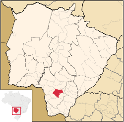 Location in Mato Grosso do Sul state | |
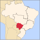
 Caarapó Location in Brazil | |
| Coordinates: 22°38′02″S 54°49′19″W | |
| Country | Brazil |
| Region | Central-West |
| State | Mato Grosso do Sul |
| Area | |
| • Total | 2,090 km2 (810 sq mi) |
| Population (2020 [1]) | |
| • Total | 30,593 |
| • Density | 15/km2 (38/sq mi) |
| Time zone | UTC−4 (AMT) |
References
Capital: Campo Grande | |||||||||
| Mesoregion Centro Norte de Mato Grosso do Sul |
|  | |||||||
| Mesoregion Leste de Mato Grosso do Sul |
| ||||||||
| Mesoregion Pantanal Sul Mato-Grossense |
| ||||||||
| Mesoregion Sudoeste de Mato Grosso do Sul |
| ||||||||
This Mato Grosso do Sul, Brazil location article is a stub. You can help Wikipedia by expanding it. |
На других языках
- [en] Caarapó
[ru] Каарапо
Каарапо (порт. Caarapó) — муниципалитет в Бразилии, входит в штат Мату-Гросу-ду-Сул. Составная часть мезорегиона Юго-запад штата Мату-Гроссу-ду-Сул. Входит в экономико-статистический микрорегион Дорадус. Население составляет 19 386 человек на 2006 год. Занимает площадь 2 089,706 км². Плотность населения — 9,3 чел./км².Текст в блоке "Читать" взят с сайта "Википедия" и доступен по лицензии Creative Commons Attribution-ShareAlike; в отдельных случаях могут действовать дополнительные условия.
Другой контент может иметь иную лицензию. Перед использованием материалов сайта WikiSort.org внимательно изучите правила лицензирования конкретных элементов наполнения сайта.
Другой контент может иметь иную лицензию. Перед использованием материалов сайта WikiSort.org внимательно изучите правила лицензирования конкретных элементов наполнения сайта.
2019-2026
WikiSort.org - проект по пересортировке и дополнению контента Википедии
WikiSort.org - проект по пересортировке и дополнению контента Википедии