world.wikisort.org - Bosnia_and_Herzegovina
Grahovik is a village in the municipality of Travnik, Bosnia and Herzegovina.[1]
Grahovik | |
|---|---|
Village | |
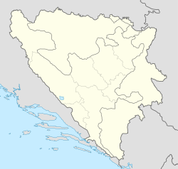  Grahovik | |
| Coordinates: 44.2095847°N 17.6714863°E | |
| Country |  Bosnia and Herzegovina Bosnia and Herzegovina |
| Entity | Federation of Bosnia and Herzegovina |
| Canton |  Central Bosnia Central Bosnia |
| Municipality |  Travnik Travnik |
| Area | |
| • Total | 0.34 sq mi (0.87 km2) |
| Population (2013) | |
| • Total | 277 |
| • Density | 820/sq mi (320/km2) |
| Time zone | UTC+1 (CET) |
| • Summer (DST) | UTC+2 (CEST) |
Demographics
According to the 2013 census, its population was 277.[2]
| Ethnicity | Number | Percentage |
|---|---|---|
| Bosniaks | 182 | 65.7% |
| Croats | 80 | 28.9% |
| Serbs | 4 | 1.4% |
| other/undeclared | 11 | 4.0% |
| Total | 277 | 100% |
References
- Official results from the book: Ethnic composition of Bosnia-Herzegovina population, by municipalities and settlements, 1991. census, Zavod za statistiku Bosne i Hercegovine - Bilten no.234, Sarajevo 1991.
- "Naseljena Mjesta 1991/2013" (in Bosnian). Statistical Office of Bosnia and Herzegovina. Retrieved December 4, 2021.
 | This Bosnia and Herzegovina geography article is a stub. You can help Wikipedia by expanding it. |
Текст в блоке "Читать" взят с сайта "Википедия" и доступен по лицензии Creative Commons Attribution-ShareAlike; в отдельных случаях могут действовать дополнительные условия.
Другой контент может иметь иную лицензию. Перед использованием материалов сайта WikiSort.org внимательно изучите правила лицензирования конкретных элементов наполнения сайта.
Другой контент может иметь иную лицензию. Перед использованием материалов сайта WikiSort.org внимательно изучите правила лицензирования конкретных элементов наполнения сайта.
2019-2026
WikiSort.org - проект по пересортировке и дополнению контента Википедии
WikiSort.org - проект по пересортировке и дополнению контента Википедии