world.wikisort.org - Belgium
Zoutleeuw (Dutch pronunciation: [ˌzʌu̯tˈleːu] (![]() listen); French: Léau [leo]) is a municipality and city in the Hageland, in the extreme east of the Belgian province of Flemish Brabant. On 1 January 2018 the municipality had 8,498 inhabitants. The total area is 46.73 km2, giving a population density of 182 inhabitants per km2.
listen); French: Léau [leo]) is a municipality and city in the Hageland, in the extreme east of the Belgian province of Flemish Brabant. On 1 January 2018 the municipality had 8,498 inhabitants. The total area is 46.73 km2, giving a population density of 182 inhabitants per km2.
This article needs additional citations for verification. (January 2013) |
Zoutleeuw | |
|---|---|
Municipality | |
 | |
 Flag  Coat of arms | |
 Zoutleeuw Location in Belgium
Location of Zoutleeuw in Flemish Brabant  | |
| Coordinates: 50°50′N 05°06′E | |
| Country | Belgium |
| Community | Flemish Community |
| Region | Flemish Region |
| Province | Flemish Brabant |
| Arrondissement | Leuven |
| Government | |
| • Mayor | Boudewijn Herbots (CD&V) |
| • Governing party/ies | CD&V |
| Area | |
| • Total | 46.73 km2 (18.04 sq mi) |
| Population (2018-01-01)[1] | |
| • Total | 8,498 |
| • Density | 180/km2 (470/sq mi) |
| Postal codes | 3440 |
| Area codes | 011 |
| Website | www.zoutleeuw.be |
The name Leeuw means "lion", to which Zout ("salt") was added from the 16th century in recognition of the town's right to levy a salt tax.
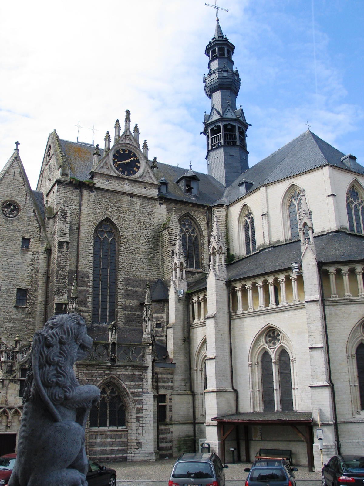
In 1999, UNESCO included the historical St. Leonard's Church as part of the World Heritage Site Belfries of Belgium and France.[2]
Other centres
As well as Zoutleeuw proper, the municipality also comprises the ancienne communes of:
- Budingen
- Dormaal
- Halle-Booienhoven
- Helen-Bos
- Ossenweg
References
- "Wettelijke Bevolking per gemeente op 1 januari 2018". Statbel. Retrieved 9 March 2019.
- "World Heritage List | Belfries of Belgium and France". UNESCO. Retrieved 2021-03-16.
External links
 Media related to Zoutleeuw at Wikimedia Commons
- Official website (in Dutch)
- Archaeology in Zoutleeuw
Places adjacent to Zoutleeuw | ||||||||||||||||
|---|---|---|---|---|---|---|---|---|---|---|---|---|---|---|---|---|
| ||||||||||||||||
Municipalities in the province of Flemish Brabant, Flanders, Belgium | ||
|---|---|---|
| Halle-Vilvoorde |
|  |
| Leuven | ||
Bold indicates cities · Italic indicates municipalities with language facilities | ||
Authority control | |
|---|---|
| General |
|
| National libraries | |
| Other |
|
This Flemish Brabant location article is a stub. You can help Wikipedia by expanding it. |
На других языках
[de] Zoutleeuw
Zoutleeuw (französisch Léau) ist eine belgische Stadt im Hageland in der Region Flandern. Die Stadt liegt am Fluss Kleine Gete, einem Nebenarm der Gete.- [en] Zoutleeuw
[es] Zoutleeuw
Zoutleeuw (en francés, Léau) es una ciudad de la provincia belga de Brabante Flamenco.Другой контент может иметь иную лицензию. Перед использованием материалов сайта WikiSort.org внимательно изучите правила лицензирования конкретных элементов наполнения сайта.
WikiSort.org - проект по пересортировке и дополнению контента Википедии