world.wikisort.org - Belgium
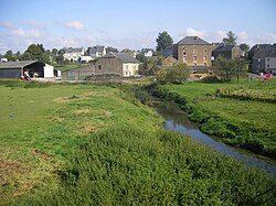
Étalle (French pronunciation: [etal]; Lorrain: Ètaule) is a municipality of Wallonia located in the province of Luxembourg, Belgium.
Étalle | |
|---|---|
Municipality | |
 | |
 Flag  Coat of arms | |
 Étalle Location in Belgium
Location of Étalle in Luxembourg province  | |
| Coordinates: 49°41′N 05°36′E | |
| Country | Belgium |
| Community | French Community |
| Region | Wallonia |
| Province | Luxembourg |
| Arrondissement | Virton |
| Government | |
| • Mayor | Henry Thiry (MR) |
| • Governing party/ies | Mayeur |
| Area | |
| • Total | 78.10 km2 (30.15 sq mi) |
| Population (2018-01-01)[1] | |
| • Total | 5,855 |
| • Density | 75/km2 (190/sq mi) |
| Postal codes | 6740-6743 |
| Area codes | 063 |
| Website | www |
On 1 January 2007 the municipality, which covers 78.1 km2, had 5,389 inhabitants, giving a population density of 69 inhabitants per km2.
The municipality consists of the following districts: Buzenol, Chantemelle, Étalle, Sainte-Marie, Vance, and Villers-sur-Semois. Other population centers include: Croix Rouge, Fratin, Huombois, and Sivry.
See also
- List of protected heritage sites in Étalle, Belgium
References
- "Wettelijke Bevolking per gemeente op 1 januari 2018". Statbel. Retrieved 9 March 2019.
External links
 Media related to Étalle, Belgium at Wikimedia Commons
На других языках
[de] Étalle (Belgien)
Étalle ist eine belgische Gemeinde im Arrondissement Virton der Provinz Luxemburg.- [en] Étalle, Belgium
[ru] Эталь (Бельгия)
Эталь (фр. Étalle) — коммуна в Валлонии, расположенная в провинции Люксембург, округ Виртон. Принадлежит Французскому языковому сообществу Бельгии. На площади 78,10 км² проживают 5317 человек (плотность населения — 68 чел./км²), из которых 50,74 % — мужчины и 49,26 % — женщины. Средний годовой доход на душу населения в 2003 году составлял 13 633 евро.Текст в блоке "Читать" взят с сайта "Википедия" и доступен по лицензии Creative Commons Attribution-ShareAlike; в отдельных случаях могут действовать дополнительные условия.
Другой контент может иметь иную лицензию. Перед использованием материалов сайта WikiSort.org внимательно изучите правила лицензирования конкретных элементов наполнения сайта.
Другой контент может иметь иную лицензию. Перед использованием материалов сайта WikiSort.org внимательно изучите правила лицензирования конкретных элементов наполнения сайта.
2019-2025
WikiSort.org - проект по пересортировке и дополнению контента Википедии
WikiSort.org - проект по пересортировке и дополнению контента Википедии
