world.wikisort.org - Azerbaijan
Khojaly District (Azerbaijani: Xocalı rayonu) is one of the 66 districts of Azerbaijan. It is located in the west of the country and belongs to the Karabakh Economic Region. The district borders the districts of Kalbajar, Lachin, Shusha, Agdam and Khojavend. Its capital and largest city is Khojaly. As of 2020, the district had a nominal population of 28,800.[2]
Khojaly District | |
|---|---|
District | |
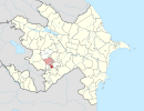
 Map of Azerbaijan showing Khojaly District | |
| Country | |
| Region | Karabakh |
| Established | 26 November 1991 |
| Capital | Khojaly |
| Settlements[1] | 53 |
| Government | |
| • Governor | Shahmar Usubov |
| Area | |
| • Total | 1,000 km2 (400 sq mi) |
| Population (2020)[2] | |
| • Total | 28,800 |
| • Density | 29/km2 (75/sq mi) |
| Time zone | UTC+4 (AZT) |
| Postal code | 2600 |
| Website | xocali-ih |
The centre of the district, the town of Khojaly, was also the site of the Khojaly Massacre, the largest massacre throughout the whole Nagorno-Karabakh conflict. Following the massacre, most of the district was captured and made part of the Askeran Province of the self-proclaimed Republic of Artsakh. Following the 2020 Nagorno-Karabakh war, Azerbaijan recaptured some villages in the district, while most of the district, including its capital, was put under Russian peacekeeping control.
History
Khojaly district was established on the basis of the Askeran District of the Nagorno-Karabakh Autonomous Oblast in 1991. It was captured by Armenian forces in 1991–1992.
The district consists of 1 city, 2 settlements and 50 villages in the district.[3] It was once a site of prehistoric Khojaly-Gadabay culture.
Geography
This section does not cite any sources. (June 2017) |
Khojaly district is located in Nagorno-Karabakh. The territory of the district is mountainous. The highest altitudes are Qirkhqiz and Gizgala, the main rivers are Gargar and Badara. [citation needed]The climate is mild-hot except the mountainous area.
Notable figures
- Ramil Usubov – the former Minister of Internal Affairs of Republic of Azerbaijan.;[4]
- Elman Mammadov – Azerbaijani politician who serves as the Member of National Assembly of Azerbaijan from 124th Shusha-Fuzuli-Khojaly-Khojavend district. He's a veteran of the First Nagorno-Karabakh War.
- Alif Hajiyev – Azerbaijani officer, Commandant of Khojaly Airport and National Hero of Azerbaijan.[5]
- Tofig Huseynov – Azerbaijani army commander.
- Pele Pughi – 18th century Armenian satirist and fabulist.
See also
References
- "İnzibati-ərazi vahidləri" (PDF). preslib.az. Retrieved 28 February 2021.
- "Population of Azerbaijan". stat.gov.az. State Statistics Committee. Retrieved 22 February 2021.
- Электронный бюллетень «Изменения географических названий государств-участников СНГ» (обновлённый по состоянию на 2019 год)
- "Biographies. Ramil Usubov". Retrieved 2010-07-12.
- Elman Mammadov (Autumn 1999). "Running For Our Lives. Massacre and Flight From Khojaly". Azerbaijan International: 54–56. Retrieved 2010-04-27.
Capital: Khojaly | ||
|  | |
Authority control | |
|---|---|
| General |
|
| National libraries | |
| Other |
|
На других языках
- [en] Khojaly District
[ru] Ходжалинский район
Ходжалинский район (азерб. Xocalı rayonu) — административная единица на юго-западе Азербайджана. Фактически большая часть района с 1992 года контролируется непризнанной Нагорно-Карабахской Республикой (НКР) и входит в состав Аскеранского района НКР. Административный центр — город Ходжалы[1].Другой контент может иметь иную лицензию. Перед использованием материалов сайта WikiSort.org внимательно изучите правила лицензирования конкретных элементов наполнения сайта.
WikiSort.org - проект по пересортировке и дополнению контента Википедии