world.wikisort.org - L'Autriche
Kalwang est une commune autrichienne du district de Leoben en Styrie.
Cet article est une ébauche concernant une localité autrichienne.
Vous pouvez partager vos connaissances en l’améliorant (comment ?) selon les recommandations des projets correspondants.
| Kalwang | ||||
 Héraldique |
||||

| ||||
| Administration | ||||
|---|---|---|---|---|
| Pays | ||||
| Land | ||||
| District (Bezirk) |
District de Leoben | |||
| Code postal | A- | |||
| Indicatif | 43+ | |||
| Démographie | ||||
| Population | 987 hab. ([1]) | |||
| Densité | 15 hab./km2 | |||
| Géographie | ||||
| Coordonnées | 47° 25′ nord, 14° 45′ est | |||
| Altitude | 751 m |
|||
| Superficie | 6 715 ha = 67,15 km2 | |||
| Localisation | ||||
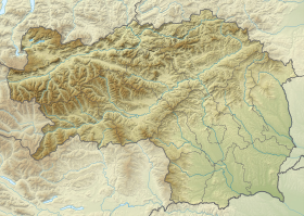
| Géolocalisation sur la carte : Autriche
Géolocalisation sur la carte : Autriche
Géolocalisation sur la carte : Styrie
| ||||
| modifier |
||||


Géographie
Cette section est vide, insuffisamment détaillée ou incomplète. Votre aide est la bienvenue ! Comment faire ?
Histoire
Des mines de cuivre furent ouvertes sur la municipalité au début du Moyen Âge jusqu'en 1867, puis de 1916 à 1928.
 Portail de l'Autriche
- Bevölkerung zu Jahresbeginn 2002-2016 nach Gemeinden, (statistique publique), Statistik Austria, , [lire en ligne]
На других языках
[de] Kalwang
Kalwang ist eine österreichische Marktgemeinde mit 954 Einwohnern (Stand 1. Jänner 2022) im Gerichtsbezirk bzw. Bezirk Leoben, Steiermark.[en] Kalwang
Kalwang is a municipality in the district of Leoben in the Austrian state of Styria.- [fr] Kalwang
[ru] Кальванг
Кальванг (нем. Kalwang) — ярмарочная коммуна (нем. Marktgemeinde) в Австрии, в федеральной земле Штирия.Текст в блоке "Читать" взят с сайта "Википедия" и доступен по лицензии Creative Commons Attribution-ShareAlike; в отдельных случаях могут действовать дополнительные условия.
Другой контент может иметь иную лицензию. Перед использованием материалов сайта WikiSort.org внимательно изучите правила лицензирования конкретных элементов наполнения сайта.
Другой контент может иметь иную лицензию. Перед использованием материалов сайта WikiSort.org внимательно изучите правила лицензирования конкретных элементов наполнения сайта.
2019-2026
WikiSort.org - проект по пересортировке и дополнению контента Википедии
WikiSort.org - проект по пересортировке и дополнению контента Википедии