world.wikisort.org - Austria
Ulrichsberg is a municipality in the district of Rohrbach in the Austrian state of Upper Austria.
This article may be expanded with text translated from the corresponding article in German. (November 2016) Click [show] for important translation instructions.
|
Ulrichsberg | |
|---|---|
 | |
 Coat of arms | |
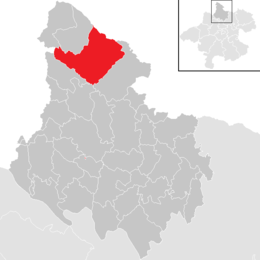 Location in the district | |
 Ulrichsberg Location within Austria | |
| Coordinates: 48°40′32″N 13°54′44″E | |
| Country | Austria |
| State | Upper Austria |
| District | Rohrbach |
| Government | |
| • Mayor | Wilfried Kellermann (ÖVP) |
| Area | |
| • Total | 56.91 km2 (21.97 sq mi) |
| Elevation | 626 m (2,054 ft) |
| Population (2018-01-01)[2] | |
| • Total | 2,843 |
| • Density | 50/km2 (130/sq mi) |
| Time zone | UTC+1 (CET) |
| • Summer (DST) | UTC+2 (CEST) |
| Postal code | 4161 |
| Area code | 07288 |
| Vehicle registration | RO |
| Website | www.ulrichsberg.at |
Geography
Ulrichsberg lies in Mühlviertel in Upper Austria near the Bohemian Forest and along the Große Mühl river (north of the Danube). It covers an area of 12.2 km north to south and 10.3 km east to west for a total area of 57 km2. 51.8% of the area is forested and 44.7% of the area is in agricultural use.
Nearby Gemeinden (municipalities) are: Berdetschlag, Breitenstein, Dietrichschlag, Erlet, Fuchslug, Hintenberg, Kandlschlag, Lichtenberg, Mühlwald, Ödenkirchen, Salnau, Schindlau, Seitelschlag, Sonnenwald, Stangl, Stollnberg, Ulrichsberg, and Zaglau. North of Lichtenberg, in Schöneben, is a small border crossing to the Czech Republic.
History
Ulrichsberg was first mentioned in a document in 1325.[citation needed]
References
- "Dauersiedlungsraum der Gemeinden Politischen Bezirke und Bundesländer - Gebietsstand 1.1.2018". Statistics Austria. Retrieved 10 March 2019.
- "Einwohnerzahl 1.1.2018 nach Gemeinden mit Status, Gebietsstand 1.1.2018". Statistics Austria. Retrieved 9 March 2019.
Authority control | |
|---|---|
| General | |
| National libraries | |
| Other |
|
This Upper Austria location article is a stub. You can help Wikipedia by expanding it. |
На других языках
[de] Ulrichsberg
Ulrichsberg (Uagschbeag) ist eine Marktgemeinde in Oberösterreich im Bezirk Rohrbach im oberen Mühlviertel mit 2865 Einwohnern (Stand 1. Jänner 2022). Die Gemeinde liegt im Gerichtsbezirk Rohrbach.- [en] Ulrichsberg
[ru] Ульрихсберг
Ульрихсберг (нем. Ulrichsberg) — ярмарочная коммуна в Австрии, в федеральной земле Верхняя Австрия.Другой контент может иметь иную лицензию. Перед использованием материалов сайта WikiSort.org внимательно изучите правила лицензирования конкретных элементов наполнения сайта.
WikiSort.org - проект по пересортировке и дополнению контента Википедии