world.wikisort.org - Austria
Roppen is a municipality in the Imst district and is located 5 km southeast of Imst between the mouths of the Pitze River and the Ötztaler Ache. The village was mentioned in documents in 1260 for the first time as "Roupen" but settlement already began 3000 years ago.
Roppen | |
|---|---|
 | |
 Coat of arms | |
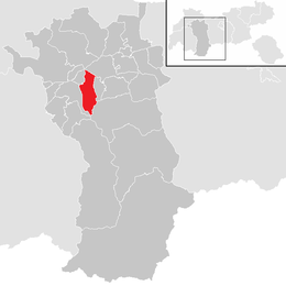 Location in the district | |
 Roppen Location within Austria | |
| Coordinates: 47°13′00″N 10°49′12″E | |
| Country | Austria |
| State | Tyrol |
| District | Imst |
| Government | |
| • Mayor | Ingobert Mayr (SPÖ) |
| Area | |
| • Total | 30.87 km2 (11.92 sq mi) |
| Elevation | 724 m (2,375 ft) |
| Population (2018-01-01)[2] | |
| • Total | 1,800 |
| • Density | 58/km2 (150/sq mi) |
| Time zone | UTC+1 (CET) |
| • Summer (DST) | UTC+2 (CEST) |
| Postal code | 6426 |
| Area code | 05417 |
| Vehicle registration | IM |
| Website | www.roppen.tirol.gv.at |
Population
| Year | Pop. | ±% |
|---|---|---|
| 1869 | 656 | — |
| 1880 | 630 | −4.0% |
| 1890 | 592 | −6.0% |
| 1900 | 612 | +3.4% |
| 1910 | 647 | +5.7% |
| 1923 | 653 | +0.9% |
| 1934 | 728 | +11.5% |
| 1939 | 825 | +13.3% |
| 1951 | 883 | +7.0% |
| 1961 | 930 | +5.3% |
| 1971 | 1,118 | +20.2% |
| 1981 | 1,199 | +7.2% |
| 1991 | 1,390 | +15.9% |
| 2001 | 1,605 | +15.5% |
| 2011 | 1,644 | +2.4% |
References
- "Dauersiedlungsraum der Gemeinden Politischen Bezirke und Bundesländer - Gebietsstand 1.1.2018". Statistics Austria. Retrieved 10 March 2019.
- "Einwohnerzahl 1.1.2018 nach Gemeinden mit Status, Gebietsstand 1.1.2018". Statistics Austria. Retrieved 9 March 2019.
External links
Wikimedia Commons has media related to Roppen.
This Tyrol location article is a stub. You can help Wikipedia by expanding it. |
На других языках
- [en] Roppen
[ru] Роппен
Роппен (нем. Roppen) — коммуна в Австрии, в федеральной земле Тироль.Текст в блоке "Читать" взят с сайта "Википедия" и доступен по лицензии Creative Commons Attribution-ShareAlike; в отдельных случаях могут действовать дополнительные условия.
Другой контент может иметь иную лицензию. Перед использованием материалов сайта WikiSort.org внимательно изучите правила лицензирования конкретных элементов наполнения сайта.
Другой контент может иметь иную лицензию. Перед использованием материалов сайта WikiSort.org внимательно изучите правила лицензирования конкретных элементов наполнения сайта.
2019-2026
WikiSort.org - проект по пересортировке и дополнению контента Википедии
WikiSort.org - проект по пересортировке и дополнению контента Википедии