world.wikisort.org - Austria
Gaspoltshofen is a municipality in the district of Grieskirchen in the Austrian state of Upper Austria.
This article may be expanded with text translated from the corresponding article in German. (November 2016) Click [show] for important translation instructions.
|
Gaspoltshofen | |
|---|---|
 | |
 Coat of arms | |
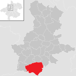 Location in the district | |
 Gaspoltshofen Location within Austria | |
| Coordinates: 48°08′40″N 13°44′11″E | |
| Country | Austria |
| State | Upper Austria |
| District | Grieskirchen |
| Government | |
| • Mayor | Wolfgang Klinger (FPÖ) |
| Area | |
| • Total | 40.61 km2 (15.68 sq mi) |
| Elevation | 455 m (1,493 ft) |
| Population (2018-01-01)[2] | |
| • Total | 3,566 |
| • Density | 88/km2 (230/sq mi) |
| Time zone | UTC+1 (CET) |
| • Summer (DST) | UTC+2 (CEST) |
| Postal code | 4673, 4674 (Altenhof) |
| Area code | 07735 |
| Vehicle registration | GR |
| Website | www.gaspoltshofen. ooe.gv.at |
Geography
Gaspoltshofen lies in the Hausruckviertel. About 19 percent of the municipality is forest, and 71 percent is farmland.
References
- "Dauersiedlungsraum der Gemeinden Politischen Bezirke und Bundesländer - Gebietsstand 1.1.2018". Statistics Austria. Retrieved 10 March 2019.
- "Einwohnerzahl 1.1.2018 nach Gemeinden mit Status, Gebietsstand 1.1.2018". Statistics Austria. Retrieved 9 March 2019.
| Wikimedia Commons has media related to Gaspoltshofen. |
This Upper Austria location article is a stub. You can help Wikipedia by expanding it. |
На других языках
- [en] Gaspoltshofen
[ru] Гаспольтсхофен
Гаспольтсхофен (нем. Gaspoltshofen) — коммуна (нем. Gemeinde) в Австрии, в федеральной земле Верхняя Австрия.Текст в блоке "Читать" взят с сайта "Википедия" и доступен по лицензии Creative Commons Attribution-ShareAlike; в отдельных случаях могут действовать дополнительные условия.
Другой контент может иметь иную лицензию. Перед использованием материалов сайта WikiSort.org внимательно изучите правила лицензирования конкретных элементов наполнения сайта.
Другой контент может иметь иную лицензию. Перед использованием материалов сайта WikiSort.org внимательно изучите правила лицензирования конкретных элементов наполнения сайта.
2019-2026
WikiSort.org - проект по пересортировке и дополнению контента Википедии
WikiSort.org - проект по пересортировке и дополнению контента Википедии