world.wikisort.org - Austria
Flaurling is a municipality in the district Innsbruck country in Tyrol (Austria). It lies in the Inn valley between Innsbruck and Telfs south of the Inn River.
This article needs additional citations for verification. (November 2012) |
Flaurling | |
|---|---|
 | |
 Coat of arms | |
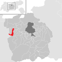 Location in the district | |
 Flaurling Location within Austria | |
| Coordinates: 47°17′32″N 11°07′23″E | |
| Country | Austria |
| State | Tyrol |
| District | Innsbruck Land |
| Area | |
| • Total | 19.64 km2 (7.58 sq mi) |
| Elevation | 675 m (2,215 ft) |
| Population (2018-01-01)[2] | |
| • Total | 1,285 |
| • Density | 65/km2 (170/sq mi) |
| Time zone | UTC+1 (CET) |
| • Summer (DST) | UTC+2 (CEST) |
| Postal code | 6403 |
| Area code | 05262 |
| Vehicle registration | IL |
| Website | www.flaurling.tirol.gv.at |
The municipality consists of the areas: Flaurling village, Flaurling station with a commercial district and Flaurlingberg at the western foothills of a low mountain range terrace. It was mentioned documentarily for the first time as "Flurininga" in the year 763.
Population
| Year | Pop. | ±% |
|---|---|---|
| 1869 | 556 | — |
| 1880 | 542 | −2.5% |
| 1890 | 517 | −4.6% |
| 1900 | 441 | −14.7% |
| 1910 | 493 | +11.8% |
| 1923 | 531 | +7.7% |
| 1934 | 583 | +9.8% |
| 1939 | 578 | −0.9% |
| 1951 | 701 | +21.3% |
| 1961 | 712 | +1.6% |
| 1971 | 884 | +24.2% |
| 1981 | 908 | +2.7% |
| 1991 | 976 | +7.5% |
| 2001 | 1,106 | +13.3% |
| 2011 | 1,224 | +10.7% |
| 2015 | 1,285 | +5.0% |
Twin towns
 Andocs, Hungary
References
- "Dauersiedlungsraum der Gemeinden Politischen Bezirke und Bundesländer - Gebietsstand 1.1.2018". Statistics Austria. Retrieved 10 March 2019.
- "Einwohnerzahl 1.1.2018 nach Gemeinden mit Status, Gebietsstand 1.1.2018". Statistics Austria. Retrieved 9 March 2019.
External links
Wikimedia Commons has media related to Flaurling.
Municipalities in the district of Innsbruck-Land | ||
|---|---|---|
| ||
На других языках
- [en] Flaurling
[ru] Флаурлинг
Флаурлинг (нем. Flaurling) — коммуна в Австрии, в федеральной земле Тироль.Текст в блоке "Читать" взят с сайта "Википедия" и доступен по лицензии Creative Commons Attribution-ShareAlike; в отдельных случаях могут действовать дополнительные условия.
Другой контент может иметь иную лицензию. Перед использованием материалов сайта WikiSort.org внимательно изучите правила лицензирования конкретных элементов наполнения сайта.
Другой контент может иметь иную лицензию. Перед использованием материалов сайта WikiSort.org внимательно изучите правила лицензирования конкретных элементов наполнения сайта.
2019-2026
WikiSort.org - проект по пересортировке и дополнению контента Википедии
WikiSort.org - проект по пересортировке и дополнению контента Википедии