world.wikisort.org - Austria
Deutschkreutz (Hungarian: Sopronkeresztúr until 1899, Németkeresztúr Yiddish: צעלעם, romanized: Zelem Croatian: Kerestur) is an Austrian market town in the district of Oberpullendorf in the state of Burgenland.
This article needs additional citations for verification. (March 2013) |
Deutschkreutz | |
|---|---|
 | |
 Coat of arms | |
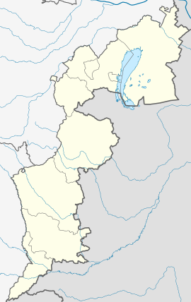 Deutschkreutz Location within Burgenland  Deutschkreutz Location within Austria | |
| Coordinates: 47°36′06″N 16°37′41″E | |
| Country | Austria |
| State | Burgenland |
| District | Oberpullendorf |
| Government | |
| • Mayor | Manfred Kölly (FBL) |
| Area | |
| • Total | 34.11 km2 (13.17 sq mi) |
| Population (2018-01-01)[2] | |
| • Total | 3,088 |
| • Density | 91/km2 (230/sq mi) |
| Time zone | UTC+1 (CET) |
| • Summer (DST) | UTC+2 (CEST) |
| Postal code | 7301 |
| Vehicle registration | OP |
| Website | www.deutschkreutz.at |
Geography
Deutschkreutz lies in Middle Burgenland. It is divided into the districts of Deutschkreutz and Girm. The town, like its neighbors Unterpetersdorf, Horitschon, and Neckenmarkt, is located in Blaufränkischland.
History
Deutschkreutz has been a market town since 1340 (no documention 1370-1429). The town belonged to Hungary as part of Sopron County until 1920. After the end of World War I, the territory was given to Austria by the Treaties of St. Germain and Trianon. Since 1921, the town has belonged to the newly founded State of Burgenland.
In Jewish history, Deutschkreutz was one of the Seven Communities of Burgenland.
Population
| Year | Pop. | ±% |
|---|---|---|
| 1869 | 3,177 | — |
| 1880 | 3,184 | +0.2% |
| 1890 | 3,646 | +14.5% |
| 1900 | 3,952 | +8.4% |
| 1910 | 3,891 | −1.5% |
| 1923 | 3,929 | +1.0% |
| 1934 | 4,220 | +7.4% |
| 1939 | 3,796 | −10.0% |
| 1951 | 3,852 | +1.5% |
| 1961 | 3,901 | +1.3% |
| 1971 | 3,673 | −5.8% |
| 1981 | 3,522 | −4.1% |
| 1991 | 3,327 | −5.5% |
| 2001 | 3,221 | −3.2% |
| 2011 | 3,136 | −2.6% |
| 2016 | 3,102 | −1.1% |
Politics
Deutschkreutz's mayor is Manfred Kölly who was expelled from the FPÖ in December 2006. Vice mayors are Mag. Robert Friedl of the SPÖ and Paul Fennes of the ÖVP. Its chief officer is Stefan Schöller.
The mandate assignments in the Municipal Council (23 seats) are SPÖ 11, ÖVP 7, FPÖ 5, Grüne 0, and other lists 0.
Climate
| Climate data for Deutschkreutz (1971–2000) | |||||||||||||
|---|---|---|---|---|---|---|---|---|---|---|---|---|---|
| Month | Jan | Feb | Mar | Apr | May | Jun | Jul | Aug | Sep | Oct | Nov | Dec | Year |
| Record high °C (°F) | 16.0 (60.8) |
20.4 (68.7) |
25.7 (78.3) |
28.1 (82.6) |
31.3 (88.3) |
33.6 (92.5) |
36.1 (97.0) |
37.4 (99.3) |
34.0 (93.2) |
26.5 (79.7) |
20.5 (68.9) |
19.9 (67.8) |
37.4 (99.3) |
| Average high °C (°F) | 2.7 (36.9) |
4.9 (40.8) |
10.3 (50.5) |
15.3 (59.5) |
20.7 (69.3) |
23.5 (74.3) |
26.2 (79.2) |
26.0 (78.8) |
21.1 (70.0) |
15.0 (59.0) |
7.5 (45.5) |
4.0 (39.2) |
14.8 (58.6) |
| Daily mean °C (°F) | −1.0 (30.2) |
0.5 (32.9) |
5.0 (41.0) |
9.4 (48.9) |
14.8 (58.6) |
17.8 (64.0) |
20.0 (68.0) |
19.5 (67.1) |
14.8 (58.6) |
9.2 (48.6) |
3.5 (38.3) |
0.7 (33.3) |
9.5 (49.1) |
| Average low °C (°F) | −3.8 (25.2) |
−2.6 (27.3) |
1.1 (34.0) |
4.6 (40.3) |
9.2 (48.6) |
12.3 (54.1) |
14.2 (57.6) |
14.1 (57.4) |
10.4 (50.7) |
5.4 (41.7) |
0.6 (33.1) |
−1.9 (28.6) |
5.3 (41.5) |
| Record low °C (°F) | −22.0 (−7.6) |
−20.5 (−4.9) |
−21.0 (−5.8) |
−4.5 (23.9) |
−1.6 (29.1) |
4.5 (40.1) |
6.0 (42.8) |
4.5 (40.1) |
1.5 (34.7) |
−6.0 (21.2) |
−13.0 (8.6) |
−19.0 (−2.2) |
−22.0 (−7.6) |
| Average precipitation mm (inches) | 29.8 (1.17) |
28.2 (1.11) |
36.4 (1.43) |
43.6 (1.72) |
71.8 (2.83) |
86.3 (3.40) |
61.2 (2.41) |
65.1 (2.56) |
60.5 (2.38) |
45.4 (1.79) |
53.0 (2.09) |
36.0 (1.42) |
617.3 (24.30) |
| Average snowfall cm (inches) | 17.4 (6.9) |
14.2 (5.6) |
8.5 (3.3) |
1.0 (0.4) |
0.0 (0.0) |
0.0 (0.0) |
0.0 (0.0) |
0.0 (0.0) |
0.0 (0.0) |
0.0 (0.0) |
8.7 (3.4) |
19.3 (7.6) |
69.1 (27.2) |
| Average precipitation days (≥ 1.0 mm) | 5.7 | 5.6 | 7.4 | 6.4 | 9.2 | 10.1 | 7.9 | 7.8 | 7.1 | 5.9 | 8.0 | 7.1 | 88.2 |
| Average relative humidity (%) (at 14:00) | 67.9 | 61.7 | 54.8 | 47.7 | 49.1 | 51.3 | 46.5 | 47.5 | 52.4 | 58.5 | 69.5 | 72.3 | 56.6 |
| Source: Central Institute for Meteorology and Geodynamics[3] | |||||||||||||
Personalities
- Elizabeth Báthory
- Lajos Dóczi
See also
References
- "Dauersiedlungsraum der Gemeinden Politischen Bezirke und Bundesländer - Gebietsstand 1.1.2018". Statistics Austria. Retrieved 10 March 2019.
- "Einwohnerzahl 1.1.2018 nach Gemeinden mit Status, Gebietsstand 1.1.2018". Statistics Austria. Retrieved 9 March 2019.
- "Klimadaten von Österreich 1971–2000 – Burgenland-Deutschkreutz" (in German). Central Institute for Meteorology and Geodynamics. Archived from the original on 12 October 2019. Retrieved 16 November 2019.
- The information in this article is based on a translation of its German equivalent.
Authority control | |
|---|---|
| General | |
| National libraries | |
This Hungarian history article is a stub. You can help Wikipedia by expanding it. |
This Austrian history article is a stub. You can help Wikipedia by expanding it. |
This article related to Jewish history is a stub. You can help Wikipedia by expanding it. |
На других языках
- [en] Deutschkreutz
[ru] Дойчкройц
Дойчкройц[1] (нем. Deutschkreutz) — коммуна (нем. Gemeinde) в Австрии, в федеральной земле Бургенланд.Другой контент может иметь иную лицензию. Перед использованием материалов сайта WikiSort.org внимательно изучите правила лицензирования конкретных элементов наполнения сайта.
WikiSort.org - проект по пересортировке и дополнению контента Википедии