world.wikisort.org - Austria
Attersee am Attersee is a village on the western shore of Attersee lake in the Austrian state of Upper Austria.
Attersee am Attersee | |
|---|---|
 | |
 Coat of arms | |
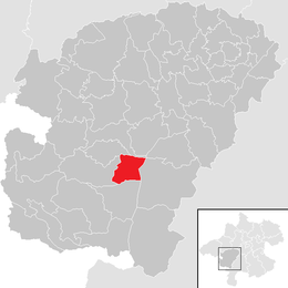 Location in the district | |
 Attersee am Attersee Location within Austria | |
| Coordinates: 47°55′00″N 13°32′29″E | |
| Country | Austria |
| State | Upper Austria |
| District | Vöcklabruck |
| Government | |
| • Mayor | Walter Kastinger (SPÖ) |
| Area | |
| • Total | 14.67 km2 (5.66 sq mi) |
| Elevation | 496 m (1,627 ft) |
| Population (2018-01-01)[2] | |
| • Total | 1,585 |
| • Density | 110/km2 (280/sq mi) |
| Time zone | UTC+1 (CET) |
| • Summer (DST) | UTC+2 (CEST) |
| Postal code | 4864 |
| Area code | 07666 |
| Vehicle registration | VB |
| Website | www.attersee.ooe.gv.at |
Geography
The village center lies between the lake and the slopes of the Buchberg (888 m or 2913 feet, "Beech Mountain") and is the location of a Baroque pilgrimage church. There are views across the lake and up to the Höllengebirge ("Mountains of Hell").
Transport
A light railway connects the village with the main Westbahn railway line between Linz and Salzburg. The village is a centre for sailing on the Attersee, with a shipyard and an important yacht club (the Union Yachtclub Attersee) which organizes international sailing competitions. As Attersee am Attersee mainly depends on the tourist industry it can be very busy during the summer months but has a quieter ambiance during the winter. A village festival is held annually, when local people come together to celebrate and play music.
UNESCO World Heritage Site
The village is home to prehistoric pile-dwelling (or stilt house) settlements[3] that are part of the Prehistoric Pile dwellings around the Alps UNESCO World Heritage Site.[4]
References
- "Dauersiedlungsraum der Gemeinden Politischen Bezirke und Bundesländer - Gebietsstand 1.1.2018". Statistics Austria. Retrieved 10 March 2019.
- "Einwohnerzahl 1.1.2018 nach Gemeinden mit Status, Gebietsstand 1.1.2018". Statistics Austria. Retrieved 9 March 2019.
- "UNESCO Welterbe - Prähistorische Pfahlbauten am Attersee". 17 June 2012.
- UNESCO World Heritage Site - Prehistoric Pile dwellings around the Alps
Authority control | |
|---|---|
| General |
|
| National libraries | |
This Upper Austria location article is a stub. You can help Wikipedia by expanding it. |
На других языках
- [en] Attersee am Attersee
[ru] Аттерзе-ам-Аттерзе
Аттерзе-ам-Аттерзе (нем. Attersee am Attersee) — община (нем. Gemeinde) в Австрии, в федеральной земле Верхняя Австрия. Расположен на берегу озера Аттерзе.Другой контент может иметь иную лицензию. Перед использованием материалов сайта WikiSort.org внимательно изучите правила лицензирования конкретных элементов наполнения сайта.
WikiSort.org - проект по пересортировке и дополнению контента Википедии