world.wikisort.org - Australia
Yimbun is a rural locality in the Somerset Region, Queensland, Australia.[2] In the 2016 census Yimbun had a population of 33 people.[1]
| Yimbun Queensland | |||||||||||||||
|---|---|---|---|---|---|---|---|---|---|---|---|---|---|---|---|
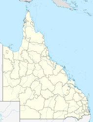  Yimbun | |||||||||||||||
| Coordinates | 27.0316°S 152.3594°E | ||||||||||||||
| Population | 33 (2016 census)[1] | ||||||||||||||
| • Density | 4.34/km2 (11.25/sq mi) | ||||||||||||||
| Postcode(s) | 4313 | ||||||||||||||
| Area | 7.6 km2 (2.9 sq mi) | ||||||||||||||
| Time zone | AEST (UTC+10:00) | ||||||||||||||
| Location |
| ||||||||||||||
| LGA(s) | Somerset Region | ||||||||||||||
| State electorate(s) | Nanango | ||||||||||||||
| Federal division(s) | Blair | ||||||||||||||
| |||||||||||||||
Geography
Yimbun is predominantly used for farming with no urban development. The Brisbane Valley Highway runs north to south through the locality. The now-closed Brisbane Valley railway line ran from north to south through Yimbun.[3]
History
Yimbun takes its name from the Yimbun railway station, a word from the Dunibara dialect of the Waka language meaning bullrush (Typha angustifolia). It was briefly named Moorabool from 1904 to 1906 and then Kannangur from 1906 to 1914.[2]
In the 2016 census Yimbun had a population of 33 people.[1]
References
- Australian Bureau of Statistics (27 June 2017). "Yimbun (SSC)". 2016 Census QuickStats. Retrieved 20 October 2018.
- "Yimbun – locality in Somerset Region (entry 44938)". Queensland Place Names. Queensland Government. Retrieved 29 December 2020.
- "Queensland Globe". State of Queensland. Retrieved 6 July 2015.

Further reading
- 'Glory days' of the Brisbane Valley line : Colinton, Yimbun & Ottaba, Toogoolawah & District History Group, 2008
Текст в блоке "Читать" взят с сайта "Википедия" и доступен по лицензии Creative Commons Attribution-ShareAlike; в отдельных случаях могут действовать дополнительные условия.
Другой контент может иметь иную лицензию. Перед использованием материалов сайта WikiSort.org внимательно изучите правила лицензирования конкретных элементов наполнения сайта.
Другой контент может иметь иную лицензию. Перед использованием материалов сайта WikiSort.org внимательно изучите правила лицензирования конкретных элементов наполнения сайта.
2019-2026
WikiSort.org - проект по пересортировке и дополнению контента Википедии
WikiSort.org - проект по пересортировке и дополнению контента Википедии