world.wikisort.org - Australia
Yeerongpilly is a southern suburb in the City of Brisbane, Queensland, Australia.[3] In the 2016 census, Yeerongpilly had a population of 1,934 people.[1]
| Yeerongpilly Brisbane, Queensland | |||||||||||||||
|---|---|---|---|---|---|---|---|---|---|---|---|---|---|---|---|
 Fairfield Road | |||||||||||||||
 Yeerongpilly | |||||||||||||||
| Coordinates | 27.5300°S 153.0119°E | ||||||||||||||
| Population | 1,934 (2016 census)[1] | ||||||||||||||
| • Density | 1,018/km2 (2,640/sq mi) | ||||||||||||||
| Postcode(s) | 4105 | ||||||||||||||
| Area | 1.9 km2 (0.7 sq mi) | ||||||||||||||
| Time zone | AEST (UTC+10:00) | ||||||||||||||
| Location | 8.5 km (5 mi) SW of Brisbane GPO | ||||||||||||||
| LGA(s) | City of Brisbane (Tennyson Ward)[2] | ||||||||||||||
| State electorate(s) | Miller | ||||||||||||||
| Federal division(s) | Moreton | ||||||||||||||
| |||||||||||||||
Geography
Yeerongpilly is 8.5 kilometres (5.3 mi) south-west of the Brisbane GPO.[4]
A small section of the north eastern boundary runs along Ipswich Road.
History
Yeerongpilly is an Aboriginal word meaning rain coming according to Thomas Petrie[5] or is derived from the Aboriginal words yurong meaning rain or yarung meaning sandy or gravelly. The suffix "pilly" means a gully or watercourse.[3]
Yeerongpilly grew from an area named Boggo,[3] which was logged for timber for Brisbane.[citation needed]
In April 1885, "Lathorn Estate" made up of 118 allotments were advertised to be auctioned by James R. Dickson & Co. A map advertising the auction states the Estate consisted of 118 subdivisions of 131 Portion, Parish of Yeerongpilly.[6] Newspaper advertising states the Estate was "situated at the junction of Ipswich and Boggo Roads" and "within a quarter of a mile of Yeerong Railway Station".[7]
In October 1887, 24 large allotments of the "Ortive Estate" were advertised to be auctioned by G. T. Bell, Auctioneer. A map advertising the auction states the Estate was "close to South Coast Junction Railway Station."[8] Newspaper advertising states the Estate was "within stone throw of railway station" with "24 grand large-sized building allotments, all over 20 perches".[9]
In February 1890, "Grand View Estate" made up of 18 allotments were advertised to be auctioned by John W. Todd. A map advertising the auction states the Estate was bordered by Fairfield Road and Boundary Road.[10] Newspaper advertising states the Estate was "directly opposite the South Brisbane cemetery" and offers "magnificent views of the River, Mountains and surrounding land."[11]
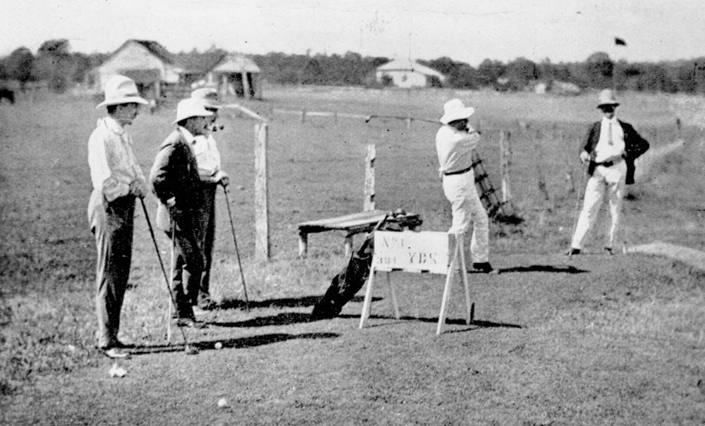
The Brisbane Golf Club was established in the suburb in 1896.[12]
A Queensland Government research complex, last known as the Animal Research Institute, occupied a site adjacent to Fairfield Road from 1909 to 2011.
In October 1927, 14 allotments of "Riverside Estate" were advertised to be auctioned by Thornton & Pearce, Auctioneers. A map advertising the auction states that the Estate was "only a few yards from Tennyson station, within easy walking distance".[13] Newspaper advertising states the Estate allotments were "the last of the select, High River frontage sites" with "appealing views of the river and mountains".[14]

The Brisbane River makes up a very small section of the northern boundary of the locality while a small section of the western boundary follows Oxley Creek.[15] Parts of Yeerongpilly were affected by the 2010–2011 Queensland floods. Insurance claims for damage created by the flood were the second highest in the state, according to Suncorp Insurance.[16]
In the 2016 census, Yeerongpilly had a population of 1,934 people, 50.8% female and 49.2% male.[1] The median age of the Yeerongpilly population was 32 years. The most common ancestries in Yeerongpilly were English 25.9%, Australian 21.0%, Irish 11.6%, Scottish 8.5% and German 4.0%. In Yeerongpilly (State Suburbs), 70.2% of people were born in Australia. The most common countries of birth were New Zealand 3.6%, England 3.4%, India 1.9%, Vietnam 1.5% and China (excludes SARs and Taiwan) 1.3%. 78.1% of people only spoke English at home. Other languages spoken at home included Vietnamese 2.1%, Mandarin 1.4%, Arabic 1.1%, Cantonese 1.0% and Spanish 0.9%.[1]
Heritage listings

Yeerongpilly has a number of heritage-listed sites, including:
- 740 Fairfield Road: Trainmen's Quarters[17]
- 681 Fairfield Road & 41 Godiva Street : Animal Research Institute Buildings[18]
- 14 Grosvenor Street: Craigilea (house)[19]
- 53 Nathan Terrace: former St Giles Uniting Church (also known as Yeerongpilly Presbyterian Church)[20]
- 12 Tees Street: Revoncourt (house)[21]
- 70 Tennyson Memorial Avenue: Brisbane Golf Club Clubhouse[22]
- 32 Wingarra Street: Warra (house)[23]
Education
There are no schools in Yeerongpilly. The nearest primary school is Yeronga State School in Yeronga to the north. The nearest secondary school is Yeronga State High School in Yeronga.[15]
Transport

Yeerongpilly railway station provides access to regular Queensland Rail City network services to Brisbane, Beenleigh and Ferny Grove.
The original proposal for the Cross River Rail project was to have its southern tunnel portal approximately at the Cardross St overbridge. The current proposal has relocated the southern tunnel portal to Dutton Park.
Sport
The Brisbane Golf Club is a 36 hole, private golf club and includes facilities such as driving range and pro shop.[12]
Notable people
- Ken Archer, an Australian cricketer was born in the suburb in 1928.
- Marty Mayberry, a double leg amputee Paralympic alpine skier born in 1986.
See also
References
- Australian Bureau of Statistics (27 June 2017). "Yeerongpilly (SSC)". 2016 Census QuickStats. Retrieved 20 October 2018.
- "Tennyson Ward". Brisbane City Council. Brisbane City Council. Archived from the original on 4 March 2017. Retrieved 19 March 2017.
- "Yeerongpilly – suburb in City of Brisbane (entry 44352)". Queensland Place Names. Queensland Government. Retrieved 11 October 2020.
- "Brisbane GPO to Yeerongpilly". Google Maps. Archived from the original on 16 October 2020. Retrieved 16 October 2020.
- "NOMENCLATURE OF QUEENSLAND—320". The Courier-mail. No. 970. Queensland, Australia. 8 October 1936. p. 12. Archived from the original on 16 October 2020. Retrieved 16 October 2020 – via National Library of Australia.
- "Lathorn Estate Being subdivisions 1 to 118 of portions 131 Parish of Yeerongpilly. For sale by auction on the ground Saturday April 25th at 2:30 p.m. Luncheon provided". State Library of Queensland. 1885. hdl:10462/deriv/18504. Archived from the original on 16 October 2020. Retrieved 5 June 2020.
- "Classified Advertising". The Brisbane Courier. Queensland, Australia. 24 April 1885. p. 7. Archived from the original on 16 October 2020. Retrieved 5 June 2020 – via Trove.
- "The Ortive Estate". State Library of Queensland. 1887. Archived from the original on 25 May 2022. Retrieved 18 May 2022.
- "Classified Advertising". The Brisbane Courier. Vol. XLIV, no. 9, 295. Queensland, Australia. 29 October 1887. p. 10. Retrieved 18 May 2022 – via National Library of Australia.
- "Plan of the Grand View Estate". State Library of Queensland. 1890. hdl:10462/deriv/280864. Archived from the original on 16 October 2020. Retrieved 5 June 2020.
- "Advertising". The Telegraph. Queensland, Australia. 25 January 1890. p. 8. Archived from the original on 16 October 2020. Retrieved 5 June 2020 – via Trove.
- "The Brisbane Golf Club Australia". Archived from the original on 11 November 2012. Retrieved 21 October 2014.
- "Riverside Estate, Yeerongpilly Thornton & Pearce, Auctioneers ; C.F. Bennett, Surveyor". State Library of Queensland. 1927. Archived from the original on 25 May 2022. Retrieved 18 May 2022.
- "Advertising". The Brisbane Courier. No. 21, 757. Queensland, Australia. 20 October 1927. p. 26. Archived from the original on 25 May 2022. Retrieved 18 May 2022 – via National Library of Australia.
- "Queensland Globe". State of Queensland. Retrieved 16 October 2020.
- "Insurer's flood payouts top $63m". Australia: ABC News. 3 November 2011. Archived from the original on 4 November 2011. Retrieved 10 October 2012.
- "Trainmen's Quarters". Brisbane Heritage Register. Brisbane City Council. Retrieved 9 March 2020.
- "Animal Research Institute (former) (entry 602598)". Queensland Heritage Register. Queensland Heritage Council. Retrieved 19 June 2013.
- "14 Grosvenor Street, Yeerongpilly". Brisbane Heritage Register. Brisbane City Council. Retrieved 9 March 2020.
- "St Giles Uniting Church (former)". Brisbane Heritage Register. Brisbane City Council. Retrieved 9 March 2020.
- "12 Tees Street, Yeerongpilly". Brisbane Heritage Register. Brisbane City Council. Retrieved 9 March 2020.
- "Brisbane Golf Club Clubhouse". Brisbane Heritage Register. Brisbane City Council. Retrieved 9 March 2020.
- "32 Wingarra Street, Yeerongpilly". Brisbane Heritage Register. Brisbane City Council. Retrieved 9 March 2020.
External links
- "Yeerongpilly". Queensland Places. Centre for the Government of Queensland, University of Queensland.
- "Yeerongpilly". BRISbites. Brisbane City Council. Archived from the original on 23 July 2008.
- "Yeerongpilly". Our Brisbane. Brisbane City Council. Archived from the original on 20 February 2008.
Другой контент может иметь иную лицензию. Перед использованием материалов сайта WikiSort.org внимательно изучите правила лицензирования конкретных элементов наполнения сайта.
WikiSort.org - проект по пересортировке и дополнению контента Википедии