world.wikisort.org - Australia
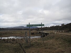
Yaouk (/ˈjaɪjæk/) is a locality in the Snowy Monaro Region, New South Wales, Australia.[2][3] It lies in open grassland valleys surrounded by mountains on both sides of the Murrumbidgee River, downstream from and east of the Tantangara Dam, north of Adaminaby, east of the Kosciuszko National Park and south of the Namadgi National Park in the Australian Capital Territory, but separated from it by the mountainous Scabby Range. It is about 110 km south of Canberra and about 75 km northwest of Cooma. At the 2016 census, it had a population of 25.[1]
| Yaouk New South Wales | |||||||||||||||
|---|---|---|---|---|---|---|---|---|---|---|---|---|---|---|---|
 Murrumbidgee River at Yaouk | |||||||||||||||
 Yaouk Location in New South Wales | |||||||||||||||
| Coordinates | 35°48′57″S 148°48′02″E | ||||||||||||||
| Population | 25 (2016 census)[1] | ||||||||||||||
| Postcode(s) | 2629 | ||||||||||||||
| Location |
| ||||||||||||||
| LGA(s) | Snowy Monaro Regional Council | ||||||||||||||
| Region | Monaro | ||||||||||||||
| County | Cowley | ||||||||||||||
| Parish | Yaouk | ||||||||||||||
| State electorate(s) | Monaro | ||||||||||||||
| Federal division(s) | Eden-Monaro | ||||||||||||||
| |||||||||||||||
History
Yaouk is named after the Yaouk Run, a 4,096 hectare "squatter's run" first held by Henry Hall in 1838.[4]
Heritage listing
Yaouk has a number of heritage-listed sites, including:
References
- Australian Bureau of Statistics (27 June 2017). "Yaouk". 2016 Census QuickStats. Retrieved 3 April 2018.
- "Yaouk". Geographical Names Register (GNR) of NSW. Geographical Names Board of New South Wales. Retrieved 3 April 2018.
- "Yaouk". OpenStreetMap. Archived from the original on 3 April 2018. Retrieved 3 April 2018.
- "Yaouk Nature Reserve: Plan of Management" (PDF). NSW National Parks and Wildlife Service. New South Wales Government. August 2009. p. 10. Archived (PDF) from the original on 21 February 2019. Retrieved 21 April 2019.
- "Scabby Range Nature Reserve (Place ID 13624)". Australian Heritage Database. Australian Government. Retrieved 11 October 2018.
- "Australian Alps National Parks and Reserves (Place ID 105891)". Australian Heritage Database. Australian Government. Retrieved 11 October 2018.
Текст в блоке "Читать" взят с сайта "Википедия" и доступен по лицензии Creative Commons Attribution-ShareAlike; в отдельных случаях могут действовать дополнительные условия.
Другой контент может иметь иную лицензию. Перед использованием материалов сайта WikiSort.org внимательно изучите правила лицензирования конкретных элементов наполнения сайта.
Другой контент может иметь иную лицензию. Перед использованием материалов сайта WikiSort.org внимательно изучите правила лицензирования конкретных элементов наполнения сайта.
2019-2025
WikiSort.org - проект по пересортировке и дополнению контента Википедии
WikiSort.org - проект по пересортировке и дополнению контента Википедии