world.wikisort.org - Australia
Wootha is a rural locality in the Sunshine Coast Region, Queensland, Australia.[2] In the 2016 census Wootha had a population of 201 people.[1]
| Wootha Queensland | |||||||||||||||
|---|---|---|---|---|---|---|---|---|---|---|---|---|---|---|---|
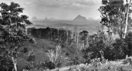 Looking across Wootha towards the Glass House Mountains, circa 1931 | |||||||||||||||
 Wootha | |||||||||||||||
| Coordinates | 26.7875°S 152.8002°E | ||||||||||||||
| Population | 201 (2016 census)[1] | ||||||||||||||
| • Density | 12.48/km2 (32.33/sq mi) | ||||||||||||||
| Postcode(s) | 4552 | ||||||||||||||
| Area | 16.1 km2 (6.2 sq mi) | ||||||||||||||
| Time zone | AEST (UTC+10:00) | ||||||||||||||
| LGA(s) | Sunshine Coast Region | ||||||||||||||
| State electorate(s) | Glass House | ||||||||||||||
| Federal division(s) | Fisher | ||||||||||||||
| |||||||||||||||
History
The name Wootha comes from the Kabi language (Dallambara dialect) meaning red cedar tree.[2]
Blackall Range Provisional School opened about 1886, becoming Blackall Range State School on 1 October 1909. It was renamed Wootha State School in 1937. It closed in 1949.[3]
In the 2016 census Wootha had a population of 201 people.[1]
Attractions

Despite its name, Maleny Botanic Gardens and Bird World is at 233 Maleny Stanley River Road in Wootha (26.7800°S 152.8346°E).[4]
References
Wikimedia Commons has media related to Wootha, Queensland.
- Australian Bureau of Statistics (27 June 2017). "Wootha (SSC)". 2016 Census QuickStats. Retrieved 20 October 2018.
- "Wootha – locality in Sunshine Coast Region (entry 48944)". Queensland Place Names. Queensland Government. Retrieved 29 December 2020.
- Queensland Family History Society (2010), Queensland schools past and present (Version 1.01 ed.), Queensland Family History Society, ISBN 978-1-921171-26-0
- "Maleny Botanic Gardens & Bird World". – Maleny Botanic Gardens & Bird World. Archived from the original on 29 December 2020. Retrieved 28 February 2021.
Further reading
- Maleny schools' centenary celebration : 100 years of education, 1913-2013, Maleny P&C, 2013 — includes Blackall Range State School
Текст в блоке "Читать" взят с сайта "Википедия" и доступен по лицензии Creative Commons Attribution-ShareAlike; в отдельных случаях могут действовать дополнительные условия.
Другой контент может иметь иную лицензию. Перед использованием материалов сайта WikiSort.org внимательно изучите правила лицензирования конкретных элементов наполнения сайта.
Другой контент может иметь иную лицензию. Перед использованием материалов сайта WikiSort.org внимательно изучите правила лицензирования конкретных элементов наполнения сайта.
2019-2026
WikiSort.org - проект по пересортировке и дополнению контента Википедии
WikiSort.org - проект по пересортировке и дополнению контента Википедии