world.wikisort.org - Australia
Whichello is a rural locality in the Toowoomba Region, Queensland, Australia.[2] In the 2016 census, Whichello had a population of 31 people.[1]
| Whichello Queensland | |||||||||||||||
|---|---|---|---|---|---|---|---|---|---|---|---|---|---|---|---|
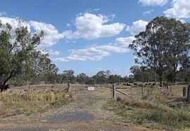
 Paddock along Pechey Maclagan Road, 2014 | |||||||||||||||
 Whichello | |||||||||||||||
| Coordinates | 27.2941°S 151.9980°E | ||||||||||||||
| Population | 31 (2016 census)[1] | ||||||||||||||
| • Density | 2.65/km2 (6.86/sq mi) | ||||||||||||||
| Postcode(s) | 4352 | ||||||||||||||
| Area | 11.7 km2 (4.5 sq mi) | ||||||||||||||
| Time zone | AEST (UTC+10:00) | ||||||||||||||
| LGA(s) | Toowoomba Region | ||||||||||||||
| State electorate(s) | Condamine | ||||||||||||||
| Federal division(s) | Maranoa | ||||||||||||||
| |||||||||||||||
Geography

Whichello is on the Darling Downs in southern Queensland.
Whichello is similar to many of the localities in the eastern Downs, with the land mostly cleared for agriculture and few facilities or amenities. A 2-hectare (4.9-acre) reserve is situated in Whichello School Road.
Road infrastructure
The Pechey-Maclagan Road runs through from east to south.[3]
History
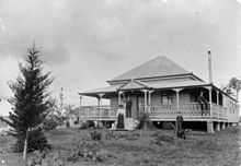
Whichello Provisional School opened circa 1894. On 1 January 1909 it became Whichello State School. It closed circa 1941.[4]
References
Wikimedia Commons has media related to Whichello, Queensland.
- Australian Bureau of Statistics (27 June 2017). "Whichello (SSC)". 2016 Census QuickStats. Retrieved 20 October 2018.
- "Whichello – locality in Toowoomba Region (entry 48094)". Queensland Place Names. Queensland Government. Retrieved 17 November 2019.
- Whichello, Queensland (Map). OpenStreetMap. Retrieved 28 March 2022.
- Queensland Family History Society (2010), Queensland schools past and present (Version 1.01 ed.), Queensland Family History Society, ISBN 978-1-921171-26-0
Текст в блоке "Читать" взят с сайта "Википедия" и доступен по лицензии Creative Commons Attribution-ShareAlike; в отдельных случаях могут действовать дополнительные условия.
Другой контент может иметь иную лицензию. Перед использованием материалов сайта WikiSort.org внимательно изучите правила лицензирования конкретных элементов наполнения сайта.
Другой контент может иметь иную лицензию. Перед использованием материалов сайта WikiSort.org внимательно изучите правила лицензирования конкретных элементов наполнения сайта.
2019-2025
WikiSort.org - проект по пересортировке и дополнению контента Википедии
WikiSort.org - проект по пересортировке и дополнению контента Википедии