world.wikisort.org - Australia
Toolleen is a town in northern Victoria, Australia. The town is on the Northern Highway and is in the Shire of Campaspe and the City of Greater Bendigo local government areas, 142 kilometres (88 mi) north of the state capital, Melbourne. At the 2016 census, Toolleen and the surrounding area had a population of 182.[1]
| Toolleen Victoria | |
|---|---|
 Toolleen Hotel | |
 Toolleen | |
| Coordinates | 36°43′16″S 144°41′00″E |
| Population | 182 (2016 census)[1] |
| Postcode(s) | 3551 |
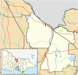
| Location |
|
| LGA(s) |
|
| State electorate(s) | Euroa |
| Federal division(s) |
|
During the Victorian Gold Rush and after the discovery of gold at nearby Rushworth, Toolleen was a busy intersection where the roads linking Bendigo, Beechworth, Melbourne and the Murray River port of Echuca crossed.[2]
Toolleen Post Office opened on 12 July 1872.[3]
The town is now mainly an agricultural region, with wine grape growing becoming more popular.[2]
References
- "2016 Census QuickStats Toolleen". Australian Bureau of Statistics. Retrieved 18 May 2019.
- "Toolleen". Shire of Campaspe. 17 February 2010. Retrieved 16 May 2010.
- Phoenix Auctions History. "Post Office List". Phoenix Auctions. Retrieved 21 March 2021.
External links
![]() Media related to Toolleen, Victoria at Wikimedia Commons
Media related to Toolleen, Victoria at Wikimedia Commons
This article about a location in Victoria, Australia is a stub. You can help Wikipedia by expanding it. |
Другой контент может иметь иную лицензию. Перед использованием материалов сайта WikiSort.org внимательно изучите правила лицензирования конкретных элементов наполнения сайта.
WikiSort.org - проект по пересортировке и дополнению контента Википедии