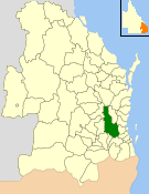
The Shire of Esk was a local government area in South East Queensland, Australia, located about 90 kilometres (56mi) west - northwest of Brisbane. It stretched from the Lockyer Valley north and west to the Great Dividing Range and up the valley of the Brisbane River. Esk covered an area of 3,936.2 square kilometres (1,519.8sqmi), and existed from 1879 until its merger with the Shire of Kilcoy to form the Somerset Region on 15 March 2008.
Map of Esk Division and adjacent local government areas, March 1902. Legend: Brassall Division (9), Walloon Division (17)
The Durundur Division was incorporated on 11 November 1879 under the Divisional Boards Act 1879 with a population of 1428.[2] Its name was changed to Esk Division on 2 June 1880 by proclamation.[3][4]
On 18 January 1884, there was an adjustment of boundaries between Highfields Division's subdivisions Nos. 1 and 2 and Esk Division.[5][6]
With the passage of the Local Authorities Act 1902, Esk became a Shire on 31 March 1903.[4][7] The council consisted of an elected mayor and ten councillors, and was not subdivided.
In 1980, the Council of the Shire of Esk adopted the head of the red deer as its logo, honouring a gift from Queen Victoria in September 1873 to the district. In 1984 the official logo was adopted.[8] The Weeping Bottlebrush was adopted as the shire's floral emblem on 10 August 1994.
On 15 March 2008, under the Local Government (Reform Implementation) Act 2007 passed by the Parliament of Queensland on 10 August 2007, the Shire of Esk merged with the Shire of Kilcoy to form the Somerset Region.[7][9]
Towns and localities
The Shire of Esk included the following settlements:
Kerr, Ruth (1988). Confidence and tradition: a history of the Esk Shire. Esk Shire Council. ISBN978-0-7316-1568-1.
Pugh, Theophilus Parsons (1927). Pugh's Almanac for 1927. Archived from the original on 4 March 2014. Retrieved 13 June 2014.
"NEW BRIDGE". The Brisbane Courier. National Library of Australia. 26 October 1931. p.12. Retrieved 9 June 2014.
Bray stepped down in January 2004 in order to contest the Ipswich West state electorate for the Liberal Party. See Electoral Commission of Queensland (20 February 2004). "2004 State General Election – Ipswich West – District Summary". Archived from the original on 28 July 2008. Retrieved 22 March 2008.
Другой контент может иметь иную лицензию. Перед использованием материалов сайта WikiSort.org внимательно изучите правила лицензирования конкретных элементов наполнения сайта.
2019-2026 WikiSort.org - проект по пересортировке и дополнению контента Википедии