world.wikisort.org - Australia
The Shire of Bulla was a local government area located about 40 kilometres (25 mi) northwest of Melbourne, the state capital of Victoria, Australia. The shire covered an area of 422.17 square kilometres (163.0 sq mi), and existed from 1862 until 1994.
| Shire of Bulla Victoria | |||||||||||||||
|---|---|---|---|---|---|---|---|---|---|---|---|---|---|---|---|
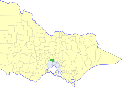 Location in Victoria | |||||||||||||||
| Population | 42,500 (1992)[1] | ||||||||||||||
| • Density | 100.67/km2 (260.73/sq mi) | ||||||||||||||
| Established | 1862 | ||||||||||||||
| Area | 422.17 km2 (163.0 sq mi) | ||||||||||||||
| Council seat | Sunbury | ||||||||||||||
| Region | Northwest Melbourne | ||||||||||||||
| County | Bourke | ||||||||||||||
| |||||||||||||||
History
The Bulla Road District was created on 16 September 1862. It became a shire on 9 March 1866. It gained some territory from the Shire of Broadmeadows in 1955, including then-rural areas such as Craigieburn.[2] The Shire Offices were transferred from Bulla to Sunbury in 1956.[3]
On 15 December 1994, the Shire of Bulla was abolished, and, along with sections of the City of Broadmeadows north of the Western Ring Road and parts of the Cities of Keilor and Whittlesea, was merged into the newly created City of Hume.[4]
Council met at the Shire Offices, in Sunbury. The facility is used today by the City of Hume, Western Water and VicRoads.
Wards
The Shire of Bulla was divided into four ridings on 1 April 1985, each of which elected three councillors:
- Bulla Riding
- Craigieburn Riding
- Sunbury East Riding
- Sunbury West Riding
Suburbs and localities
- Attwood
- Bulla
- Craigieburn (shared with the City of Whittlesea)
- Diggers Rest (shared with the Shire of Melton)
- Greenvale
- Kalkallo
- Melbourne Airport (shared with the City of Keilor)
- Mickleham
- Oaklands Junction
- Roxburgh Park
- Somerton (shared with the City of Whittlesea)
- Sunbury
- Wildwood
- Yuroke
Population
| Year | Population |
|---|---|
| 1871 | 2,234 |
| 1947 | 2,656 |
| 1954 | 3,232 |
| 1958 | 4,020*+ |
| 1961 | 4,824 |
| 1966 | 5,711 |
| 1971 | 8,243 |
| 1976 | 13,399 |
| 1981 | 18,624 |
| 1986 | 28,347 |
| 1991 | 39,301 |
* Estimate in the 1958 Victorian Year Book.
+ Includes population gained from City of Broadmeadows in 1955.
References
- Australian Bureau of Statistics, Victoria Office (1994). Victorian Year Book. p. 49. ISSN 0067-1223.
- Victorian Municipal Directory. Brunswick: Arnall & Jackson. 1992. pp. 612–613. Accessed at State Library of Victoria, La Trobe Reading Room.
- Monash University (1999). "Australian Places - Bulla". Archived from the original on 20 December 2002. Retrieved 4 January 2008.
- Australian Bureau of Statistics (1 August 1995). Victorian local government amalgamations 1994-1995: Changes to the Australian Standard Geographical Classification (PDF). Commonwealth of Australia. p. 7. ISBN 0-642-23117-6. Retrieved 16 December 2007.
Authority control | |
|---|---|
| General | |
| National libraries | |
Другой контент может иметь иную лицензию. Перед использованием материалов сайта WikiSort.org внимательно изучите правила лицензирования конкретных элементов наполнения сайта.
WikiSort.org - проект по пересортировке и дополнению контента Википедии