world.wikisort.org - Australia
Norwell is a rural locality in the City of Gold Coast, Queensland, Australia.[2] In the 2016 census, Norwell had a population of 200 people.[1]
| Norwell Gold Coast, Queensland | |||||||||||||||
|---|---|---|---|---|---|---|---|---|---|---|---|---|---|---|---|
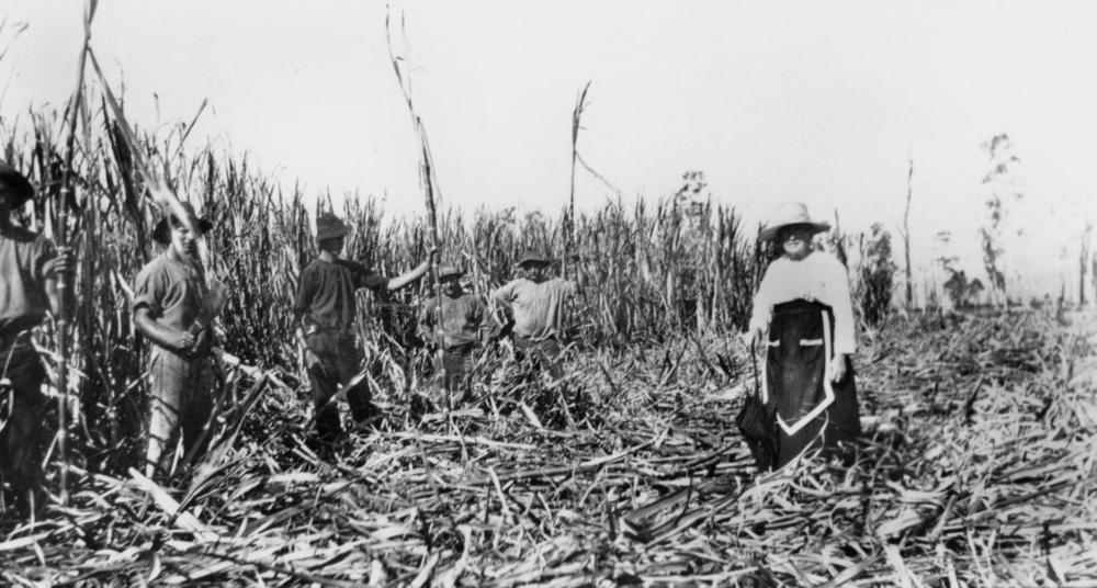 Canefields, Norwell, circa 1915 | |||||||||||||||
 Norwell | |||||||||||||||
| Coordinates | 27.7769°S 153.3125°E | ||||||||||||||
| Population | 200 (2016 census)[1] | ||||||||||||||
| • Density | 7.7/km2 (20/sq mi) | ||||||||||||||
| Postcode(s) | 4208 | ||||||||||||||
| Area | 26.1 km2 (10.1 sq mi) | ||||||||||||||
| Time zone | AEST (UTC+10:00) | ||||||||||||||
| Location |
| ||||||||||||||
| LGA(s) | City of Gold Coast | ||||||||||||||
| State electorate(s) | Coomera | ||||||||||||||
| Federal division(s) | Fadden | ||||||||||||||
| |||||||||||||||
Geography
Norwell is in the north of the City of Gold Coast. It is bounded to the east by Jacobs Well, to the south by Pimpama, to the west by Ormeau, and to the north by Gilberton and Woongoolba.
History

In the late 1800s, the farming district located between the Pimpama River and the Logan River called Pimpama Island and encompasses the modern localities of Jacobs Well, Norwell, Steiglitz and Woongoolba. It was referred to as an island because there were a number of lagoons and swamps that isolated the area during the wet season; however, this disadvantage made it good land for growing sugar cane.[3]
Norwell was named after the Norwell sugar plantation which was owned by William Pidd in the 1870s.[4]
On 17 January 1910, Norwell State School was officially opened by James Stodart, Member of the Queensland Legislative Assembly for Logan. It closed on 30 April 1971.[5][6][7] The school was at approx 544 Norwell Road (27.7753°S 153.3099°E).[8][9][10] Later[when?], the Norwell State School building was relocated to Woongoolba to extend the Woongoolba Public Hall.[11]
Jacob's Well State School opened in 1920. It closed on 3 May 1974. The school then became the Jacob's Well Environmental Study Centre.[12][13][14][15]
In 1914, the Apostolic Church of Queensland opened in a church in Norwell. On 26 October 1963, the foundation stone for a new church was laid by the Apostles Arnold Edward Zielke and Arnan Niemeyer. It opened in 1964, replacing an earlier church which was demolished.[16][17][4]
St John's Lutheran Church was officially opened on Sunday 19 July 1914 by the Reverend Pastor Thiele.[18] It was demolished in 1980.[19] It was at approx 557 Norwell Road (27.7750°S 153.3105°E).[9][10]
In the 2011 census, Norwell had a population of 282 people.[20]
In the 2016 census, Norwell had a population of 200 people.[1]
Education
Despite the name, Jacobs Well Environmental Education Centre is an Outdoor and Environmental Education Centre on the corner of Behms and Pimpama-Jacobs Well Roads in Norwell (27.7824°S 153.3349°E).[21][22] It was the former Jacob Wells State School.[23]
There are no conventional schools in Norwell. The nearest primary schools are Woongoolba State School in neighbouring Woongoolba to the north and Ormeau State School in neighbouring Ormeau to the west. The nearest secondary school is Ormeau Woods State High School in Ormeau.[10]
Amenities

Norwell Apostolic Church is at 207 Norwell Road.[17]
Attractions

Holden operate a driver training facility at Norwell. In addition to driver safety programs at a number of levels of experience, the centre also offers 4WD training and performance driving courses and "hot laps" in a high-performance car.[24] It is also the base for Paul Morris Motorsport and MARC Cars Australia.[25]
References
- Australian Bureau of Statistics (27 June 2017). "Norwell (SSC)". 2016 Census QuickStats. Retrieved 20 October 2018.
- "Norwell – locality in City of Gold Coast (entry 46071)". Queensland Place Names. Queensland Government. Retrieved 27 December 2020.
- "Woongoolba History". City of Gold Coast Council. Archived from the original on 7 April 2014. Retrieved 5 April 2014.
- "Norwell History". City of Gold Coast Council. Archived from the original on 7 April 2014. Retrieved 4 April 2014.
- "Opening of Norwell School". The Brisbane Courier. No. 16, 229. Queensland, Australia. 17 January 1910. p. 4. Archived from the original on 21 January 2022. Retrieved 21 January 2022 – via National Library of Australia.
- "Opening and closing dates of Queensland Schools". Queensland Government. Retrieved 4 April 2014.
- "Agency ID 6494, Norwell State School". Queensland State Archives. Retrieved 4 April 2014.
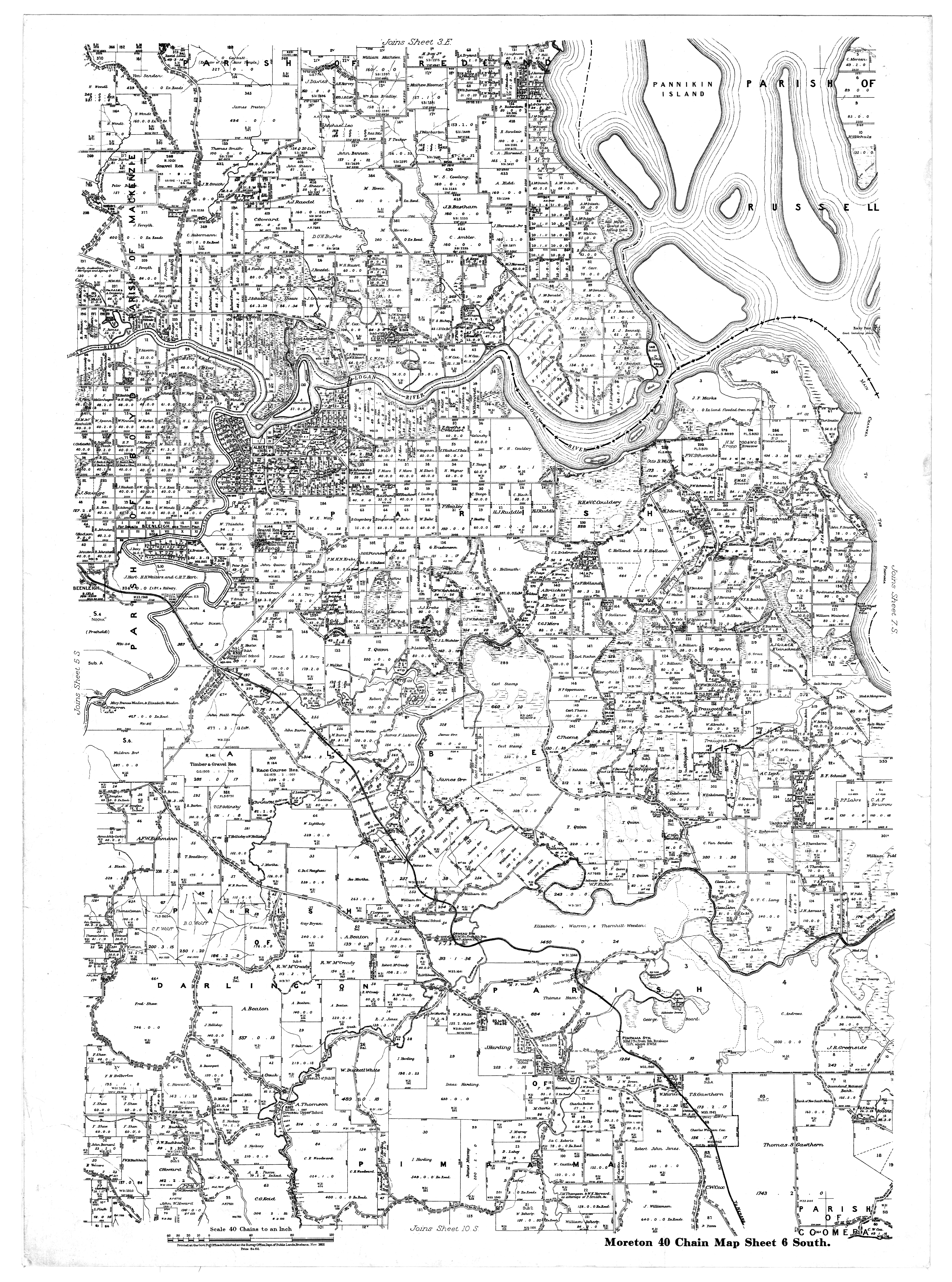
- "Moreton 40 Chain map AG2 series sheet 6 south" (Map). Queensland Government. 1922. Archived from the original on 18 April 2022. Retrieved 18 April 2022.
- "Tamborine" (Map). Queensland Government. 1954. Archived from the original on 2 April 2020. Retrieved 18 April 2022.
- "Queensland Globe". State of Queensland. Retrieved 18 April 2022.
- "Woongoolba Hall - General Community Facilities - Gold Coast Community Directory". www.mycommunitydirectory.com.au. Archived from the original on 21 January 2022. Retrieved 21 January 2022.
- Queensland Family History Society (2010), Queensland schools past and present (Version 1.01 ed.), Queensland Family History Society, ISBN 978-1-921171-26-0
- "State and non-state school details". Queensland Government. 9 July 2018. Archived from the original on 21 November 2018. Retrieved 21 November 2018.
- "Jacobs Well Environmental Education Centre". Archived from the original on 24 November 2018. Retrieved 21 November 2018.
- "History". Jacobs Well Environmental Education Centre. 30 October 2020. Archived from the original on 8 March 2021. Retrieved 19 December 2021.
- Blake, Thom. "Norwell Apostolic Church (1914)". Queensland religious places database. Archived from the original on 18 April 2022. Retrieved 18 April 2022.
- Blake, Thom. "Norwell Apostolic Church (1964)". Queensland religious places database. Archived from the original on 18 April 2022. Retrieved 18 April 2022.
- "New Lutheran Church at Norwell, Pimpama". The Brisbane Courier. No. 17, 643. Queensland, Australia. 1 August 1914. p. 12. Archived from the original on 18 April 2022. Retrieved 19 April 2022 – via National Library of Australia.
- Blake, Thom. "St John's Lutheran Church". Queensland religious places database. Archived from the original on 18 April 2022. Retrieved 18 April 2022.
- Australian Bureau of Statistics (31 October 2012). "Norwell". 2011 Census QuickStats. Retrieved 4 April 2014.
- "State and non-state school details". Queensland Government. 9 July 2018. Archived from the original on 21 November 2018. Retrieved 21 November 2018.
- "Jacobs Well Environmental Education Centre". Archived from the original on 24 November 2018. Retrieved 21 November 2018.
- "History". Jacobs Well Environmental Education Centre. 30 October 2020. Archived from the original on 8 March 2021. Retrieved 19 December 2021.
- "About the Driving Centre". Holden. Archived from the original on 24 January 2014. Retrieved 14 April 2014.
- "Motor Sport". Morris International. Archived from the original on 25 February 2021. Retrieved 4 March 2021.
На других языках
[de] Norwell (Gold Coast)
Norwell ist ein ländlich geprägter Vorort der Stadt Gold Coast in Queensland, Australien. Er liegt etwa 30 Kilometer nördlich des Zentrums und hatte im Jahr 2011 282 Einwohner.[1]- [en] Norwell, Queensland
Другой контент может иметь иную лицензию. Перед использованием материалов сайта WikiSort.org внимательно изучите правила лицензирования конкретных элементов наполнения сайта.
WikiSort.org - проект по пересортировке и дополнению контента Википедии