world.wikisort.org - Australia
North Maclagan is a rural locality in the Toowoomba Region, Queensland, Australia.[2] In the 2016 census North Maclagan had a population of 5 people.[1]
| North Maclagan Queensland | |||||||||||||||
|---|---|---|---|---|---|---|---|---|---|---|---|---|---|---|---|
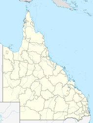  North Maclagan | |||||||||||||||
| Coordinates | 27.0297°S 151.6830°E | ||||||||||||||
| Population | 5 (2016 census)[1] | ||||||||||||||
| • Density | 0.38/km2 (0.98/sq mi) | ||||||||||||||
| Postcode(s) | 4352 | ||||||||||||||
| Area | 13.2 km2 (5.1 sq mi) | ||||||||||||||
| Time zone | AEST (UTC+10:00) | ||||||||||||||
| LGA(s) | Toowoomba Region | ||||||||||||||
| State electorate(s) | Nanango | ||||||||||||||
| Federal division(s) | Groom | ||||||||||||||
| |||||||||||||||
History
The locality is named for being north of the town of Maclagan. The town was originally named Bismarck after Otto von Bismarck. Due to the anti-German sentiment during World War I, the town was renamed Maclagan in honour of Brigadier Ewen George Sinclair-Maclagan in 1916.[2][3]
Maclagan North State School opened on 12 September 1922. It closed on 4 May 1962.[4]
In the 2016 census North Maclagan had a population of 5 people.[1]
References
- Australian Bureau of Statistics (27 June 2017). "North Maclagan (SSC)". 2016 Census QuickStats. Retrieved 20 October 2018.
- "North Maclagan – locality in Toowoomba Region (entry 48027)". Queensland Place Names. Queensland Government. Retrieved 29 December 2020.
- "Queensland Place names". Archived from the original on 24 October 2014. Retrieved 24 October 2014.
- Queensland Family History Society (2010), Queensland schools past and present (Version 1.01 ed.), Queensland Family History Society, ISBN 978-1-921171-26-0

 | This Toowoomba Region, Queensland, Australia location article is a stub. You can help Wikipedia by expanding it. |
Текст в блоке "Читать" взят с сайта "Википедия" и доступен по лицензии Creative Commons Attribution-ShareAlike; в отдельных случаях могут действовать дополнительные условия.
Другой контент может иметь иную лицензию. Перед использованием материалов сайта WikiSort.org внимательно изучите правила лицензирования конкретных элементов наполнения сайта.
Другой контент может иметь иную лицензию. Перед использованием материалов сайта WikiSort.org внимательно изучите правила лицензирования конкретных элементов наполнения сайта.
2019-2026
WikiSort.org - проект по пересортировке и дополнению контента Википедии
WikiSort.org - проект по пересортировке и дополнению контента Википедии