world.wikisort.org - Australia
Murrumbidgee Shire was a local government area in the Riverina region of south western New South Wales, Australia. The Shire was located adjacent to the Murrumbidgee River and the Newell Highway.
| Murrumbidgee Shire New South Wales | |||||||||||||||
|---|---|---|---|---|---|---|---|---|---|---|---|---|---|---|---|
 Shire office and chambers, in Darlington Point. | |||||||||||||||
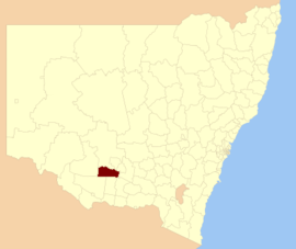 Location within New South Wales | |||||||||||||||
| Coordinates | 34°48′S 145°53′E | ||||||||||||||
| Population | 2,415 (2012)[1] | ||||||||||||||
| • Density | 0.68843/km2 (1.7830/sq mi) | ||||||||||||||
| Abolished | 2016 | ||||||||||||||
| Area | 3,508 km2 (1,354.4 sq mi) | ||||||||||||||
| Council seat | Darlington Point[2] | ||||||||||||||
| Region | Riverina | ||||||||||||||
| State electorate(s) | Murray | ||||||||||||||
| Federal division(s) | Riverina | ||||||||||||||
| |||||||||||||||
The two main administrative centres for the Murrumbidgee Shire were Coleambally and Darlington Point. It also contained the small town of Waddi.
Amalgamation
A 2015 review of local government boundaries by the NSW Government Independent Pricing and Regulatory Tribunal recommended that the Murrumbidgee Shire merge with parts of the Jerilderie Shire to form a new council with an area of 4,924 square kilometres (1,901 sq mi) and support a population of approximately 3,000.[3] The Jerilderie Shire Council submitted an alternate proposal to the Minister for Local Government that the entire Jerilderie Shire be amalgamated with the Murrumbidgee Shire.[4]
Murrumbidgee Shire was dissolved on 12 May 2016 with the area, along with Jerilderie Shire, incorporated into the new Murrumbidgee Council.[5]
Council
Former composition and election method
At the time of dissolution, Murrumbidgee Shire Council was composed of six councillors elected proportionally in two separate wards, each electing three councillors. All councillors were elected for a fixed four-year term of office. The mayor was elected by the councillors at the first meeting of the council. The final election was held on 8 September 2012. In East Ward, there were only three candidates, being those below, nominated for election. There being no additional candidates, the election for East Ward was uncontested.[6] An election was held in the North Ward.
References
- "3218.0 – Regional Population Growth, Australia, 2012". Australian Bureau of Statistics. 30 August 2013. Retrieved 27 March 2014. Estimated resident population (ERP) at 30 June 2012.
- "Murrumbidgee Shire Council". Department of Local Government. Retrieved 9 November 2006.
- "Merger proposal: Murrumbidgee Shire Council, Jerilderie Shire Council (part)" (PDF). Government of New South Wales. January 2016. p. 8. Retrieved 13 March 2016.
- Jerilderie Shire Council (26 January 2016). "Merger proposal: Jerilderie Shire Council and Murrumbidgee Shire Council" (PDF). Council Boundary Review. Government of New South Wales. Retrieved 13 March 2016.
- "Murrumbidgee Council". Stronger Councils. Government of New South Wales. 12 May 2016. Retrieved 13 May 2016.
- "No council vote in some Riverina shires". Australia: ABC News. 10 August 2012. Retrieved 2 October 2012.
Другой контент может иметь иную лицензию. Перед использованием материалов сайта WikiSort.org внимательно изучите правила лицензирования конкретных элементов наполнения сайта.
WikiSort.org - проект по пересортировке и дополнению контента Википедии