world.wikisort.org - Australia
Moombria is a former rural locality in the Barcaldine Region, Queensland, Australia.[2] In the 2016 census, Moombria had a population of 0 people.[1]
| Moombria Queensland | |||||||||||||||
|---|---|---|---|---|---|---|---|---|---|---|---|---|---|---|---|
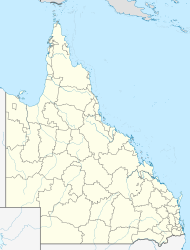  Moombria | |||||||||||||||
| Coordinates | 24.0625°S 144.9961°E | ||||||||||||||
| Population | 0 (2016 census)[1] | ||||||||||||||
| • Density | 0.0000/km2 (0.000/sq mi) | ||||||||||||||
| Postcode(s) | 4725 | ||||||||||||||
| Area | 209.9 km2 (81.0 sq mi) | ||||||||||||||
| Time zone | AEST (UTC+10:00) | ||||||||||||||
| Location |
| ||||||||||||||
| LGA(s) | Barcaldine Region | ||||||||||||||
| State electorate(s) | Gregory | ||||||||||||||
| Federal division(s) | Maranoa | ||||||||||||||
| |||||||||||||||
On 22 November 2019, the Queensland Government decided to amalgamate the localities in the Barcaldine Region, resulting in five expanded localities based on the larger towns: Alpha, Aramac, Barcaldine, Jericho and Muttaburra. Moombria was incorporated into Barcaldine.[3][4][5]
Geography
The Barcoo River forms the southern boundary of the locality while the Alice River forms the western boundary. Their confluence is at the south-western boundary of the locality.[6]
The principal land use is grazing on native vegetation.[6]
Education
There are no schools in Moombria. The nearest primary and secondary schools are in Blackall.
References
- Australian Bureau of Statistics (27 June 2017). "Moombria (SSC)". 2016 Census QuickStats. Retrieved 20 October 2018.
- "Moombria – locality in Barcaldine Region (entry 47088)". Queensland Place Names. Queensland Government. Retrieved 10 June 2019.
- "Recent place name decisions". Queensland Government. 22 November 2019. Archived from the original on 22 October 2019. Retrieved 15 January 2020.
- "Proposed Locality Boundaries and Names: Barcaldine Regional: Alpha, Aramac, Barcaldine, Jericho and Muttaburra" (PDF). Queensland Government. 17 May 2019. Archived from the original (PDF) on 15 January 2020. Retrieved 15 January 2020.
- "Locality Boundaries and Names: Barcaldine Regional Council: Alpha, Aramac, Barcaldine, Jericho and Muttaburra" (PDF). Queensland Government. 17 May 2019. Archived from the original (PDF) on 15 January 2020. Retrieved 15 January 2020.
- "Queensland Globe". State of Queensland. Retrieved 6 August 2019.

Другой контент может иметь иную лицензию. Перед использованием материалов сайта WikiSort.org внимательно изучите правила лицензирования конкретных элементов наполнения сайта.
WikiSort.org - проект по пересортировке и дополнению контента Википедии