world.wikisort.org - Australia
Miallo is a rural locality in the Shire of Douglas, Queensland, Australia.[2] In the 2016 census, Miallo had a population of 376 people.[1]
| Miallo Queensland | |||||||||||||||
|---|---|---|---|---|---|---|---|---|---|---|---|---|---|---|---|
 A farm house in Miallo next to the cane railway | |||||||||||||||
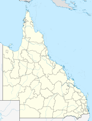  Miallo | |||||||||||||||
| Coordinates | 16.4055°S 145.3683°E | ||||||||||||||
| Population | 376 (2016 census)[1] | ||||||||||||||
| • Density | 13.43/km2 (34.78/sq mi) | ||||||||||||||
| Postcode(s) | 4873 | ||||||||||||||
| Area | 28.0 km2 (10.8 sq mi) | ||||||||||||||
| Time zone | AEST (UTC+10:00) | ||||||||||||||
| Location |
| ||||||||||||||
| LGA(s) | Shire of Douglas | ||||||||||||||
| State electorate(s) | Cook | ||||||||||||||
| Federal division(s) | Leichhardt | ||||||||||||||
| |||||||||||||||
Geography
Miallo consists of flat land (about 10 metres above sea level) which is used for farming surrounding a mountainous area rising to Mount Somerset (16.4217°S 145.3668°E), a peak 221 metres (725 ft) above sea level.[3][4][5] The crops grown are sugarcane and tropical fruit.[6]
There is a cane tramway system through Miallo to deliver sugarcane to the sugar mill at Mossman.[5]
Thooleer is a neighbourhood in the locality (16.4166°S 145.3833°E).[7]
History
The name Miallo is an Aboriginal word, meaning wild country.[2]
Mialloa Provisional School opened on 2 October 1911. It became Miallo State School on 30 July 1923.[8]
On Sunday 20 December, St Anthony's Catholic Church was officially opened and dedicated by Bishop Thomas Cahill. It was a reconstruction of a building bought from Lawrence Butler Rutherford. Prior to the construction of the church, Mass had been held in private homes.[9]
In the 2016 census, Miallo had a population of 376 people.[1]
Education
Miallo State School is a government primary (Prep-6) school for boys and girls at Miallo Bamboo Creek Road (16.3888°S 145.3761°E).[10][11] In 2017, the school had an enrolment of 179 students with 16 teachers (11 full-time equivalent) and 13 non-teaching staff (6 full-time equivalent).[12] In 2018, the school had an enrolment of 190 students with 16 teachers (11 full-time equivalent) and 12 non-teaching staff (6 full-time equivalent).[13]
There is no secondary school in Miallo. The nearest government secondary school is Mossman State High School in neighbouring Mossman to the south.[5]
References
- Australian Bureau of Statistics (27 June 2017). "Miallo (SSC)". 2016 Census QuickStats. Retrieved 20 October 2018.
- "Miallo – locality in Shire of Douglas (entry 48754)". Queensland Place Names. Queensland Government. Retrieved 27 December 2020.
- "Mountain peaks and capes - Queensland". Queensland Open Data. Queensland Government. 12 November 2020. Archived from the original on 25 November 2020. Retrieved 25 November 2020.
- "Mount Somerset – mountain in Douglas Shire (entry 31393)". Queensland Place Names. Queensland Government. Retrieved 25 November 2020.
- "Queensland Globe". State of Queensland. Retrieved 28 January 2022.
- "Destination Daintree". Archived from the original on 29 September 2017. Retrieved 29 September 2017.
- "Thooleer – locality unbounded in Shire of Douglas (entry 34293)". Queensland Place Names. Queensland Government. Retrieved 27 December 2020.
- Queensland Family History Society (2010), Queensland schools past and present (Version 1.01 ed.), Queensland Family History Society, ISBN 978-1-921171-26-0
- "MOSSMAN NOTES". Cairns Post. No. 16, 165. Queensland, Australia. 1 January 1954. p. 5. Archived from the original on 28 January 2022. Retrieved 28 January 2022 – via National Library of Australia.
- "State and non-state school details". Queensland Government. 9 July 2018. Archived from the original on 21 November 2018. Retrieved 21 November 2018.
- "Miallo State School". Miallo State School. 18 December 2019. Archived from the original on 1 April 2020. Retrieved 28 January 2022.
- "ACARA School Profile 2017". Archived from the original on 22 November 2018. Retrieved 22 November 2018.
- "ACARA School Profile 2018". Australian Curriculum, Assessment and Reporting Authority. Archived from the original on 27 August 2020. Retrieved 28 January 2020.

Further reading

- Miallo State School (1986), Miallo State School 75th anniversary 1911-1986, Miallo State School, retrieved 29 September 2017
Другой контент может иметь иную лицензию. Перед использованием материалов сайта WikiSort.org внимательно изучите правила лицензирования конкретных элементов наполнения сайта.
WikiSort.org - проект по пересортировке и дополнению контента Википедии