world.wikisort.org - Australia
Mayfield is a locality in the Queanbeyan–Palerang Regional Council, New South Wales, Australia. It is located about 85 km east of Canberra and 58 km south of Goulburn.[2][3] At the 2021 census, it had a population of 57.[1] It had an Anglican church, St Luke's from 1895 to 1965. A "half-time" school was located at Virginia station in Mayfield from 1894 to 1899.[4]
| Mayfield New South Wales | |||||||||||||||
|---|---|---|---|---|---|---|---|---|---|---|---|---|---|---|---|
 Site of St Luke's Church of England | |||||||||||||||
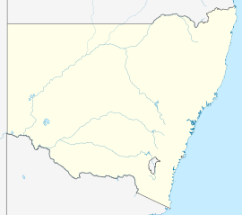  Mayfield Location in New South Wales | |||||||||||||||
| Coordinates | 35°13′57″S 149°46′52″E | ||||||||||||||
| Population | 57 (2021 census)[1] | ||||||||||||||
| Postcode(s) | 2580 | ||||||||||||||
| Location | |||||||||||||||
| LGA(s) | Queanbeyan-Palerang Regional Council | ||||||||||||||
| Region | Southern Tablelands | ||||||||||||||
| County | Argyle | ||||||||||||||
| Parish | Boro | ||||||||||||||
| State electorate(s) | Monaro | ||||||||||||||
| Federal division(s) | Eden-Monaro | ||||||||||||||
| |||||||||||||||
Heritage listings
Mayfield has a number of heritage-listed sites, including:
- Charleyong Road: Virginia[5]
References
- Australian Bureau of Statistics (28 June 2022). "Mayfield (Queanbeyan-Palerang Regional - NSW)". 2021 Census QuickStats. Retrieved 29 September 2022.
- "Mayfield". Geographical Names Register (GNR) of NSW. Geographical Names Board of New South Wales. Retrieved 14 February 2018.
- "Mayfield". OpenStreetMap. Retrieved 14 February 2018.
- "Virginia in the School history database search". New South Wales Department of Education. Retrieved 23 July 2018.
- "Virginia". New South Wales State Heritage Register. Office of Environment & Heritage. H01374. Retrieved 18 May 2018.

 Queanbeyan–Palerang Region, New South Wales, Australia | |
|---|---|
| Queanbeyan suburbs |
|
| Localities and rural places |
|
Main Article: Local government areas of New South Wales | |
 | This Southern Tablelands geography article is a stub. You can help Wikipedia by expanding it. |
Текст в блоке "Читать" взят с сайта "Википедия" и доступен по лицензии Creative Commons Attribution-ShareAlike; в отдельных случаях могут действовать дополнительные условия.
Другой контент может иметь иную лицензию. Перед использованием материалов сайта WikiSort.org внимательно изучите правила лицензирования конкретных элементов наполнения сайта.
Другой контент может иметь иную лицензию. Перед использованием материалов сайта WikiSort.org внимательно изучите правила лицензирования конкретных элементов наполнения сайта.
2019-2026
WikiSort.org - проект по пересортировке и дополнению контента Википедии
WikiSort.org - проект по пересортировке и дополнению контента Википедии