world.wikisort.org - Australia
Marmor is a rural town and locality in the Rockhampton Region, Queensland, Australia.[2][3] In the 2016 census, the locality of Marmor had a population of 212 people.[1]
| Marmor Queensland | |||||||||||||||
|---|---|---|---|---|---|---|---|---|---|---|---|---|---|---|---|
 Marmor | |||||||||||||||
| Coordinates | 23.6794°S 150.7130°E | ||||||||||||||
| Population | 212 (2016 census)[1] | ||||||||||||||
| • Density | 1.533/km2 (3.970/sq mi) | ||||||||||||||
| Postcode(s) | 4702 | ||||||||||||||
| Area | 138.3 km2 (53.4 sq mi) | ||||||||||||||
| Time zone | AEST (UTC+10:00) | ||||||||||||||
| LGA(s) | Rockhampton Region | ||||||||||||||
| State electorate(s) | Mirani | ||||||||||||||
| Federal division(s) | Flynn | ||||||||||||||
| |||||||||||||||
Geography
Marmor is approximately 45 kilometres (28 mi) south of the city of Rockhampton. It is bounded to the north by the salt lakes of Port Alma and to the east and south-east by Raglan Creek and its tributary Horrigan Creek. The town is in the north-west of the locality.[4]
The Bruce Highway enters the locality from the east (Raglan), bypasses immediately south-west of the town and exits to the north-west (Bajool). The North Coast railway line enters the locality from the east (Raglan) immediately north of the highway, passes through the centre of the town, and then exists to the north-west (Bajool) immediately north of the highway, with the locality being served by the following stations:[4]
- Toonda railway station (now abandoned) (23.6849°S 150.7316°E)[5]
- Marmor railway station (23.6773°S 150.7089°E)[5]
- Sisalana railway station (now abandoned) (23.6709°S 150.6794°E)[5]
Toonda is a neighbourhood with the locality (23.6833°S 150.7333°E).[6]
History
The town/locality takes its name from the Marmor railway station, which was called Marmor being the Latin word for marble, which is found in the district.[7]
The Marmor Provisional School opened on 6 November 1906. It became a State School on 1 January 1909.[8][9] It is located on Rogers Road (23.67968°S 150.70763°E).[10]
Marmor Post Office opened by October 1906 (a receiving office in the area had been open from 1883, earlier known as San Jose, then Toonda) and closed in 1982.[11]
The Marmor School of Arts opened circa December 1908.[12]
On Sunday 6 November 1910 Bishop James Duhig officially opened and dedicated St Ita's Catholic Church. The church is in the Gothic style and was built by Messrs Neumann and Coker from the design of architect E.M. Hockings of Rockhampton. The church has a single nave 50 by 18 feet (15.2 by 5.5 m), a transept 28 by 12 feet (8.5 by 3.7 m) which has two vestries each 12 by 24 feet (3.7 by 7.3 m), and a spacious vestibule.[13]
On Thursday 16 November 1911 a United church was opened in Marmor, provided by the Mount Morgan Gold Mining Company. The church which was next door to the School of Arts could seat 100 people and was available for any Protestant denomination to hold their services, which were currently being held in private homes.[14]
In August 2004 the town received funding of $1772.50 from the Australian Government's Saluting Their Service program to construct a war memorial in the Marmor Memorial Park as a focal point for annual Anzac Day commemorations.[15]
At the 2011 census, Marmor had a population of 205 people.[16]
In the 2016 census the locality of Marmor had a population of 212 people.[1]
There are a number of former churches in Marmor, including
- St Faith the Virgin Mary Anglican Church, 20 Rogers Street (23.6796°S 150.7082°E)[17][18] It closed circa 2013 and was sold into private ownership in December 2018 for $110,000.[19][20]
- St Ita's Catholic Church, 17 Tynan Street (23.6806°S 150.7119°E)[21]
- Marmor Uniting Church, Rogers Street[22]
Economy

The Marmor Limestone Mine has its own limestone kiln and processing plant. It is at 435 Sisalana Road (23.6764°S 150.7099°E).[4] In the early 1900s, the mine's purpose was to supply lime to Mount Morgan, which was transported on the North Coast railway line. However, now the lime is mainly used in agricultural application, such as correcting soil acidification.[23]
Education
Marmor State School is a government primary (Prep-6) school for boys and girls at Rogers Street (23.6800°S 150.7079°E).[24][25] In 2018, the school had an enrolment of 13 students with 3 teachers (2 full-time equivalent) and 4 non-teaching staff (2 full-time equivalent).[26]
There is no secondary school in Marmor. The nearest secondary school is Mount Larcom State School (to Year 10) in Mount Larcom to the south-east. The nearest secondary school to Year 12 is Rockhampton State High School in Wandal, Rockhampton to the north-west.[4]
Amenities
Marmor Police Station is at 27 Rogers Street (23.6788°S 150.7076°E).[27][28]
The Marmor branch of the Queensland Country Women's Association meets at 46 Westacott Street (23.6782°S 150.7089°E).[29]
Marmor Memorial Park is at 29 Tynan Street (23.6795°S 150.7115°E). It has picnic facilities and a playground.[30]
References
- Australian Bureau of Statistics (27 June 2017). "Marmor (SSC)". 2016 Census QuickStats. Retrieved 20 October 2018.
- "Marmor – town in Rockhampton Region (entry 21037)". Queensland Place Names. Queensland Government. Retrieved 29 December 2020.
- "Marmor – locality in Rockhampton Region (entry 48748)". Queensland Place Names. Queensland Government. Retrieved 29 December 2020.
- "Queensland Globe". State of Queensland. Retrieved 28 February 2021.
- "Railway stations and sidings - Queensland". Queensland Open Data. Queensland Government. 2 October 2020. Archived from the original on 5 October 2020. Retrieved 5 October 2020.
- "Toonda – locality unbounded in Rockhampton Regional (entry 34924)". Queensland Place Names. Queensland Government. Retrieved 29 December 2020.
- "Marmor – railway station in Rockhampton Region (entry 39194)". Queensland Place Names. Queensland Government. Retrieved 28 September 2017.
- "Opening and closing dates of Queensland Schools". Queensland Government. Retrieved 20 April 2014.
- "Agency ID 5457, Marmor State School". Queensland State Archives. Retrieved 20 April 2014.
- "Our School". Marmor State School. Archived from the original on 21 April 2014. Retrieved 20 April 2014.
- Premier Postal History. "Post Office List". Premier Postal Auctions. Archived from the original on 15 May 2014. Retrieved 10 May 2014.
- "Marmor". The Capricornian. Vol. 34, no. 50. Queensland, Australia. 12 December 1908. p. 34. Archived from the original on 9 March 2021. Retrieved 28 February 2021 – via National Library of Australia.
- "Marmor Roman Catholic Church". Morning Bulletin. No. 14, 364. Queensland, Australia. 7 November 1910. p. 6. Retrieved 28 February 2021 – via National Library of Australia.
- "Opening of Marmor United Church". The Capricornian. Vol. 36, no. 46. Queensland, Australia. 18 November 1911. p. 6. Retrieved 28 February 2021 – via National Library of Australia.
- Neville, Paul (11 August 2004). "Marmor war memorial gets the green light". Parliament of Australia. Retrieved 28 February 2021.
{{cite web}}: CS1 maint: url-status (link) - Australian Bureau of Statistics (31 October 2012). "Marmor (SSC)". 2011 Census QuickStats. Retrieved 20 April 2014.
- "All Saints Anglican Church - Former". Churches Australia. Retrieved 28 February 2021.
{{cite web}}: CS1 maint: url-status (link) - Hughes, Wendy (12 June 2017). "Queensland church conversions: Glam renovations, cool features, blank canvases". Domain. Archived from the original on 11 October 2018. Retrieved 9 March 2021.
- "20 Rogers Street, Marmor, Qld 4702". Realestate.com.au. Retrieved 28 February 2021.
{{cite web}}: CS1 maint: url-status (link) - "St Faith the Virgin Mary Anglican Church (-2013)". National Redress Scheme. Retrieved 9 March 2021.
{{cite web}}: CS1 maint: url-status (link) - "St Ita's Catholic Church - Former". Churches Australia. Retrieved 28 February 2021.
{{cite web}}: CS1 maint: url-status (link) - "Marmor Uniting Church - Former". Churches Australia. Retrieved 28 February 2021.
{{cite web}}: CS1 maint: url-status (link) - "Marmor". Archived from the original on 21 April 2014. Retrieved 20 April 2014.
- "State and non-state school details". Queensland Government. 9 July 2018. Archived from the original on 21 November 2018. Retrieved 21 November 2018.
- "Marmor State School". Archived from the original on 1 April 2020. Retrieved 21 November 2018.
- "ACARA School Profile 2018". Australian Curriculum, Assessment and Reporting Authority. Archived from the original on 27 August 2020. Retrieved 28 January 2020.
- "Emergency services facilities - Queensland". Queensland Open Data. Queensland Government. 18 November 2020. Archived from the original on 24 November 2020. Retrieved 24 November 2020.
- "Marmor Station". Queensland Police. Archived from the original on 2 April 2020. Retrieved 28 February 2021.
- "Branch Locations". Queensland Country Women's Association. Archived from the original on 26 December 2018. Retrieved 26 December 2018.
- "Marmor Memorial Park". Rockhampton Regional Council. Retrieved 28 February 2021.
{{cite web}}: CS1 maint: url-status (link)
Further reading
- Gillespie, Kath (2005), No classy houses in Calico Town : Marmor, Toonda and San Jose, 1850s-1950s, Kath Gillespie, ISBN 978-0-646-44167-2
- Gillespie, Kath (1986), The historical landscape : a study of Marmor – via Central Queensland University
External links
| Wikimedia Commons has media related to Marmor, Queensland. |
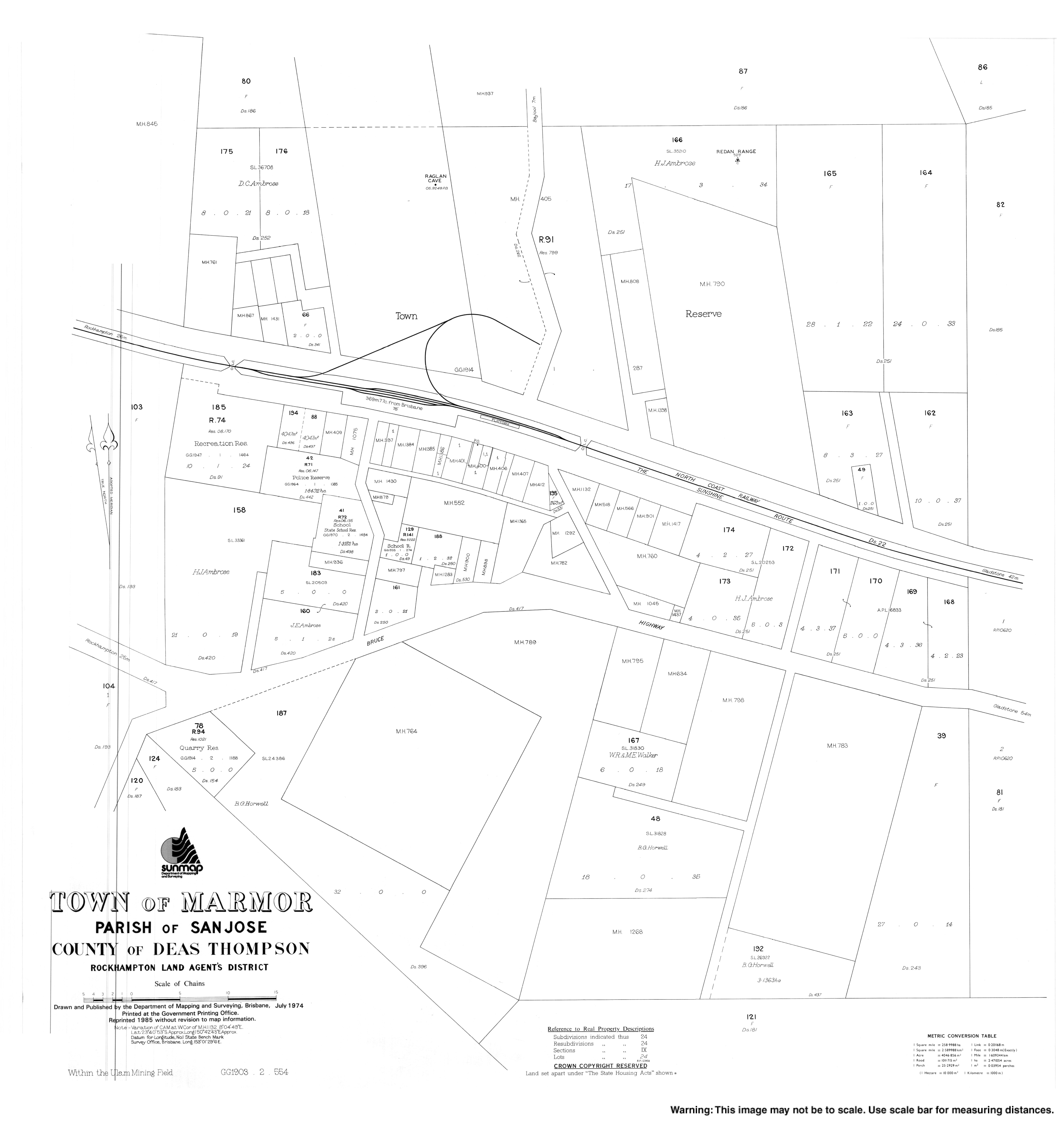
- "Town map of Marmor". Queensland Government. 1974.
- "Marmor". Rural, Historic, Abandoned and Desolate Places. Archived from the original on 25 September 2009. Retrieved 23 March 2009.
Другой контент может иметь иную лицензию. Перед использованием материалов сайта WikiSort.org внимательно изучите правила лицензирования конкретных элементов наполнения сайта.
WikiSort.org - проект по пересортировке и дополнению контента Википедии