world.wikisort.org - Australia
Kenton Valley is a locality named for a valley located between Gumeracha and Lobethal, about 40 km (25 mi) east of Adelaide, South Australia. It is located in the Adelaide Hills Council local government area.
| Kenton Valley South Australia | |||||||||||||||
|---|---|---|---|---|---|---|---|---|---|---|---|---|---|---|---|
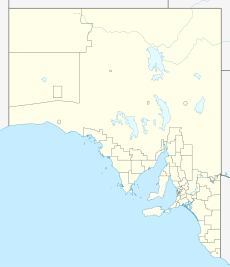  Kenton Valley | |||||||||||||||
| Coordinates | 34.85°S 138.89°E | ||||||||||||||
| Population | 256 (2016 census)[1] | ||||||||||||||
| Established | 2013 (boundaries); 1839 (settlement) | ||||||||||||||
| Postcode(s) | 5233 | ||||||||||||||
| Location |
| ||||||||||||||
| LGA(s) | Adelaide Hills Council | ||||||||||||||
| State electorate(s) | Morialta | ||||||||||||||
| Federal division(s) | Mayo | ||||||||||||||
| |||||||||||||||
| Footnotes | [2] | ||||||||||||||
The area contains cherry and strawberry farms and a golf course. It is sparsely populated, and residents rely on nearby Gumeracha for educational and commercial services.
The town developed on a parcel of land taken up by the South Australian Company.[3] The first manager of the station was William Beavis Randell who named a home he built, Kenton Park, after his home town in Devon.[3]
The Kenton Valley Post Office operated from 1873 to 1973.[4] The school operated from 1904 to 1943.[5]
See also

- List of valleys of Australia
References
- Australian Bureau of Statistics (27 June 2017). "Kenton Valley". 2016 Census QuickStats. Retrieved 4 March 2019.
- "Placename Details: Kenton Valley (LOCB)". Property Location Browser Report. Government of South Australia. 21 November 2013. SA0067992. Archived from the original on 12 October 2016. Retrieved 4 March 2019.
- "Historical Town Information". Adelaide Hills Council. 7 May 2008. Archived from the original on 26 September 2011. Retrieved 26 October 2011.
- "Placename Details: Kenton Valley Post Office". Property Location Browser Report. Government of South Australia. 27 June 2013. SA0067851. Archived from the original on 12 October 2016. Retrieved 4 March 2019.
- "Placename Details: Kenton Valley General School". Property Location Browser Report. Government of South Australia. 27 June 2013. SA0067893. Archived from the original on 12 October 2016. Retrieved 4 March 2019.

 | This South Australia geography article is a stub. You can help Wikipedia by expanding it. |
Другой контент может иметь иную лицензию. Перед использованием материалов сайта WikiSort.org внимательно изучите правила лицензирования конкретных элементов наполнения сайта.
WikiSort.org - проект по пересортировке и дополнению контента Википедии