world.wikisort.org - Australia
Jamberoo is a village on the South Coast of New South Wales, Australia in the Municipality of Kiama. It is approximately 11.3 km inland from Kiama. At the 2016 census, Jamberoo had a population of 1,667.[1] The town's name is derived from an Aboriginal word meaning 'track'.[2]
| Jamberoo New South Wales | |
|---|---|
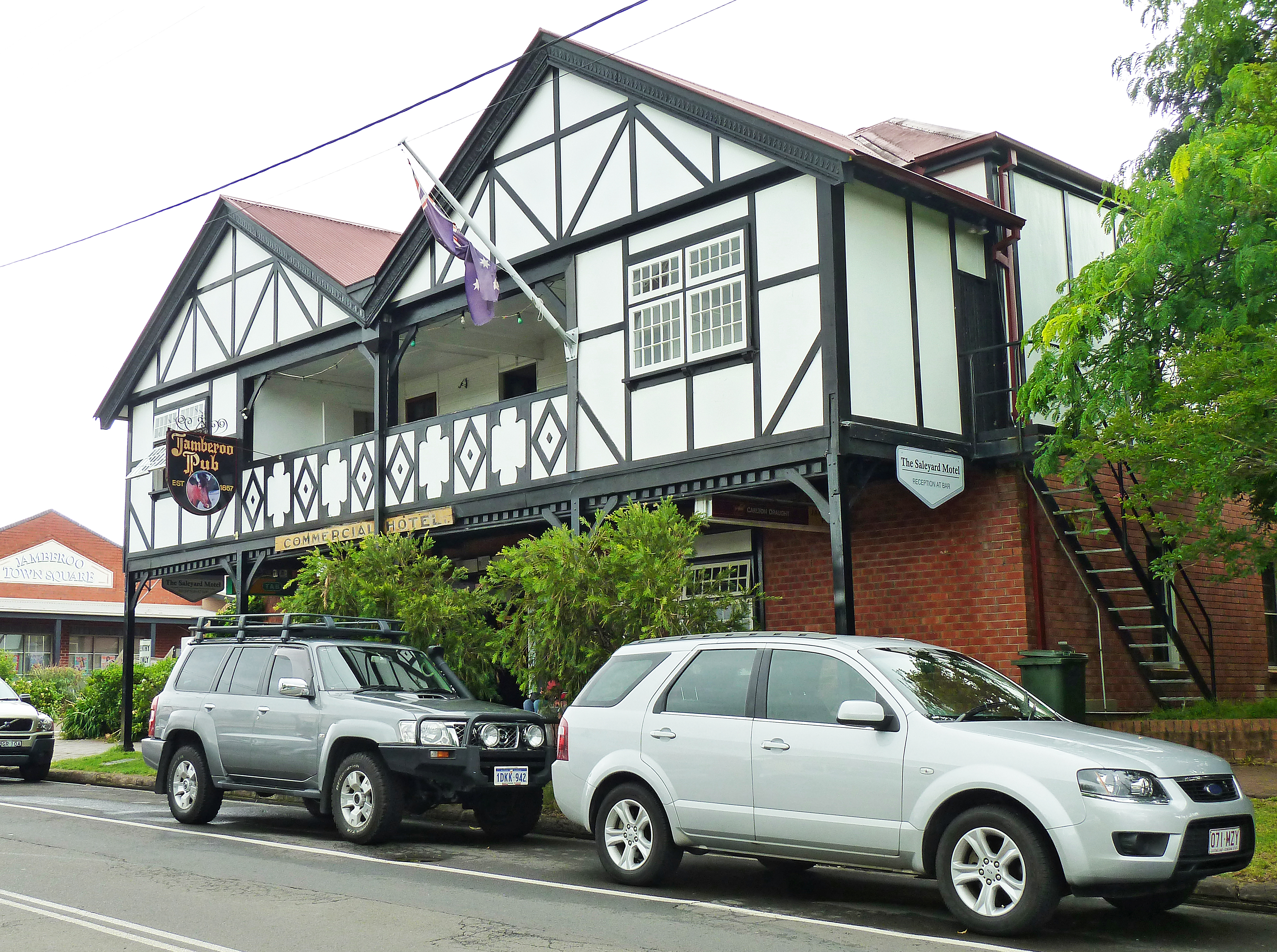 Jamberoo Hotel, pictured in 2012 | |
Jamberoo | |
| Coordinates | 34°39′S 150°47′E |
| Population | 1,636 (2016 census)[1] |
| Established | 1833 – as Woodstock |
| Postcode(s) | 2533 |
| Elevation | 24 m (79 ft) |
| Location |
|
| LGA(s) | Municipality of Kiama |
| County | Camden |
| Parish | Kiama |
| State electorate(s) | Kiama |
| Federal division(s) | Gilmore |
It is well known for the Jamberoo Action Park, Jamberoo Hotel, a pub, and the local dairy-farming community. The Australian Illawarra Shorthorn cattle breed originated in the area. Jamberoo is the birthplace of politician Joseph Cullen.[3]
History
European history in the valley began in the early 19th century when the cedar-cutters moved through the rainforests gathering this valuable timber. Pioneer settlers followed in the early 1820s with William Davis receiving the first land grant in 1821, followed by John Ritchie and John Cullen shortly afterwards.[4]
Michael Hyam was a property owner by the late 1830s and he laid out the private village of Jamberoo in 1841. The Main South Coast Road formed the northern boundary of his village and at the western end of the town he gave out lots for Protestant Churches.[4] The Presbyterian church of St Stephen stands on the original lot. The Methodist church around the corner in Wyalla St is now the Uniting Church and still hosts services, while the land given to the Church of England, now Anglican Church of Australia has been sold off and the Anglican Church is located north of Hyams Creek on Tates Hill. The old Presbyterian, Anglican and Uniting cemeteries are still located on the original lots, although they have been closed to burials since at least the 1920s[5]
A sign outside the only fuel station in Jamberoo proclaims the town as the birthplace of co-operative dairy production in Australia. The first co-operative butter factory in Australia was begun at Jamberoo in 1884 adjacent to the old Main South Coast Road (now Jamberoo Road), 2 km from the Princes Highway and just west of Spring Creek and the monument marking the old toll gate. The location is better described as Kiama. An obelisk marks the spot.[6]
In time, there were other butter factories: Woodstock [7] and Wauchope[8] which became the main factory in Factory Lane to the east of the town.[8]
Heritage listings
Jamberoo has a number of heritage-listed sites, including:
- 2 Allowrie Street: St Stephen's Presbyterian Church[9]
- 2 km east of Jamberoo Main Road: Culwalla Homestead[10]
Geography
Jamberoo sits at the western end of Minnamurra Swamp, known locally as The Swamp. The Minnamurra River flows from Minnamurra Falls along the northern side of the swamp. Just east of the old butter factory on Factory Lane the river enters a man-made channel that keeps the river flowing on the northern side of the swamp; the original channel meandered through the broad eastern end of the swamp before crossing Swamp Road and running along the south side of the swamp. In times of high tide and high rainfall, the river resumes its old course closing Swamp Road.
The valley of Jamberoo and the Minnamurra River is steep-sided and reasonably narrow. As a result, the town and valley is not subject to the extremes of weather that nearby Albion Park is. This is a significant observation because the climate data for the district is recorded at Albion Park. Local research (unverified) from Jamberoo weather stations suggests that wind speeds in Jamberoo are approximately half that experienced at Albion Park, while rainfall varies significantly depending on the altitude and proximity to the steep valley sides. Air temperature is not as extreme as recorded for Albion Park.[11]
Governance
Jamberoo was declared a municipality on 21 November 1890.[12] The butcher's shop in Allowrie Street is the former Council Chamber while the bridge over Hyams Creek that joins the northern and southern sides of the village was opened in 1937 by Mrs Fredericks, Mayor of Jamberoo. Jamberoo is a part of the Municipality of Kiama, State seat of Kiama and Federal seat of Gilmore which, apart from Jamberoo, consists mostly of the metropolitan area of southern Wollongong and Shellharbour.
Demographics
n the 2016 Census, there were 1,636 people in Jamberoo. 79.9% of people were born in Australia and 90.5% of people spoke only English at home. The most common responses for religion were No Religion 27.1%, Anglican 24.6% and Catholic 24.5%.[1]
Education
Education in Jamberoo was first provided by the Church of England (now Anglican) on the site of the original grant of land from Michael Hyam. School commenced early in 1842 in a building partly funded by private subscription and government money.[4] After a school teacher left in August 1873, there was talk of converting the school house into a Public School however this did not occur and it reopened in March 1874 with 40 students.[13]
The Public School came into operation in January 1878 which led to the closure of the denominational schools.[14]
Notable people
- John Thomas (Tom) Cole (1854-1927); a dairy farmer and stud-breeder who played a leading role in the dairy industry and was involved in local politics.[15]
- Sir William Portus Cullen (1855-1935); a chief justice and politician: Admitted to the New South Wales Bar Association in 1883.[16]
- Solomon Herbert Hyam (1837-1901); a produce merchant and politician. He established himself as a wholesale produce merchant, elected an alderman of Balmain (1874) and mayor (1876-1879).[17]
- Kevin Walsh (c. 1917-1975); a prominent contributor to local and national rugby league in the 1950s, 1960s and 1970s. The Kiama Municipal Council honoured his memory with the naming of Jamberoo's main sporting field as the Kevin Walsh Oval.[18]
References
- Australian Bureau of Statistics (27 June 2017). "Jamberoo". 2016 Census QuickStats. Retrieved 13 July 2017.
- "Jamberoo". Geographical Names Register (GNR) of NSW. Geographical Names Board of New South Wales. Retrieved 11 October 2009.
- "Jamberoo". Visit NSW. Retrieved 7 April 2013.
- Stewart, Elsie. Church of the Resurrection: Church of England: Jamberoo, 1867–1967. Church of England Jamberoo. p. 2.
- Stewart, Elsie. Church of the Resurrection: Church of England: Jamberoo, 1867–1967. Church of England Jamberoo. p. ?.
- "Walkabout travel guide: Jamberoo". Sydney Morning Herald. Archived from the original on 8 June 2007. Retrieved 27 June 2007.
- "Woodstock Butter Mill". Wollongong City Council Image Library. Archived from the original on 13 July 2005. Retrieved 30 January 2020.
- "Woodstock Butter Mill". Wollongong City Council Image Library. Archived from the original on 13 July 2005. Retrieved 30 January 2020.
- "St. Stephen's Presbyterian Church (former)". New South Wales State Heritage Register. Office of Environment & Heritage. H00121. Retrieved 18 May 2018.
- "Culwalla Homestead". New South Wales State Heritage Register. Office of Environment & Heritage. H00447. Retrieved 18 May 2018.
- Unpublished weather data from the Anglican Rectory, Jamberoo compared with Bureau of Meteorology data from Albion Park Regional Airport
- "THE MUNICIPALITY OF JAMBEROO". The Sydney Morning Herald. National Library of Australia. 22 November 1890. p. 9. Retrieved 29 December 2012.
- Stewart, Elsie. Church of the Resurrection: Church of England: Jamberoo, 1867–1967. Church of England Jamberoo. p. 10.
- Stewart, Elsie. Church of the Resurrection: Church of England: Jamberoo, 1867–1967. Church of England Jamberoo. p. 11.
- Routh, S. J. (2005). Cole, John Thomas (Tom) (1854-1927). Australian Dictionary of Biography. Retrieved 9 December 2017.
- Bennett, J. M. (1981). Cullen, Sir William Portus (1855-1935). Australian Dictionary of Biography. Retrieved 3 March 2015.
- Bergman, G. F. J. (1972). Hyam, Solomon Herbert (1837-1901). Australian Dictionary of Biography. Retrieved 30 March 2015.
- "Kevin Walsh Scholarship - South Coast Group 7 Junior Rugby League - SportsTG". websites.sportstg.com. Archived from the original on 14 November 2018.
External links
Другой контент может иметь иную лицензию. Перед использованием материалов сайта WikiSort.org внимательно изучите правила лицензирования конкретных элементов наполнения сайта.
WikiSort.org - проект по пересортировке и дополнению контента Википедии