world.wikisort.org - Australia
The Gulf Coastal, an interim Australian bioregion, is located in the Northern Territory,[1][2] comprising 2,711,718 hectares (6,700,800 acres).[3]
| Gulf Coastal Northern Territory | |||||||||||||||
|---|---|---|---|---|---|---|---|---|---|---|---|---|---|---|---|
 The interim Australian bioregions, with Gulf Coastal in red | |||||||||||||||
| Area | 27,117.18 km2 (10,470.0 sq mi) | ||||||||||||||
| |||||||||||||||
The code for the bioregion is GUC.[3]
| IBRA regions and subregions: IBRA7 | ||||
|---|---|---|---|---|
| IBRA region / subregion | IBRA code | Area | States | Location in Australia |
| Gulf Coastal | GUC | 2,711,718 hectares (6,700,800 acres) | NT | 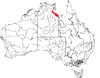 |
| Limmen | GUC01 | 12,714,805 hectares (31,418,970 acres) | ||
| Pellews | GUC02 | 2,914,114 hectares (7,200,930 acres) | ||
See also
- Geography of Australia
References
- Environment Australia. "Revision of the Interim Biogeographic Regionalisation for Australia (IBRA) and Development of Version 5.1 - Summary Report". Department of the Environment and Water Resources, Australian Government. Archived from the original on 5 September 2006. Retrieved 31 January 2007.
- IBRA Version 6.1 data
- "Interim Biogeographic Regionalisation for Australia (IBRA7) regions and codes". Department of Sustainability, Environment, Water, Population and Communities. Commonwealth of Australia. 2012. Retrieved 13 January 2013.
Further reading
- Thackway, R and I D Cresswell (1995) An interim biogeographic regionalisation for Australia : a framework for setting priorities in the National Reserves System Cooperative Program Version 4.0 Canberra : Australian Nature Conservation Agency, Reserve Systems Unit, 1995. ISBN 0-642-21371-2
Northern Territory | ||
|---|---|---|
| Topics |
| |
| Regions |
| |
| Major settlements |
| |
This Northern Territory geography article is a stub. You can help Wikipedia by expanding it. |
Текст в блоке "Читать" взят с сайта "Википедия" и доступен по лицензии Creative Commons Attribution-ShareAlike; в отдельных случаях могут действовать дополнительные условия.
Другой контент может иметь иную лицензию. Перед использованием материалов сайта WikiSort.org внимательно изучите правила лицензирования конкретных элементов наполнения сайта.
Другой контент может иметь иную лицензию. Перед использованием материалов сайта WikiSort.org внимательно изучите правила лицензирования конкретных элементов наполнения сайта.
2019-2026
WikiSort.org - проект по пересортировке и дополнению контента Википедии
WikiSort.org - проект по пересортировке и дополнению контента Википедии