world.wikisort.org - Australia
Greta is a small town in the Hunter Region of New South Wales, Australia.[3][4][8]
| Greta Cessnock, New South Wales | |||||||||||||||
|---|---|---|---|---|---|---|---|---|---|---|---|---|---|---|---|
 Greta's historic court house | |||||||||||||||
Greta | |||||||||||||||
| Coordinates | 32°41′14″S 151°23′4″E | ||||||||||||||
| Population | 2,830 (2016 census)[1][Note 1] | ||||||||||||||
| • Density | 486.9/km2 (1,261/sq mi) [Note 2] | ||||||||||||||
| Postcode(s) | 2334 | ||||||||||||||
| Elevation | 70 m (230 ft)[Note 3] | ||||||||||||||
| Area | 5.1 km2 (2.0 sq mi)[2][Note 4] | ||||||||||||||
| Time zone | AEST (UTC+10) | ||||||||||||||
| • Summer (DST) | AEDT (UTC+11) | ||||||||||||||
| Location |
| ||||||||||||||
| LGA(s) |
| ||||||||||||||
| Region | Hunter[3][4] | ||||||||||||||
| County | Northumberland[5] | ||||||||||||||
| Parish | Branxton[5] | ||||||||||||||
| State electorate(s) | Cessnock[6] | ||||||||||||||
| Federal division(s) | Hunter[7] | ||||||||||||||
| |||||||||||||||
History
The Traditional Owners and Custodians of the Maitland area are the Wonnarua people.[9] The Greta area was first colonized by Europeans around Anvil Creek in the 1830s.[10]
When the town was surveyed in 1842 it was given the name Greta, possibly after a small river in Cumberland, England. Coal mining was established in the area in 1862 with the development of a railway station.[10]
In 1864, kerosene shale was discovered. By the 1870s, Greta had four hotels, four churches, a school and schools of arts. Geologist Edgeworth David discovered the Greta Coal Seam in 1886. By 1907 ten collieries were in operation.[10]
At the 2016 census the town had a population of 2,830.
Greta Army Camp
The Greta Army Camp, located on the town's outskirts, was opened in 1939 as a training ground for World War II soldier training, and in 1949 was transferred to the Department of Immigration who transformed it into one of Australia's largest migrant reception and training centres between June 1949 and January 1960 as part of the post-war immigration to Australia. Over 100,000 new migrants seeking a new life in Australia passed through Greta Camp throughout its 11-years in operation.[11]
Transport
Greta is located on the New England Highway, approximately 183 km (114 mi) north of Sydney. Access to Sydney will be possible via the Hunter Expressway when it is completed. NSW TrainLink's Hunter Line passes through Greta railway station, which opened in 1869.[12]
Heritage listings
Greta has the Greta railway station.[13]
Images of Greta
 Greta War Memorial Cenotaph
 Greta Rest area shelter
 The welcoming sign to Greta's Hunter River Catchment
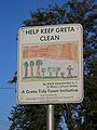 A Child's litter prevention sign. These signs were commissioned by Greta Tidy Towns to help children understand the importance of maintaining a Tidy Town


Notes
- ABS QuickStats only provides population data for the town of Greta, not the entire suburb.
- This is the average density of the actual town, based on figures provided by the ABS.
- Average elevation of the suburb as shown on 1:100000 map 9132 Cessnock.
- This is the area of the town, not the entire suburb.
References
- Australian Bureau of Statistics (31 October 2012). "Greta (NSW) (State Suburb)". 2011 Census QuickStats. Retrieved 25 September 2012.
- Australian Bureau of Statistics (31 October 2012). "2011 Community Profiles: Greta (NSW) (State Suburb)". 2011 Census of Population and Housing. Retrieved 25 September 2012.
- "Suburb Search – Local Council Boundaries – Hunter (HT) – Cessnock City Council". New South Wales Division of Local Government. Archived from the original on 22 May 2009. Retrieved 25 September 2012.
- "Suburb Search – Local Council Boundaries – Hunter (HT) – Maitland City Council". New South Wales Division of Local Government. Archived from the original on 30 October 2013. Retrieved 25 September 2012.
- "Greta (suburb)". Geographical Names Register (GNR) of NSW. Geographical Names Board of New South Wales. Retrieved 25 September 2012.
- "Cessnock". New South Wales Electoral Commission. Retrieved 23 November 2019.
- "Hunter". Australian Electoral Commission. 26 July 2012. Archived from the original on 5 October 2013. Retrieved 25 September 2012.
- "Greta". Land and Property Management Authority - Spatial Information eXchange. New South Wales Land and Property Information. Retrieved 25 September 2012.
- "Aboriginal and Torres Straight Islander Peoples". Maitland City Council. Retrieved 8 September 2020.
- "Greta, NSW". Aussie Towns. Retrieved 7 October 2020.
- Newcastle City Council. "New Lives, New Australians – Snapshots of Greta Migrant Camp, 1949 – 1960". Local Government & Shires Associations of NSW. Archived from the original on 26 April 2012. Retrieved 25 September 2012.
- "Main North Line". NSWrail.net. Retrieved 25 September 2012.
- "Greta Railway Station group". New South Wales State Heritage Register. Office of Environment & Heritage. H01156. Retrieved 18 May 2018.
External links
| Wikimedia Commons has media related to Greta, New South Wales. |
- "Greta". Australian Explorer. Retrieved 25 September 2012.
Другой контент может иметь иную лицензию. Перед использованием материалов сайта WikiSort.org внимательно изучите правила лицензирования конкретных элементов наполнения сайта.
WikiSort.org - проект по пересортировке и дополнению контента Википедии