world.wikisort.org - Australia
Genoa is a town in Eastern Gippsland, Victoria, Australia. It is close to the New South Wales border where the Princes Highway crosses the Genoa River. The town is an important access point to the Croajingolong National Park. At the 2006 census, Genoa and the surrounding area had a population of 304.[2]
| Genoa Victoria | |
|---|---|
 | |
 Genoa | |
| Coordinates | 37°29′0″S 149°35′0″E |
| Population | 55 (2016 census)[1] |
| Postcode(s) | 3891 |
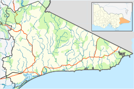
| Location |
|
| LGA(s) | Shire of East Gippsland |
| State electorate(s) | Gippsland East |
| Federal division(s) | Gippsland |
The Genoa Post Office opened on 9 April 1888.[3]
In 1972 the earliest fossil trackway of primitive tetrapods were found in the Genoa River Gorge, dating back 350 million years.[4]
In 2019, bush fires in Eastern Gippsland did "significant" damage to Genoa and the nearby town of Mallacoota.[5]
Genoa Peak
Genoa Peak is located in the Croajingolong National Park, and is 490 metres (1,610 ft) above sea level at the summit. The walk to the summit is 1.5 kilometres (0.93 mi) one way, and is rated for a moderate/steep fitness level. The view includes Mallacoota Lake which is over 40 kilometres (25 mi) away.[6]
References
- Australian Bureau of Statistics (27 June 2017). "Genoa (State Suburb)". 2016 Census QuickStats. Retrieved 5 September 2020.
- Australian Bureau of Statistics (25 October 2007). "Genoa (State Suburb)". 2006 Census QuickStats. Retrieved 27 July 2007.
- Phoenix Auctions History, Post Office List, retrieved 12 March 2021
- Warren, J. W. & Wakefield, N. A., 1972. Trackways of tetrapod vertebrates from the Upper Devonian of Victoria, Aust. Nature 238, 469-470.
- "Bushfires hit Victorian towns including Mallacoota and Corryong, leaving four missing and properties destroyed". ABC News. 31 December 2019. Retrieved 18 November 2021.
- "Croajingolong National Park, Attraction, Gippsland, Victoria, Australia". Visit Victoria. Retrieved 21 February 2022.
Другой контент может иметь иную лицензию. Перед использованием материалов сайта WikiSort.org внимательно изучите правила лицензирования конкретных элементов наполнения сайта.
WikiSort.org - проект по пересортировке и дополнению контента Википедии