world.wikisort.org - Australia
Garfield is a town in Victoria, Australia, 79 km south-east of Melbourne's Central Business District, located within the Shire of Cardinia local government area. Garfield recorded a population of 2,114 at the 2021 census.[1]
| Garfield Victoria | |||||||||||||||
|---|---|---|---|---|---|---|---|---|---|---|---|---|---|---|---|
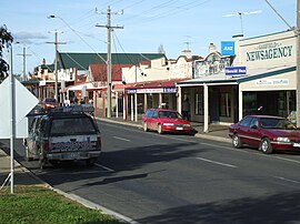
 Main street | |||||||||||||||
 Garfield | |||||||||||||||
 | |||||||||||||||
| Coordinates | 38°04′S 145°41′E | ||||||||||||||
| Population | 2,114 (2021 census)[1] | ||||||||||||||
| Postcode(s) | 3814 | ||||||||||||||
| Location | |||||||||||||||
| LGA(s) | Shire of Cardinia | ||||||||||||||
| State electorate(s) | Narracan | ||||||||||||||
| Federal division(s) | Monash | ||||||||||||||
| |||||||||||||||
History
The area was originally called Cannibal Creek, but was renamed to Garfield in memory of the U.S. President James A. Garfield.[2]
The Post Office opened as Cannibal Creek on 1 May 1886 and was renamed Garfield in 1887.[3]
Garfield today
Garfield has a primary school with approximately 490 students. There is a church at the top end of the schoolgrounds. Local businesses include a milk bar, and a newsagency
The town has an Australian Rules football team playing in the Ellinbank and District Football League.[4] Garfield has an undulating golf course on Thirteen Mile Road run by the Garfield Golf Club.[5]
Gallery
- Main street
- Iona Hotel
See also
- Shire of Pakenham – Garfield was previously within this former local government area.
- Garfield railway station
References
- Australian Bureau of Statistics (28 June 2022). "Garfield (Suburbs and Localities)". 2021 Census QuickStats. Retrieved 10 July 2022.
- "Garfield Township Strategy" (PDF). Cardinia Shire Council. 19 August 2002. p. 36. Archived from the original (PDF) on 1 April 2012. Retrieved 24 January 2012.
Originally Cannibal Creek Siding was built in 1877 to serve the booming timber industry when the railway line was laid from Dandenong to Bunyip. The district was latter [sic] renamed Garfield after an American President.
- Phoenix Auctions History, Post Office List, retrieved 22 February 2021
- Full Points Footy, Garfield, archived from the original on 30 April 2008, retrieved 25 July 2008
- Golf Select, Garfield, retrieved 11 May 2009
Другой контент может иметь иную лицензию. Перед использованием материалов сайта WikiSort.org внимательно изучите правила лицензирования конкретных элементов наполнения сайта.
WikiSort.org - проект по пересортировке и дополнению контента Википедии

