world.wikisort.org - Australia
Dowar Islet is an island locality in the Torres Strait Island Region, Queensland, Australia.[3] It consists of a single island, Daua Island (also known as Dowar Island) which is one of the Murray Islands group in the Torres Strait.[4] In the 2016 census, Dowar Islet had a population of 0 people.[1]
| Dowar Islet Queensland | |||||||||||||||
|---|---|---|---|---|---|---|---|---|---|---|---|---|---|---|---|
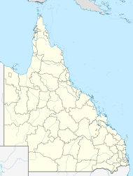  Dowar Islet | |||||||||||||||
| Coordinates | 9.9436°S 144.0263°E | ||||||||||||||
| Population | 0 (2016 census)[1] | ||||||||||||||
| • Density | 0.0/km2 (0.0/sq mi) | ||||||||||||||
| Postcode(s) | 4875[2] | ||||||||||||||
| Area | 0.5 km2 (0.2 sq mi) | ||||||||||||||
| Time zone | AEST (UTC+10:00) | ||||||||||||||
| Location |
| ||||||||||||||
| LGA(s) | Torres Strait Island Region | ||||||||||||||
| State electorate(s) | Cook | ||||||||||||||
| Federal division(s) | Leichhardt | ||||||||||||||
| |||||||||||||||
Dowar Islet's postcode is 4875.[2]
Geography
There are a few buildings on the island, but it is not developed.[5]
History
The island was declared a locality on 2 July 2010.[3]
In the 2016 census, Dowar Islet had a population of 0 people.[1]
See also
References
- Australian Bureau of Statistics (27 June 2017). "Dowar Islet (SSC)". 2016 Census QuickStats. Retrieved 20 October 2018.
- Dowar Islet Postcode Australia Post
- "Dowar Islet – locality in Torres Strait Island Region (entry 46718)". Queensland Place Names. Queensland Government. Retrieved 11 June 2019.
- "Daua Island – island in the Torres Strait Region (entry 10472)". Queensland Place Names. Queensland Government. Retrieved 3 November 2019.
- "Queensland Globe". State of Queensland. Retrieved 3 November 2019.

 | This Queensland location article is a stub. You can help Wikipedia by expanding it. |
На других языках
[de] Dowar Island
Dowar Island, von den Einheimischen der nächstgelegenen bewohnten Inseln Dauar genannt, ist eine australische Insel im Osten des Archipels der Torres-Strait-Inseln. Sie gehört zur Gruppe der Murray-Inseln und liegt 2 Kilometer südwestlich von deren Hauptinsel Murray Island (Mer) entfernt.- [en] Dowar Islet, Queensland
Текст в блоке "Читать" взят с сайта "Википедия" и доступен по лицензии Creative Commons Attribution-ShareAlike; в отдельных случаях могут действовать дополнительные условия.
Другой контент может иметь иную лицензию. Перед использованием материалов сайта WikiSort.org внимательно изучите правила лицензирования конкретных элементов наполнения сайта.
Другой контент может иметь иную лицензию. Перед использованием материалов сайта WikiSort.org внимательно изучите правила лицензирования конкретных элементов наполнения сайта.
2019-2026
WikiSort.org - проект по пересортировке и дополнению контента Википедии
WikiSort.org - проект по пересортировке и дополнению контента Википедии