world.wikisort.org - Australia
The county of Cook is a cadastral division of Queensland, centred on the city of Bundaberg,[1] and its name honours Captain James Cook. It was officially named and bounded by the Governor in Council on 7 March 1901 under the Land Act 1897.[2]
| Cook Queensland | |||||||||||||||
|---|---|---|---|---|---|---|---|---|---|---|---|---|---|---|---|
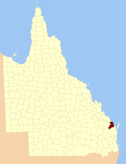 Location within Queensland | |||||||||||||||
| |||||||||||||||
Parishes
Cook is divided into parishes, as listed below:
| Parish | LGA | Coordinates | Towns |
|---|---|---|---|
| Barns | Bundaberg | 25°01′S 152°26′E | |
| Barolin | Bundaberg | 24°50′S 152°26′E | Bargara, Burnett Heads, Elliott Heads |
| Bingera | Bundaberg | 25°02′S 152°16′E | |
| Booyal | Bundaberg | 25°09′S 152°03′E | Booyal |
| Broomfield | North Burnett | 25°27′S 152°12′E | |
| Bundaberg | Bundaberg | 24°56′S 152°20′E | Bundaberg, Avoca, Branyan |
| Burrum | Fraser Coast | 25°19′S 152°32′E | Howard |
| Cherwell | Fraser Coast | 25°16′S 152°28′E | |
| Childers | Bundaberg | 25°15′S 152°18′E | Childers |
| Chowey | North Burnett | 25°28′S 151°52′E | Didcot |
| Coringa | North Burnett | 25°21′S 151°57′E | |
| Dallarnil | North Burnett | 25°22′S 152°04′E | Dallarnil |
| Degilbo | North Burnett | 25°31′S 151°57′E | Biggenden, Degilbo |
| Electra | Bundaberg | 25°04′S 152°08′E | |
| Eureka | Bundaberg | 25°18′S 152°10′E | |
| Gooburrum | Bundaberg | 24°47′S 152°20′E | Bundaberg North, Gooburrum |
| Gregory | Bundaberg | 25°09′S 152°16′E | Cordalba |
| Hercules | Bundaberg | 25°09′S 152°35′E | Woodgate (S) |
| Isis | Bundaberg | 25°11′S 152°27′E | Buxton |
| Kalkie | Bundaberg | 24°54′S 152°24′E | Bundaberg East, Kalkie, Walkervale |
| Kinagin | Bundaberg | 24°50′S 152°01′E | |
| Kolbore | Fraser Coast | 25°20′S 152°25′E | |
| Kullogum | Bundaberg | 25°21′S 152°16′E | |
| Marathon | Bundaberg | 25°06′S 152°26′E | Goodwood, Woodgate (N) |
| Mungore | North Burnett | 25°35′S 152°04′E | |
| North Kolan | Bundaberg | 24°47′S 152°12′E | |
| Otoo | Bundaberg | 24°47′S 152°15′E | Oakwood |
| South Kolan | Bundaberg | 24°55′S 152°10′E | |
| Stanton | Bundaberg | 25°14′S 152°04′E | |
| Takalvan | Bundaberg | 24°55′S 152°16′E | |
| Tantitha | Bundaberg | 24°52′S 152°16′E | Sharon |
| Walsh | Fraser Coast | 25°16′S 152°36′E | Burrum Heads, Torbanlea |
| Woowoonga | North Burnett | 25°28′S 152°05′E | |
| Yandaran | Bundaberg | 24°46′S 152°07′E | Yandaran, Avondale |
See also
- Lands administrative divisions of Queensland
References
- Wide Bay/Burnett District, County of Cook Maps - D3 Series at Queensland Archives.
- "Cook (entry 8035)". Queensland Place Names. Queensland Government. Retrieved 8 September 2015.
External links
- "Map of the County of Cook". Queensland Government. 1902.
{{cite web}}: CS1 maint: url-status (link) - "Map of the County of Cook". Queensland Government. 1920.
{{cite web}}: CS1 maint: url-status (link)
Текст в блоке "Читать" взят с сайта "Википедия" и доступен по лицензии Creative Commons Attribution-ShareAlike; в отдельных случаях могут действовать дополнительные условия.
Другой контент может иметь иную лицензию. Перед использованием материалов сайта WikiSort.org внимательно изучите правила лицензирования конкретных элементов наполнения сайта.
Другой контент может иметь иную лицензию. Перед использованием материалов сайта WikiSort.org внимательно изучите правила лицензирования конкретных элементов наполнения сайта.
2019-2026
WikiSort.org - проект по пересортировке и дополнению контента Википедии
WikiSort.org - проект по пересортировке и дополнению контента Википедии