world.wikisort.org - Australia
The County of Bowen is a county (a cadastral division) in Queensland, Australia, located in the Wide Bay–Burnett region to the west of Bundaberg. It was named in honour of Sir George Ferguson Bowen, the first Governor of Queensland.[1][2] On 7 March 1901, the Governor issued a proclamation legally dividing Queensland into counties under the Land Act 1897.[3] Its schedule described Bowen thus:
Bounded on the east by the county of Cook; on the south by the county of Mackenzie; on the west by [...] the parishes of Mundowran, Boomerang, Binjour, Jonday, Yenda, Wolca, Wombah, Kolonga and Toweran; and on the north by the northern boundaries of the parishes of Toweran, Kolonga and Manduran.
| Bowen Queensland | |||||||||||||||
|---|---|---|---|---|---|---|---|---|---|---|---|---|---|---|---|
 Location within Queensland | |||||||||||||||
| |||||||||||||||
Parishes
Bowen is divided into parishes, as listed below:
| Parish | LGA | Coordinates | Towns | Parish map |
|---|---|---|---|---|
| Binjour | North Burnett | 25°33′S 151°29′E | Binjour | 1973 map |
| Boolbunda | Bundaberg | 25°03′S 151°42′E | Boolboonda | 1968 map |
| Chin Chin | North Burnett | 25°11′S 151°50′E | 1876 map | |
| Gin Gin | Bundaberg | 25°00′S 152°00′E | Gin Gin, Bullyard, Tirroan | 1972 map |
| Grosvenor | North Burnett | 25°14′S 151°41′E | 1969 map | |
| Joanborough | Bundaberg | 24°56′S 151°54′E | 1971 map | |
| Jonday | North Burnett | 25°25′S 151°30′E | 1969 map | |
| Kolonga | Bundaberg | 24°51′S 151°43′E | Kolonga | 1977 map (sheet 2 only) |
| Mingo | North Burnett | 25°20′S 151°46′E | 1967 map | |
| Monduran | Bundaberg | 24°49′S 151°54′E | Monduran | 1971 map |
| Moolboolaman | Bundaberg | 25°01′S 151°49′E | Moolboolaman | 1972 map |
| Mount Perry | North Burnett | 25°09′S 151°42′E | Mount Perry | 1971 map |
| St Agnes | Bundaberg | 25°16′S 151°57′E | 1972 map | |
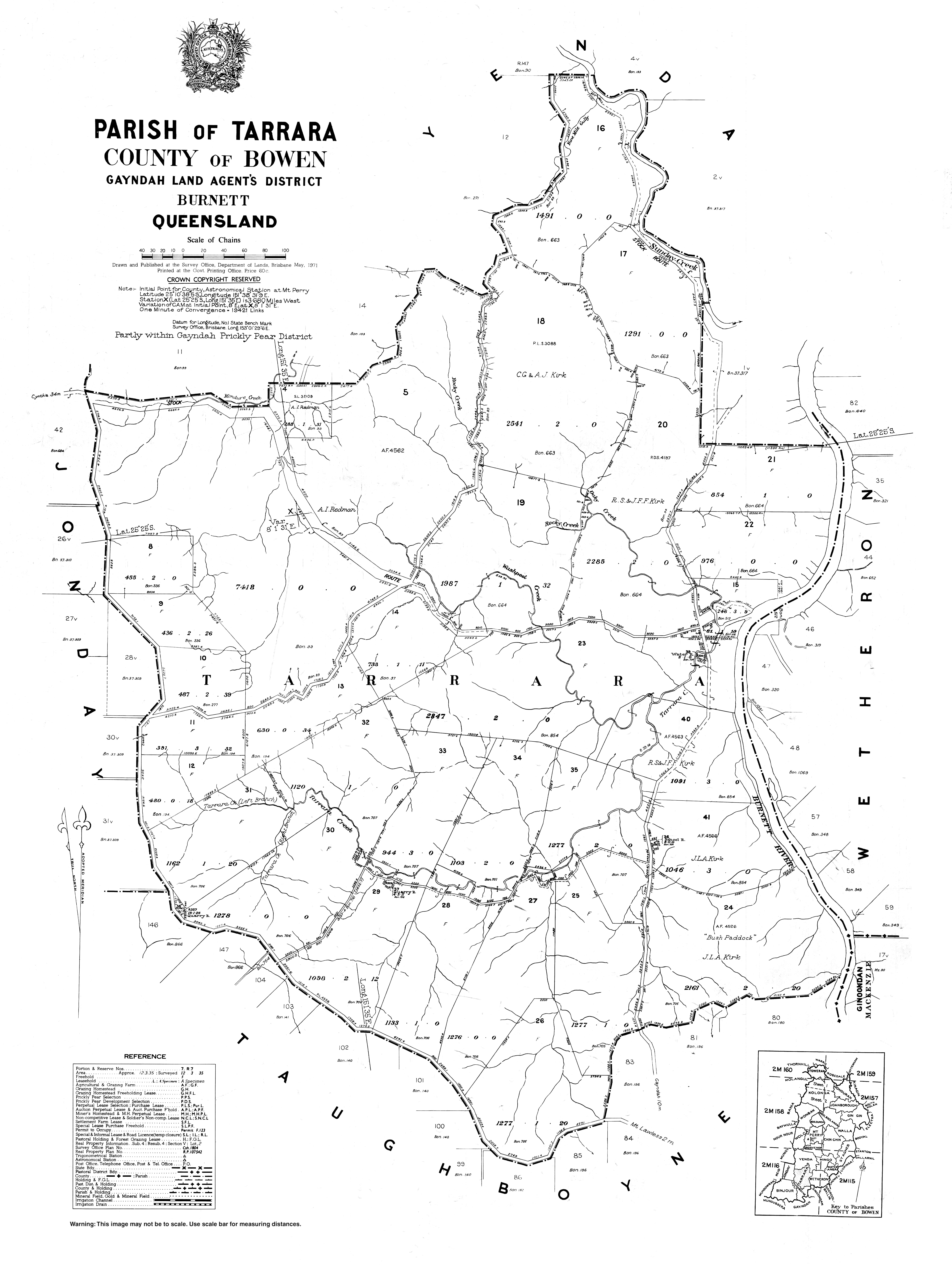
| Tarrara | North Burnett | 25°27′S 151°37′E | Yenda | 1971 map |
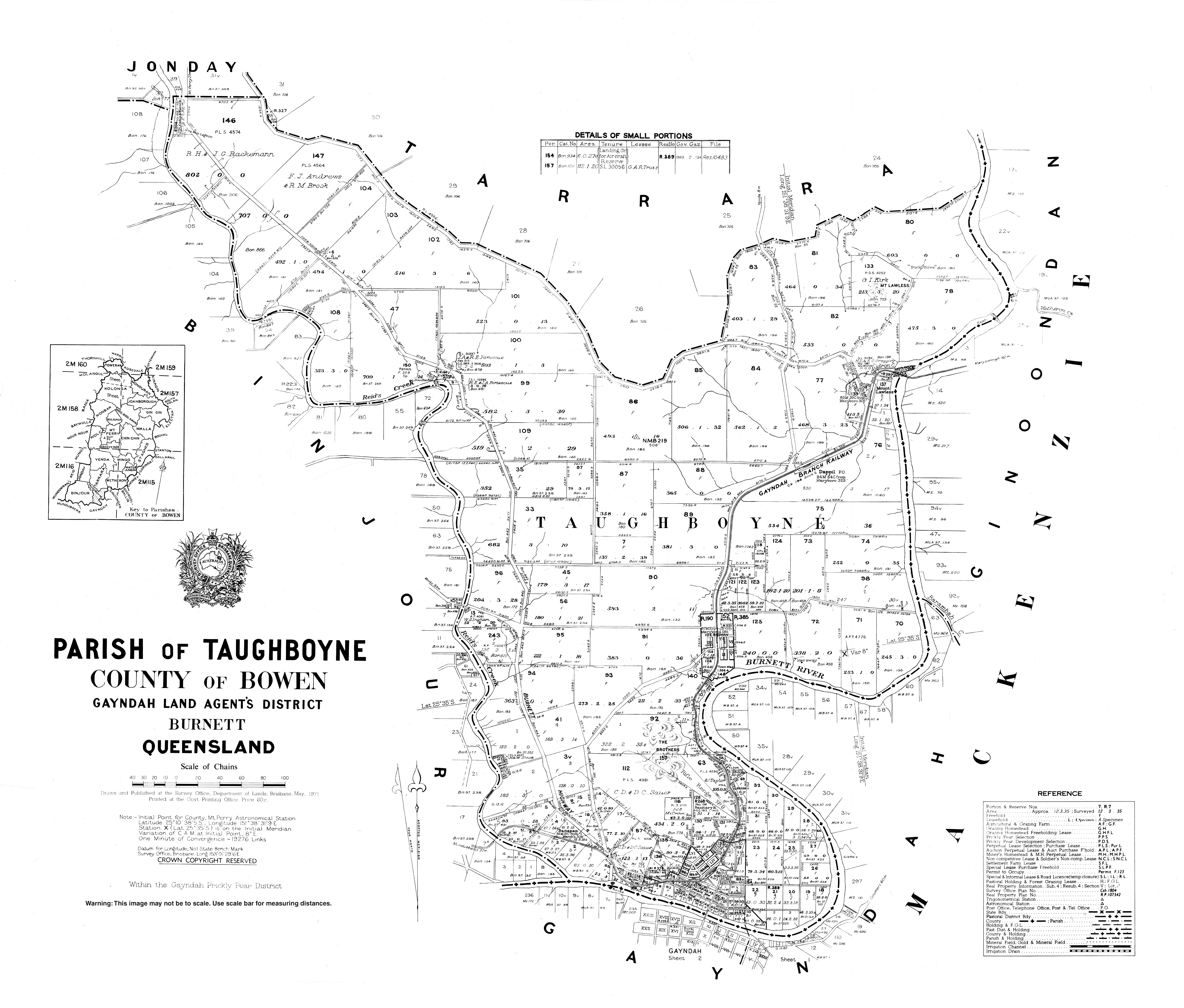
| Taughboyne | North Burnett | 25°33′S 151°37′E | Gayndah (N), Ideraway | 1971 map |
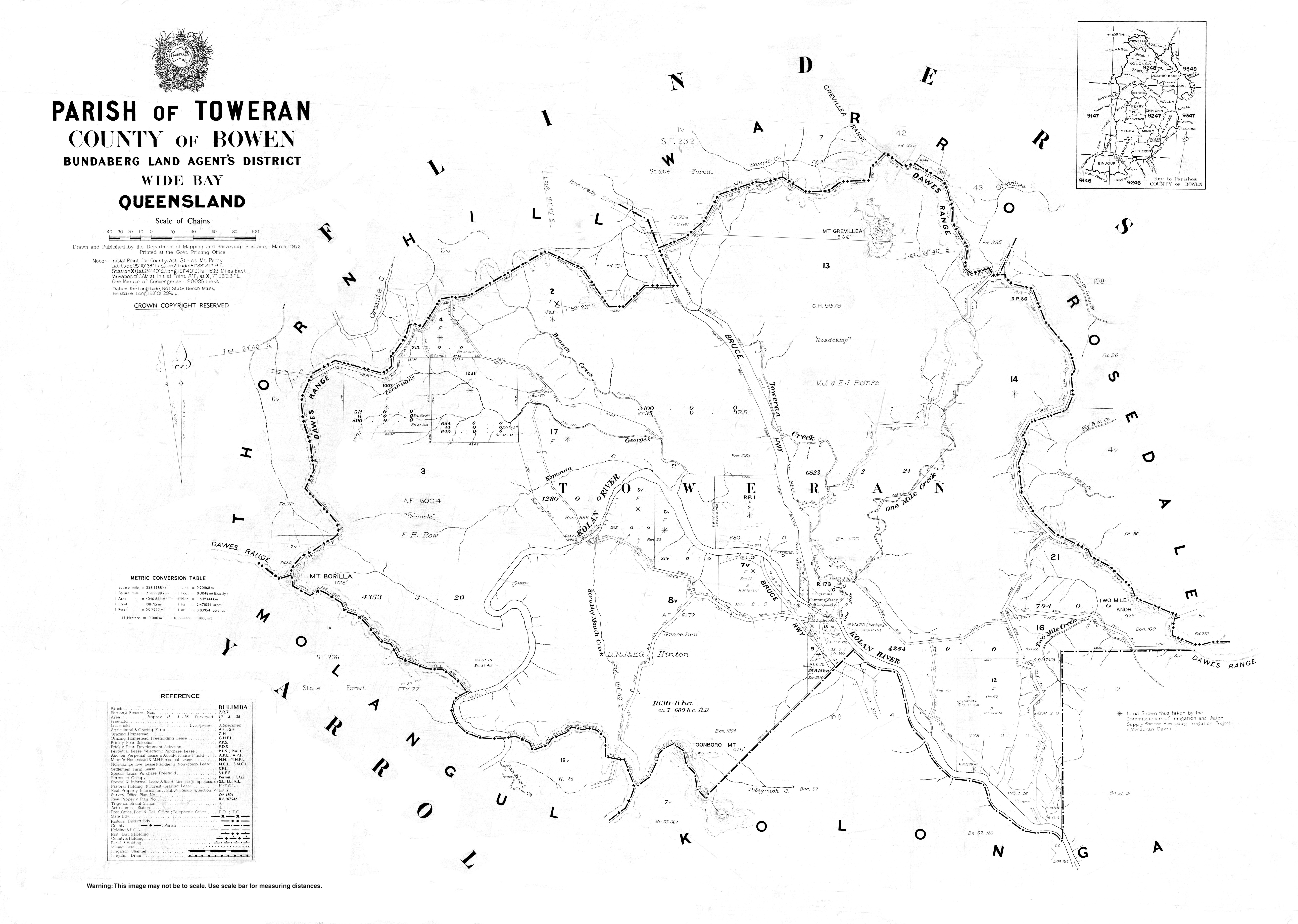
| Toweran | Gladstone | 24°42′S 151°41′E | 1976 map | |
| Walla | Bundaberg | 25°06′S 151°56′E | Wallaville | 1971 map |
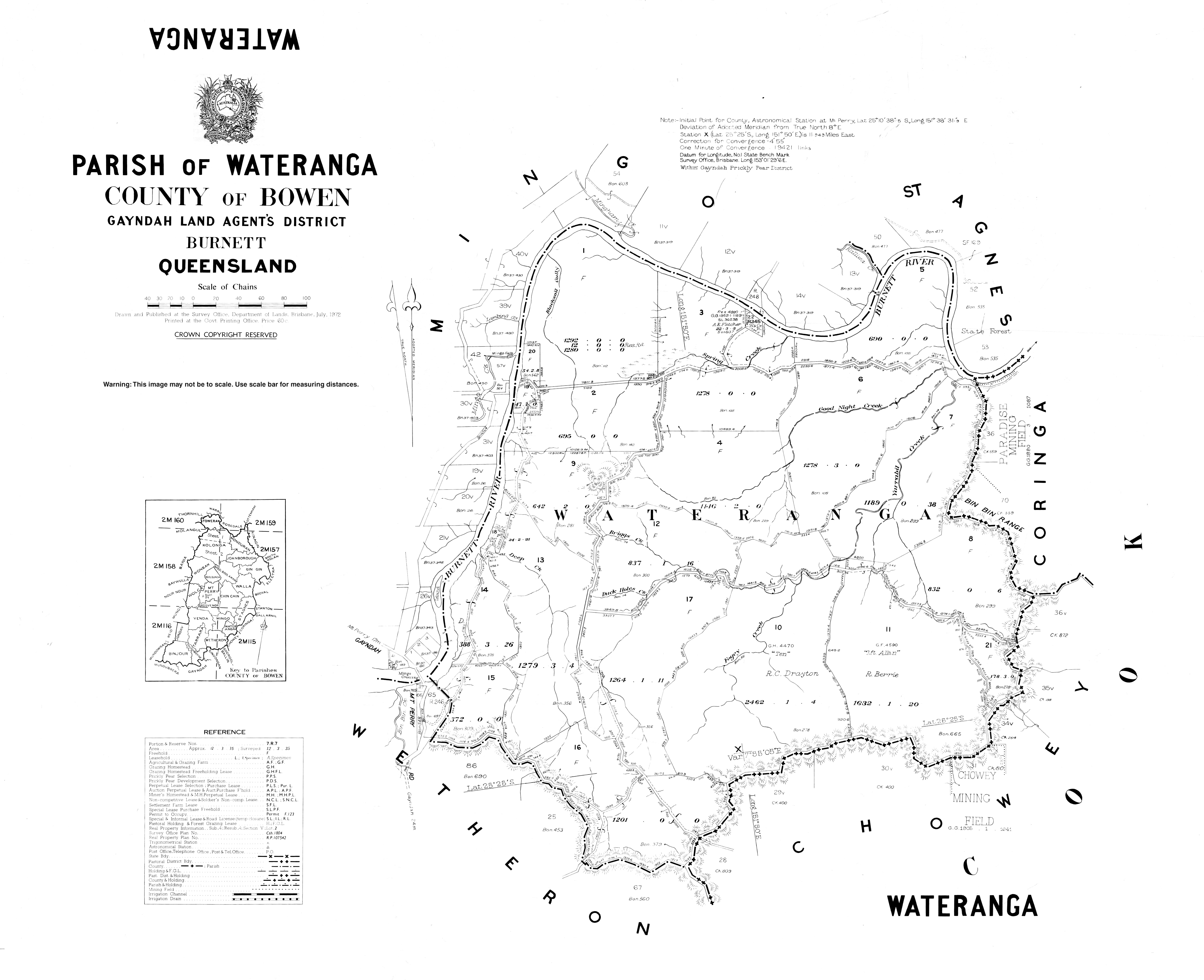
| Wateranga | North Burnett | 25°23′S 151°50′E | 1972 map | |
| Wetheron | North Burnett | 25°27′S 151°44′E | 1971 map | |
| Wolca | North Burnett | 25°11′S 151°34′E | 1973 map | |
| Wonbah | Bundaberg | 25°01′S 151°37′E | 1971 map | |
| Yenda | North Burnett | 25°20′S 151°38′E | 1966 map |
References
- "Bowen (entry 4101)". Queensland Place Names. Queensland Government. Retrieved 8 September 2015.
- Wide Bay/Burnett Districts, County of Bowen Maps – D2 Series at Queensland Archives.
- "A Proclamation". Queensland Government Gazette. Vol. 75. 8 March 1901. pp. 967–980.
External links
- "Map of the County of Bowen". Queensland Government. 1923.
{{cite web}}: CS1 maint: url-status (link)
Текст в блоке "Читать" взят с сайта "Википедия" и доступен по лицензии Creative Commons Attribution-ShareAlike; в отдельных случаях могут действовать дополнительные условия.
Другой контент может иметь иную лицензию. Перед использованием материалов сайта WikiSort.org внимательно изучите правила лицензирования конкретных элементов наполнения сайта.
Другой контент может иметь иную лицензию. Перед использованием материалов сайта WikiSort.org внимательно изучите правила лицензирования конкретных элементов наполнения сайта.
2019-2026
WikiSort.org - проект по пересортировке и дополнению контента Википедии
WikiSort.org - проект по пересортировке и дополнению контента Википедии