world.wikisort.org - Australia
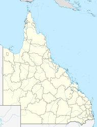
Coorada is a rural locality in the Shire of Banana, Queensland, Australia.[2] In the 2016 census, Coorada had a population of 6 people.[1]
| Coorada Queensland | |||||||||||||||
|---|---|---|---|---|---|---|---|---|---|---|---|---|---|---|---|
  Coorada | |||||||||||||||
| Coordinates | 24.9716°S 149.5461°E | ||||||||||||||
| Population | 6 (2016 census)[1] | ||||||||||||||
| • Density | 0.0093/km2 (0.0241/sq mi) | ||||||||||||||
| Postcode(s) | 4420 | ||||||||||||||
| Area | 643.8 km2 (248.6 sq mi) | ||||||||||||||
| Time zone | AEST (UTC+10:00) | ||||||||||||||
| LGA(s) | Shire of Banana | ||||||||||||||
| State electorate(s) | Callide | ||||||||||||||
| Federal division(s) | Flynn | ||||||||||||||
| |||||||||||||||
Road infrastructure
The Taroom Bauhinia Downs Road (State Route 7) runs through from south to north.[3]
References
- Australian Bureau of Statistics (27 June 2017). "Coorada (SSC)". 2016 Census QuickStats. Retrieved 20 October 2018.
- "Coorada – locality in Shire of Banana (entry 49543)". Queensland Place Names. Queensland Government. Retrieved 25 October 2019.
- Google (20 August 2021). "Coorada, Queensland" (Map). Google Maps. Google. Retrieved 20 August 2021.

Текст в блоке "Читать" взят с сайта "Википедия" и доступен по лицензии Creative Commons Attribution-ShareAlike; в отдельных случаях могут действовать дополнительные условия.
Другой контент может иметь иную лицензию. Перед использованием материалов сайта WikiSort.org внимательно изучите правила лицензирования конкретных элементов наполнения сайта.
Другой контент может иметь иную лицензию. Перед использованием материалов сайта WikiSort.org внимательно изучите правила лицензирования конкретных элементов наполнения сайта.
2019-2026
WikiSort.org - проект по пересортировке и дополнению контента Википедии
WikiSort.org - проект по пересортировке и дополнению контента Википедии