world.wikisort.org - Australia
Chahpingah is a rural locality in the South Burnett Region, Queensland, Australia.[2] In the 2016 census, Chahpingah had a population of 29 people.[1]
| Chahpingah Queensland | |||||||||||||||
|---|---|---|---|---|---|---|---|---|---|---|---|---|---|---|---|
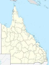  Chahpingah | |||||||||||||||
| Coordinates | 26.4719°S 151.3775°E | ||||||||||||||
| Population | 29 (2016 census)[1] | ||||||||||||||
| • Density | 0.0695/km2 (0.1799/sq mi) | ||||||||||||||
| Postcode(s) | 4610 | ||||||||||||||
| Area | 417.5 km2 (161.2 sq mi) | ||||||||||||||
| Time zone | AEST (UTC+10:00) | ||||||||||||||
| LGA(s) | South Burnett Region | ||||||||||||||
| State electorate(s) | Nanango | ||||||||||||||
| Federal division(s) | Maranoa | ||||||||||||||
| |||||||||||||||
Road infrastructure
The Chinchilla–Wondai Road runs along part of the northern boundary.[3]
References
- Australian Bureau of Statistics (27 June 2017). "Chahpingah (SSC)". 2016 Census QuickStats. Retrieved 20 October 2018.
- "Chahpingah – locality in South Burnett Region (entry 46203)". Queensland Place Names. Queensland Government. Retrieved 2 August 2019.
- Google (18 January 2022). "Chahpingah, Queensland" (Map). Google Maps. Google. Retrieved 18 January 2022.

 | This South Burnett Region, Queensland, Australia location article is a stub. You can help Wikipedia by expanding it. |
Текст в блоке "Читать" взят с сайта "Википедия" и доступен по лицензии Creative Commons Attribution-ShareAlike; в отдельных случаях могут действовать дополнительные условия.
Другой контент может иметь иную лицензию. Перед использованием материалов сайта WikiSort.org внимательно изучите правила лицензирования конкретных элементов наполнения сайта.
Другой контент может иметь иную лицензию. Перед использованием материалов сайта WikiSort.org внимательно изучите правила лицензирования конкретных элементов наполнения сайта.
2019-2026
WikiSort.org - проект по пересортировке и дополнению контента Википедии
WikiSort.org - проект по пересортировке и дополнению контента Википедии