world.wikisort.org - Australia
Castella is a locality in Victoria, Australia. It lies to the east of Kinglake at the intersection of the Melba Highway and the Healesville Kinglake Road.[3]
| Castella Victoria | |||||||||||||||
|---|---|---|---|---|---|---|---|---|---|---|---|---|---|---|---|
 Aerial view from north | |||||||||||||||
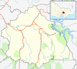 Castella Location in Shire of Murrindindi | |||||||||||||||
| Coordinates | 37°31′29″S 145°26′00″E | ||||||||||||||
| Population | 268 (2016 census)[1] | ||||||||||||||
| Postcode(s) | 3777[2] | ||||||||||||||
| LGA(s) | Shire of Murrindindi | ||||||||||||||
| State electorate(s) | Eildon | ||||||||||||||
| Federal division(s) | Indi[2] | ||||||||||||||
| |||||||||||||||
The Castella Quarries produces sandstone and crushed rock.[4] One of the quarries was used to dump the drillings from a tunnel under the Toolangi State Forest.[5] This tunnel is part of the Sugarloaf Pipeline, carrying freshwater to Melbourne from the Goulburn River.
References
- Australian Bureau of Statistics (27 June 2017). "Castella (State Suburb)". 2016 Census QuickStats. Retrieved 20 August 2020.
- http://apps.aec.gov.au/esearch/LocalitySearchResults.aspx?filter=3777&filterby=Postcode Archived 2009-10-26 at the Wayback Machine Australian Electoral Commission
- "CASTELLA Postcode (VIC)".
- "Archived copy" (PDF). Archived from the original (PDF) on 9 October 2009. Retrieved 24 November 2009.
{{cite web}}: CS1 maint: archived copy as title (link) - "Tunnelling projects protect Australian water supplies — Trenchless International — the official magazine of the ISTT, covering no-dig trenchless technology". Archived from the original on 31 October 2009. Retrieved 24 November 2009.
This article about a location in Hume (region) is a stub. You can help Wikipedia by expanding it. |
Текст в блоке "Читать" взят с сайта "Википедия" и доступен по лицензии Creative Commons Attribution-ShareAlike; в отдельных случаях могут действовать дополнительные условия.
Другой контент может иметь иную лицензию. Перед использованием материалов сайта WikiSort.org внимательно изучите правила лицензирования конкретных элементов наполнения сайта.
Другой контент может иметь иную лицензию. Перед использованием материалов сайта WikiSort.org внимательно изучите правила лицензирования конкретных элементов наполнения сайта.
2019-2026
WikiSort.org - проект по пересортировке и дополнению контента Википедии
WikiSort.org - проект по пересортировке и дополнению контента Википедии