world.wikisort.org - Australia
Campoona is a locality in the Australian state of South Australia located on Eyre Peninsula about 253 kilometres (157 mi) north-west of the state capital of Adelaide and about 18 kilometres (11 mi) north-west of the municipal seat in Cleve.[3][2] The area is part of the territory of the Parnkalla Aboriginal Australians.[7]
| Campoona South Australia | |||||||||||||||
|---|---|---|---|---|---|---|---|---|---|---|---|---|---|---|---|
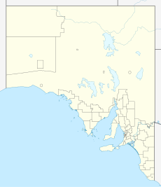  Campoona | |||||||||||||||
| Coordinates | 33.55595°S 136.41258°E | ||||||||||||||
| Population | 47 (SAL 2021)[1] | ||||||||||||||
| Established | 1998[2] | ||||||||||||||
| Postcode(s) | 5640[3] | ||||||||||||||
| Time zone | ACST (UTC+9:30) | ||||||||||||||
| • Summer (DST) | ACST (UTC+10:30) | ||||||||||||||
| Location |
| ||||||||||||||
| LGA(s) | District Council of Cleve[2] | ||||||||||||||
| Region | Eyre Western[4] | ||||||||||||||
| County | Jervois[2] | ||||||||||||||
| State electorate(s) | Flinders[5] | ||||||||||||||
| Federal division(s) | Grey[6] | ||||||||||||||
| |||||||||||||||
| Footnotes | Locations[3][2] Adjoining localities[2] | ||||||||||||||
Campoona's name was officially adopted and its boundaries were both created on 23 December 1998.[8] Its boundaries are identical to the boundaries of the cadastral unit of the Hundred of Campoona with both forming a square with an area of 260 square kilometres (100 sq mi).[2][9]
The dominant industry is broadacre farming of grains and sheep. Archer Exploration Limited proposes to establish a graphite mine in the area in 2015.[10]
Campoona is located within the federal division of Grey, the state electoral district of Flinders and the local government area of the District Council of Cleve.[6][5][2]
References
- Australian Bureau of Statistics (28 June 2022). "Campoona (Suburb and Locality)". Australian Census 2021 QuickStats. Retrieved 28 June 2022.
- "Placename Details: Campoona with the following layers being selected – "Suburbs and Localities", "Local Government Areas", "Development Plan Layers", "Place names (gazetteer)" and "Hundreds"". Government of South Australia, Department of Planning, Transport and Infrastructure. 7 April 2005. Archived from the original on 12 October 2016. Retrieved 14 May 2015.
- "Campoona, South Australia (Postcode)". postcodes-australia.com. Retrieved 11 April 2017.
- "Eyre Western SA Government region" (PDF). The Government of South Australia. Archived from the original (PDF) on 16 December 2014. Retrieved 10 October 2014.
- "District of Flinders Background Profile". Electoral Commission SA. Retrieved 9 September 2015.
- "Federal electoral division of Grey" (PDF). Australian Electoral Commission. Retrieved 24 July 2015.
- "Campoona Graphite Project Community Newsletter No. 5 – June 2014" (PDF). Archer Exploration. June 2014. p. 3. Retrieved 14 May 2015.
- "GEOGRAPHICAL NAMES ACT 1991, Notice to Assign Boundaries and Names to Places" (PDF). The South Australian Government Gazette. Government of South Australia: 2009. 23 December 1998. Retrieved 9 April 2017.
- "Search result for " Hundred of Campoona (HD)" (Record no SA0012026) with the following layers selected – "Suburbs and Localities", "Placename (Gazetteer)", "Counties" and "Hundreds"". Property Location Browser. Government of South Australia. Archived from the original on 12 October 2016. Retrieved 11 April 2017.
- "Archer Exploration Limited (ASX:AXE) Campoona Draft Mining Lease Proposal Submitted". ABN Newswire. 14 May 2015. Retrieved 14 May 2015.

Другой контент может иметь иную лицензию. Перед использованием материалов сайта WikiSort.org внимательно изучите правила лицензирования конкретных элементов наполнения сайта.
WikiSort.org - проект по пересортировке и дополнению контента Википедии