world.wikisort.org - Australia
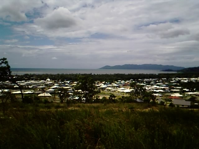
Bushland Beach is a coastal suburb in the northern beaches area of Townsville in the City of Townsville, Queensland, Australia.[2] In the 2016 census Bushland Beach had a population of 6,181 people.[1]
| Bushland Beach Townsville, Queensland | |||||||||||||||
|---|---|---|---|---|---|---|---|---|---|---|---|---|---|---|---|
 | |||||||||||||||
 Bushland Beach | |||||||||||||||
| Coordinates | 19.2016°S 146.6797°E | ||||||||||||||
| Population | 6,181 (2016 census)[1] | ||||||||||||||
| • Density | 773/km2 (2,001/sq mi) | ||||||||||||||
| Postcode(s) | 4818 | ||||||||||||||
| Area | 8.0 km2 (3.1 sq mi) | ||||||||||||||
| Time zone | AEST (UTC+10:00) | ||||||||||||||
| Location |
| ||||||||||||||
| LGA(s) | City of Townsville | ||||||||||||||
| State electorate(s) | Hinchinbrook | ||||||||||||||
| Federal division(s) | Herbert | ||||||||||||||
| |||||||||||||||
Geography
The suburb is bounded to the north by the Coral Sea with the sandy Bushland Beach (19.1884°S 146.6731°E) extending along the coastline,[3] to the north-east by the Bohle River, to the east by Stony Creek (a tributary of the river), and to the south by Mount Low, which rises 54 metres (177 ft) above sea level (19.2081°S 146.6827°E).[4][5][6]
History
The suburb of Bushland Beach was excised from the suburb of Mount Low. The name Bushland Beach was originally used as an estate name.[2]
Bushland Beach is Townsville's only master planned beachside community, developed by the Sunland Group and it is known as one of the fastest growing suburbs in Townsville.[citation needed]
In the 2016 census, Bushland Beach had a population of 6,181 people.[1]
Education
There are no schools in Bushland Beach. The nearest government primary school is North Shore State School in neighbouring Burdell to the south-east. The nearest government secondary school is Northern Beaches State High School in Deeragun to the south.[6]
Amenities
Bushland Beach is also home to its very own shopping centre which is anchored by a Coles as well as dominos, a dollar store, medical centre, two liquor stores, pharmacy, two hairdressing salons, real estate agent, pool shop and a cafe. In the future, the shopping centre will be extended which will include a Supa IGA and more specialty stores and a school has been proposed to be constructed in the near future.[citation needed]
Bushland Beach is home to the Bushland Beach Tavern, which is owned by the LH Group. Fishing, swimming and water activities are popular. The beach is well serviced with playgrounds, skatepark, and barbecue facilities .[citation needed]
There are a number of parks in the suburb, including:
- Bushland Beach Park (19.1909°S 146.6763°E)[7]
- Ocean Park Drive Park (19.1943°S 146.6838°E)[7]
There is a boat ramp and floating walkway on Marina Drive which gives access to Stony Creek off Bohle River (19.1995°S 146.7005°E). It is managed by the Townsville City Council.[8]
Transport
The Route 33 Bus or Bushland Beach Bus as it is better known, services the area every day of the year, except for weekends and public holidays.[citation needed]
References
- Australian Bureau of Statistics (27 June 2017). "Bushland Beach (SSC)". 2016 Census QuickStats. Retrieved 20 October 2018.
- "Bushland Beach – suburb in City of Townsville (entry 50179)". Queensland Place Names. Queensland Government. Retrieved 29 December 2020.
- "Mountain ranges beaches and sea passages - Queensland". Queensland Open Data. Queensland Government. 12 November 2020. Archived from the original on 25 November 2020. Retrieved 25 November 2020.
- "Mountain peaks and capes - Queensland". Queensland Open Data. Queensland Government. 12 November 2020. Archived from the original on 25 November 2020. Retrieved 25 November 2020.
- "Mount Low – mountain in Townsville City (entry 20168)". Queensland Place Names. Queensland Government. Retrieved 25 November 2020.
- "Queensland Globe". State of Queensland. Retrieved 15 April 2021.
- "Land for public recreation - Queensland". Queensland Open Data. Queensland Government. 20 November 2020. Archived from the original on 22 November 2020. Retrieved 22 November 2020.
- "Recreational Boating Facilities Queensland". Queensland Open Data. Queensland Government. 12 November 2020. Archived from the original on 22 November 2020. Retrieved 22 November 2020.
External links
- "Bushland Beach". Queensland Places. Centre for the Government of Queensland, University of Queensland.
| Urban |
|
|---|---|
| Rural |
|
| Northern Beaches |
|
| Magnetic Island |
|
Другой контент может иметь иную лицензию. Перед использованием материалов сайта WikiSort.org внимательно изучите правила лицензирования конкретных элементов наполнения сайта.
WikiSort.org - проект по пересортировке и дополнению контента Википедии