world.wikisort.org - Australia
Brindabella is a locality in south-east New South Wales, Australia, mainly in the area of Snowy Valleys Council and partly in Yass Valley Council.[2][3] It is reached by the Brindabella Road from the Australian Capital Territory over the Brindabella Ranges. It is significant as the early home of Miles Franklin, who wrote a well known book called Childhood at Brindabella.[4] It had a population of 22 at the 2016 census, who live in the Brindabella Valley. The locality also includes a large unpopulated area consisting of parts of the Brindabella National Park, the Kosciuszko National Park and the Bimberi Nature Reserve and of state forests.
| Brindabella New South Wales | |||||||||||||||
|---|---|---|---|---|---|---|---|---|---|---|---|---|---|---|---|
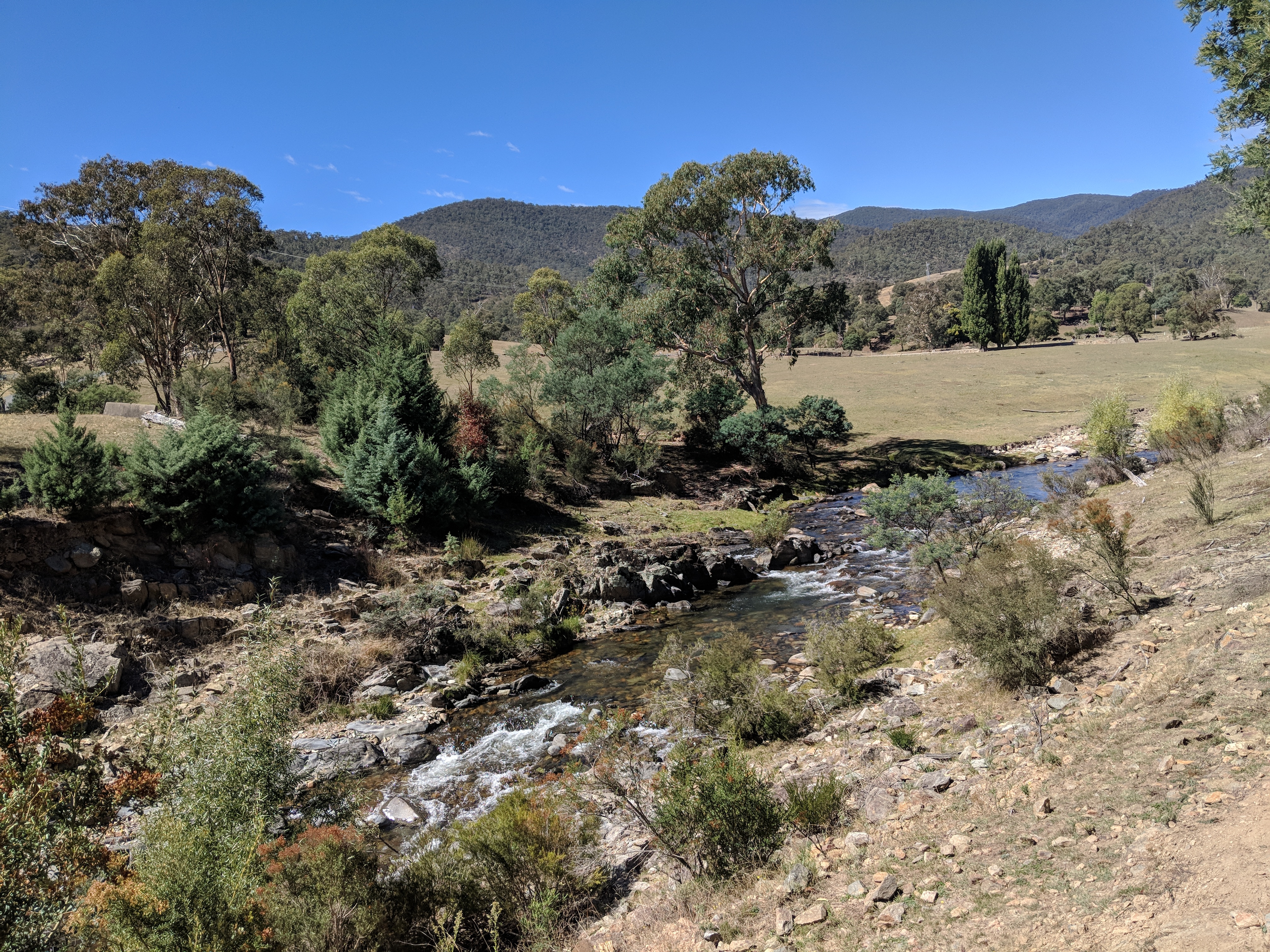
 Aerial view of Brindabella Valley from east | |||||||||||||||
Brindabella | |||||||||||||||
| Coordinates | 35°22′05″S 148°39′08″E | ||||||||||||||
| Population | 22 (2016 census)[1] | ||||||||||||||
| Postcode(s) | 2611 | ||||||||||||||
| LGA(s) | |||||||||||||||
| County | |||||||||||||||
| Parish |
| ||||||||||||||
| State electorate(s) | Goulburn | ||||||||||||||
| Federal division(s) | Eden-Monaro | ||||||||||||||
| |||||||||||||||
The Goodradigbee River flows north through the valley. A major farm in the valley is Brindabella Station.[5]
History
The place was named by Indigenous Australians as Brindabella, meaning "two kangaroo rats". The area was considered as an outstation of Yarralumla station.[6] Joseph Franklin and his family settled in the Brindabella Valley in 1861 and Thomas Franklin built the first homestead.[7]
References
- Australian Bureau of Statistics (27 June 2017). "Brindabella (State Suburb)". 2016 Census QuickStats. Retrieved 28 June 2017.
- "Brindabella". Geographical Names Register (GNR) of NSW. Geographical Names Board of New South Wales. Retrieved 19 January 2010.
- "Brindabella". OpenStreetMap. Retrieved 18 April 2018.
- "Franklin, Stella Maria ( Marian) Sarah Miles". The Australian Women's Register. Retrieved 18 January 2010.
- "Brindabella Station". Archived from the original on 16 March 2010. Retrieved 18 January 2010.
- "Brindabella". The Sydney Morning Herald. 8 February 2004. Retrieved 18 January 2010.
- "History of Brindabella Station". Archived from the original on 17 October 2009. Retrieved 18 January 2010.
Authority control | |
|---|---|
| General |
|
| National libraries | |
This Southern Tablelands geography article is a stub. You can help Wikipedia by expanding it. |
Другой контент может иметь иную лицензию. Перед использованием материалов сайта WikiSort.org внимательно изучите правила лицензирования конкретных элементов наполнения сайта.
WikiSort.org - проект по пересортировке и дополнению контента Википедии