world.wikisort.org - Australia
Berowra is an outer suburb of Northern Sydney located in the state of New South Wales, Australia 36 kilometres north of the Sydney central business district, in the local government area of Hornsby Shire. Berowra is south-east of the suburbs of Berowra Heights and east of Berowra Waters. The name Berowra means place of many shells, referring to the many shell middens on Berowra Creek.
| Berowra Sydney, New South Wales | |||||||||||||||
|---|---|---|---|---|---|---|---|---|---|---|---|---|---|---|---|
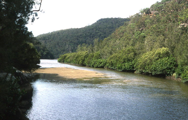
 Looking north over Berowra Regional Valley Park | |||||||||||||||
 | |||||||||||||||
| Population | 12,000 (2016 census)[1] | ||||||||||||||
| • Density | 1,380/km2 (3,570/sq mi) | ||||||||||||||
| Postcode(s) | 2081, 2082 | ||||||||||||||
| Elevation | 215 m (705 ft) | ||||||||||||||
| Area | 8.7 km2 (3.4 sq mi) | ||||||||||||||
| Location |
| ||||||||||||||
| LGA(s) | Hornsby Shire | ||||||||||||||
| State electorate(s) | Hornsby | ||||||||||||||
| Federal division(s) | Berowra | ||||||||||||||
| |||||||||||||||
Geography
Berowra is located 44 kilometres north of the Sydney CBD and lies at an altitude of 215 metres. Surrounded by bushland, it borders the national parks of both the Berowra Valley and Ku-ring-gai Chase.
Commercial area
Berowra is largely residential with a small retail precinct lining the Pacific Highway near the train station. In May 2007 a new shopping complex opened on Turner Road in Berowra Heights; this was a landmark development for the future prospects of the area.

Transport
Berowra is located off the Pacific Highway. The Pacific Motorway runs to the east, between Berowra and the Ku-ring-gai Chase National Park. In January 1960 a heavy vehicle checking station opened.[2] In December 1968 the Pacific Motorway opened from Berowra to the Hawkesbury River.[3][4] As it was a toll road, toll booths were installed at Berowra adjacent to the heavy vehicle checking station. This closed when the Pacific Motorway was extended south to Wahroonga in March 1989.[5]
Berowra railway station is located on the Main Northern line. It is served by Sydney Trains North Shore & Western Line and NSW TrainLink Central Coast & Newcastle Line services to Sydney, Hornsby, the Central Coast and Newcastle.
History
Berowra is an Aboriginal word that means place of many shells.[citation needed] The Berowra area has many Aboriginal carvings.
British settlement
One of the early land grants in the Berowra area was to John Crumpton in 1867. George Collingridge was granted 88 acres (360,000 m2) in 1880 and played a part in having the Main Northern railway line extended, so that a station was opened at Berowra in 1887. He also supported the building of a post office in 1900 and a road to Berowra Waters which opened in 1902. Berowra Post Office opened on 1 April 1897.[6] Mary Wall was granted 60 acres (240,000 m2) of land near Goodwyn Road off the Pacific Highway in 1887. Part of her grant meant she had to be there once a week and so she would walk at night through the bush from Surry Hills and tend to her farm.[7]
The area grew when the Pacific Highway and railway were built and settlers loved the fishing and surrounding bush. Mainly living in tents, the original settlers lived a tough existence and helped everyone. The first school was set up in Mary Wall's house before it was moved to what is now the Berowra District Hall on the corner of Berowra Waters Road and Crowley Road roundabout.
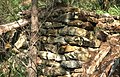 Remains of a bush hut, Berowra area
 Berowra Creek
 Aboriginal rock carving, Berowra area
 Junction of Berowra and Calna Creeks


Primary schools
Berowra and Berowra Heights share four primary schools:
- Berowra Public School (Berowra).
- Berowra Christian School (Berowra).
- Wideview Public School (Berowra Heights).
- St Bernard's Catholic Primary School (Berowra Heights)
High schools
None
Churches
Berowra and Berowra Heights share four churches:
- St Mark's Anglican Church (Berowra)
- Berowra Baptist Church (Berowra)
- St Bernard's Catholic Church (Berowra Heights)
- Berowra Uniting Church (Berowra Heights)
Clubs and Community Groups
- Apex
- Berowra Musical Society
- Berowra Toastmasters
- Berowra Rotary Club
- Lions Club
- Scouts
- Girl Guides
- The Probus club of Berowra
- Netball Club
- Soccer Club
- Football Club
Population
Demographics
At the time the 2016 census was conducted, the population of Berowra was 4,721, consisting of 2,353 (49.9%) males and 2,365 (50.1%) females. 73.3% of residents were born in Australia, while the next most common country of birth was England at 7.1%. 85.2% of residents only spoke English at home. The most common responses for religion were No Religion (29.9%), Anglican (21.5%) and Catholic (20.8%). Of the 1,493 occupied dwellings in Berowra, 94% were freestanding houses. The median weekly household income is A$2,355 and the mean household size consists of 3.1 individuals.[1]
Notable residents
- Matt Dunning, rugby union player
- Margaret Preston, (former resident) artist
- Rolf de Heer, (former resident) film director
- Mel Gibson, (former resident) actor
- James Fry, author
Events
Every year on the 2nd Sunday of August Berowra hosts the Annual Woodchop Festival. Running since 1995, this festival attracts thousands of people every year.
Restaurants
- Absolute Thai Berowra
- Bambino's Pizza & Pasta
- Berowra RSL Club
- Berowra Village Tavern
- Berowra Chinese Restaurant
- Berowra Waters Fish Cafe
- Berowra Pizza Restaurant
- Berowra Waters Inn
- Cafe Laurella
- CoHo Berowra
- Darcies Cafe
- Golden Phoenix Berowra
- Subway
- Waterview Restaurant
- Wise Monkey Cafe
+ Takeaway outlets, bakeries and grocery stores
References
- Australian Bureau of Statistics (27 June 2017). "Berowra (State Suburb)". 2016 Census QuickStats. Retrieved 12 April 2018.
- Checking Station Open October 3 Truck & Bus Transportation October 1960 page 5
- New Sydney – Newcastle Expressway Section Opened Railway Digest December 1968
- Additional Toll Work Truck & Bus Transportation December 1968 page 127
- Motorists Rejoice as Bypass Opens Sydney Morning Herald 23 March 1989
- Phoenix Auctions History. "Post Office List". Retrieved 22 January 2021.
- The Book of Sydney Suburbs, Compiled by Frances Pollon, Angus & Robertson Publishers, 1990, Published in Australia ISBN 0-207-14495-8, page 27
External links
- Berowra Community Home Page and Directory
- The Bush Telegraph: Local newsletter for Berowra and surrounding areas
- Berowra Apex: An active community service club
- "Berowra". Geographical Names Register (GNR) of NSW. Geographical Names Board of New South Wales.
- Joan Rowland (2008). "Berowra". Dictionary of Sydney. Retrieved 25 September 2015. [CC-By-SA]
Hawkesbury River region, New South Wales, Australia | |||||||||
|---|---|---|---|---|---|---|---|---|---|
| Islands | |||||||||
| National parks and nature reserves | |||||||||
| European explorers of the region |
| ||||||||
| Bridges and ferries |
| ||||||||
| Adjoining rivers, bays, reservoirs, and creeks |
| ||||||||
| Local government areas | |||||||||
| Education |
| ||||||||
| Major attractions |
| ||||||||
| |||||||||
Другой контент может иметь иную лицензию. Перед использованием материалов сайта WikiSort.org внимательно изучите правила лицензирования конкретных элементов наполнения сайта.
WikiSort.org - проект по пересортировке и дополнению контента Википедии